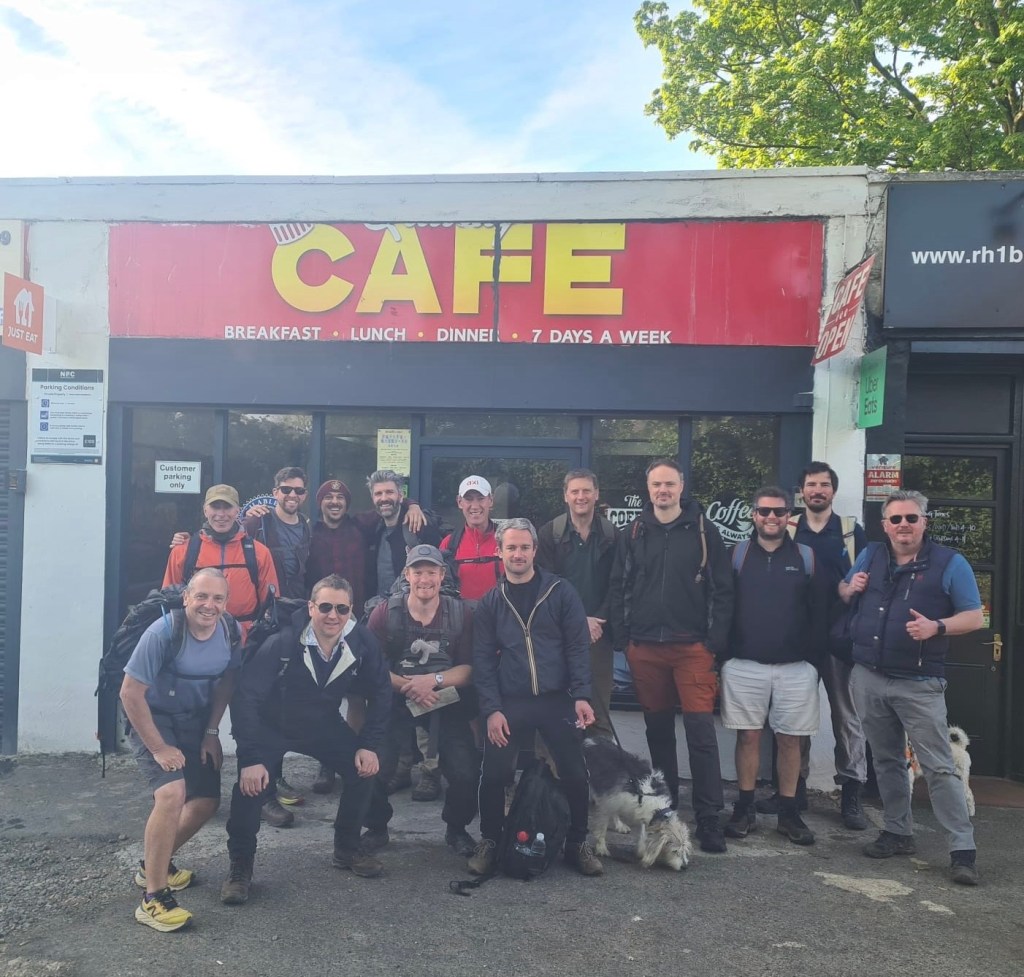
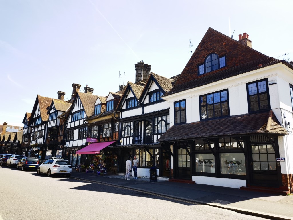
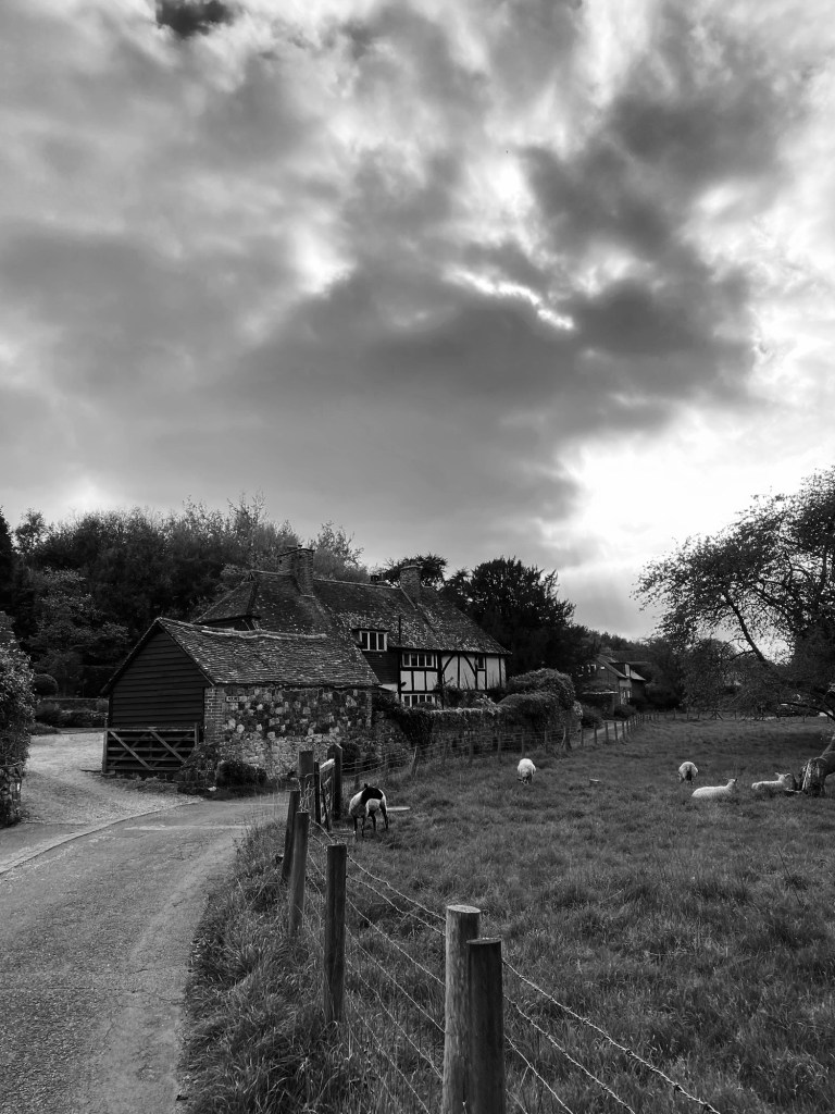
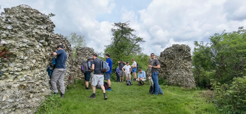
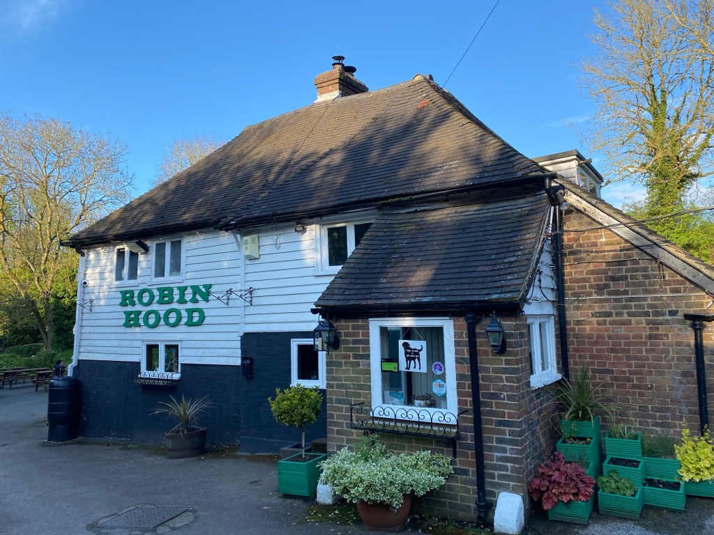
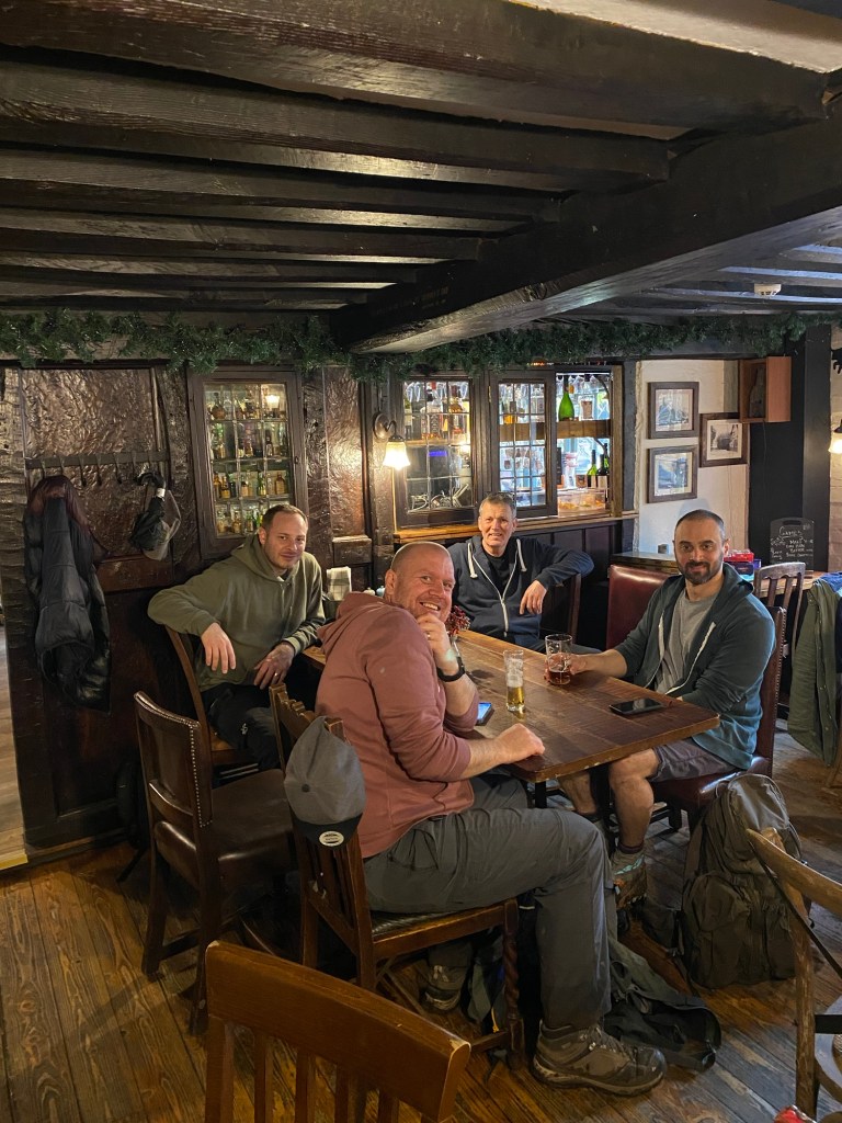
Dawn. The sun rises over the sleepy Surrey village of Merstham, the fading frost glistening in the rising sun. All is calm and quiet in the Quality Cafe, a does what it says on the tin establishment.
Then, in small batches, we arrive, shattering the silence, demanding coffee and assorted fried foods. The fry ups are needed more than usual; the Kent contingent had drinks at John’s the night before and I am informed that when the minibus rocked up at 6am, our leader greeted it in a dressing gown. For my part, Richard and I were out the night before with his mates, and I think I managed about four hours of sleep. 22 miles of hills in the sun. It was going to be fun.
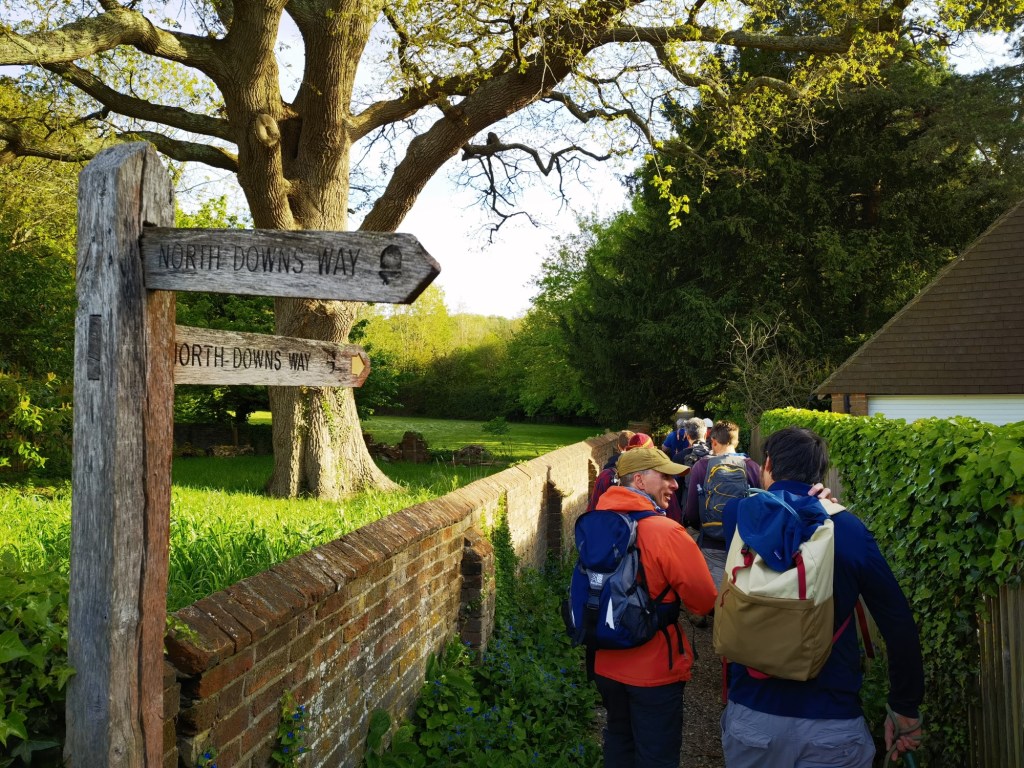
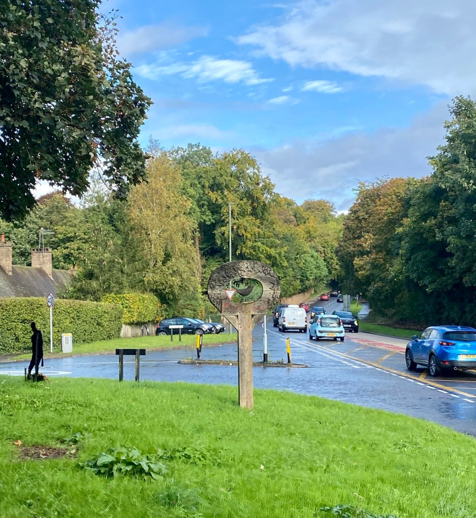
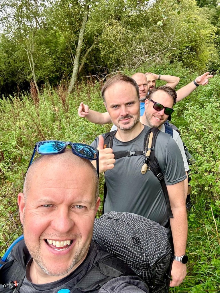
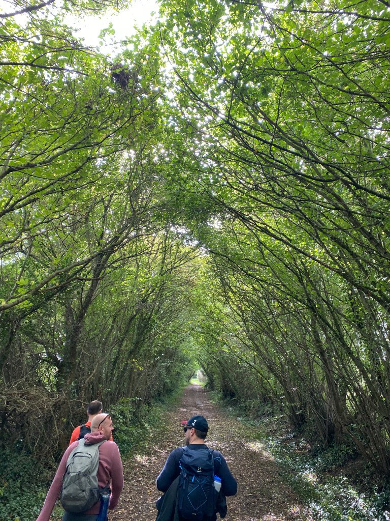
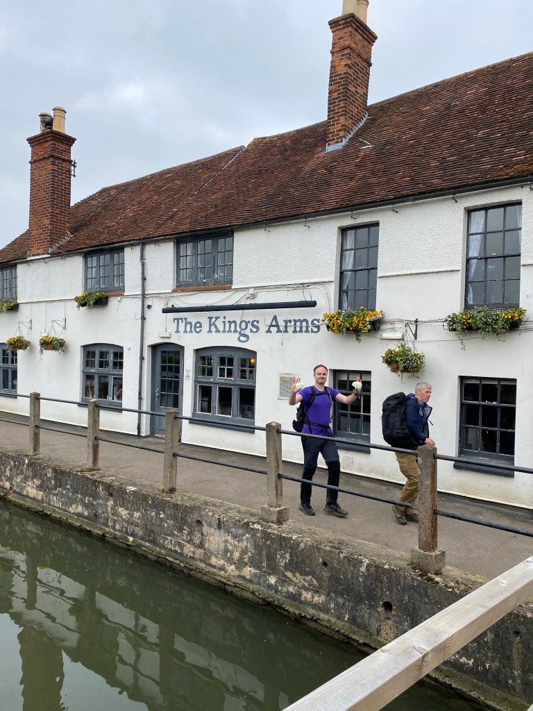
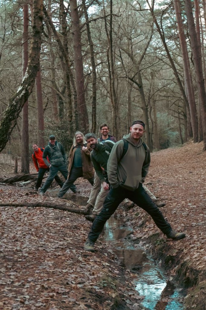
Breakfast sorted and a kindly cafe owner coerced into taking our departure photo, we make tracks. Today’s route continues to chip away at the North Downs Way, this time heading fromMerstham to Sevenoaks. It’s a location we’ve been putting off for a while because of the travel logistics involved, and despite the spectre of the M25 looming over us, it offers the possibility of some great hills, views, and quite pleasant looking towns. Max is determined to go old school with the navigation and has brought a map, and while I have the route on my watch, I agree to not consult it. I will mostly honour this.
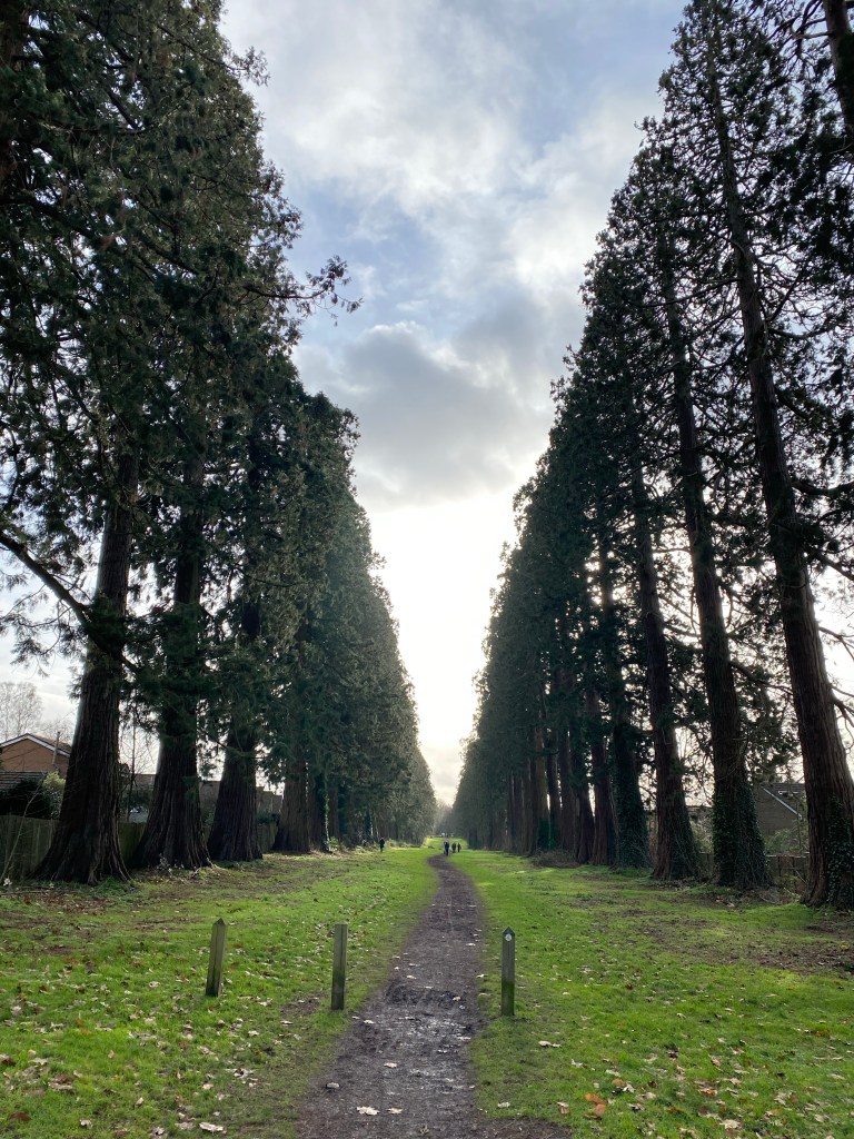
This might go down as one of the most elevation heavy hikes to date, nothing seemed to be on a flat surface.
It’s probably for the best that throughout this opening stretch I find myself deep in conversation with new bestie Kayne, the hills melt away as we deep dive all things incredibly geeky. (He also has his Star Wars priorities in order). And there are a lot of hills that need melting away.
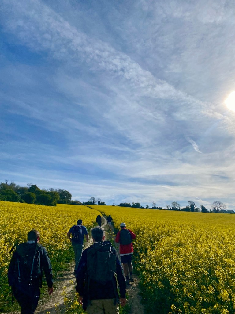
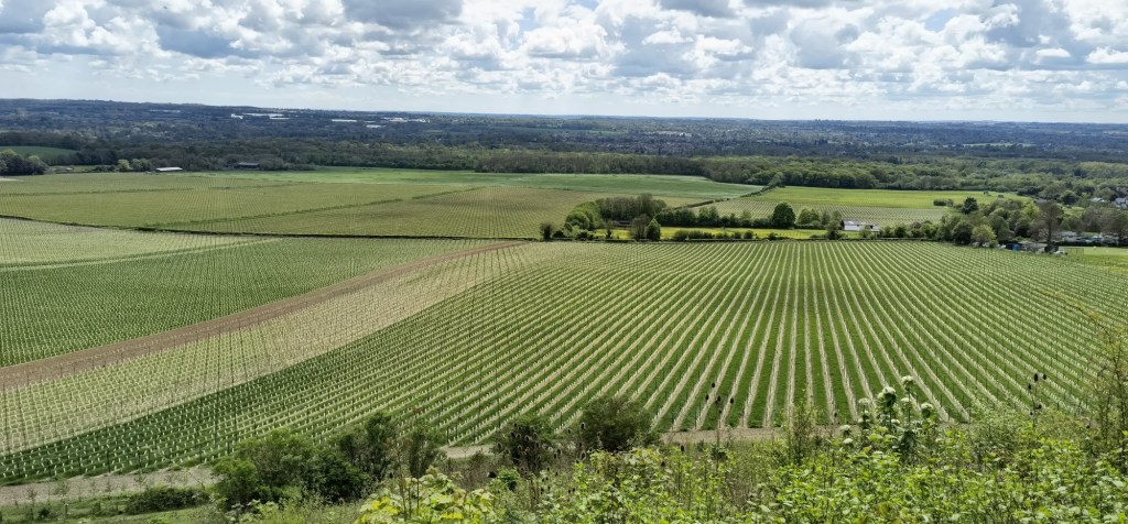
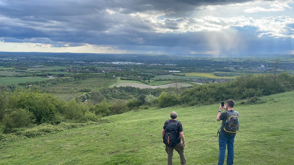
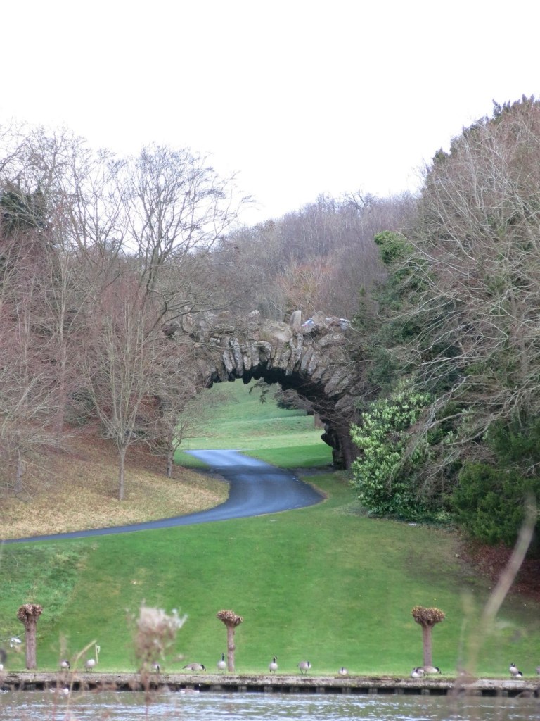
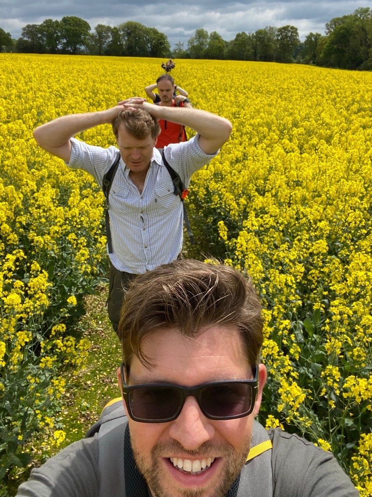
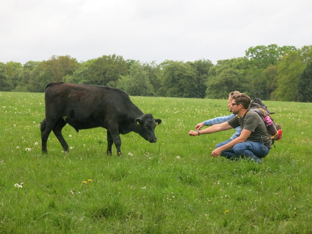
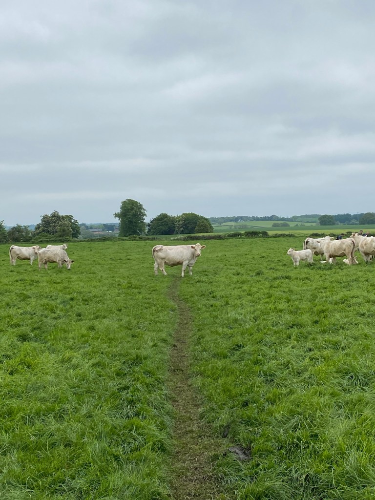
Photos are good. You can’t hear us wheezing. Offsetting the abundance of M25 we repeatedly crossed was plenty of sights like this.
At the top of an especially tall hill just past the Caterham viewpoint at mile 7, we take a sharp right and head downhill and realise we’ve lost those bringing up there rear. Richard heads back to find them, recruiting a mountain biker to inform them of where they need to go. By all accounts the cyclists’ instructions are accurate but somewhat curt. As we wait, we have to endure the increasingly tedious sound of a clay shoot, setting at least the dogs on edge. Kayne and I use the time to put the world of Tolkien to rights.
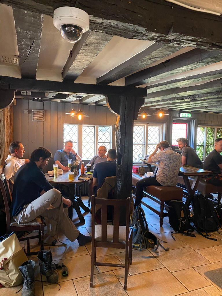
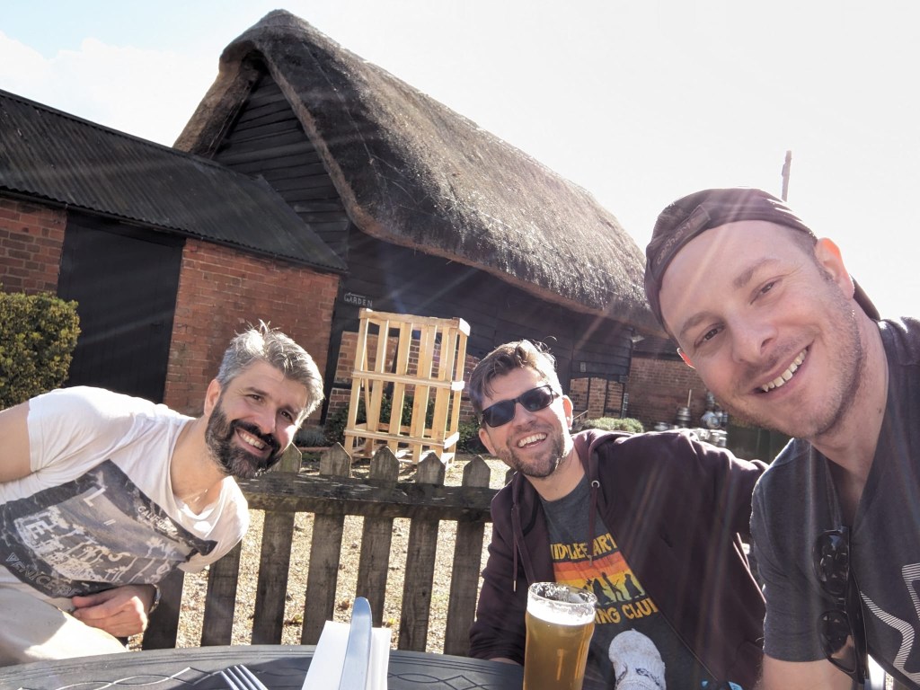
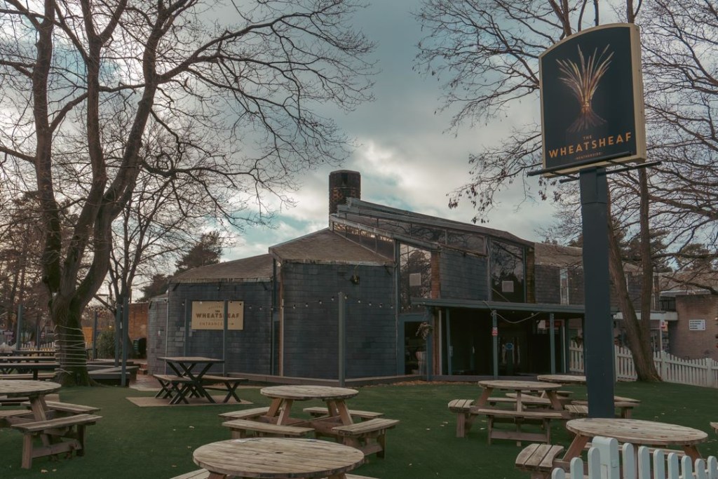
A good, solid stretch of hiking complete, 9 miles in and just before noon we reach our first scheduled pub stop, The Old Bell at Oxted.
It was empty and silent. Then we arrived.
Much like the Quality Cafe, our arrival shakes things up a bit as the bar staff quickly find themselves needing to pour more than a few pints, a bit of wine, and some water for those of us who remember to rehydrate. Driving for the first time on a hike, I only have mild FOMO. At the Old Bell we’re also greeted by Angus, last seen steering us to success on the Guildford to Alton Bentley trek two years previously.
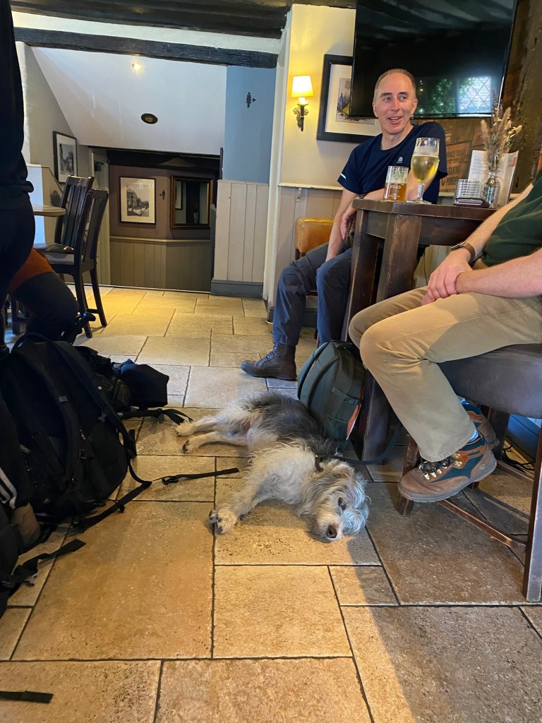
Flora charges up. Messi has infinite battery and would like your food, please.
As nice a time as we’re having, we know we have to get going and the team drink up and get ready to go. It’s still quite early, and Alex points out as we’re departing that the silence will return once we’re gone.
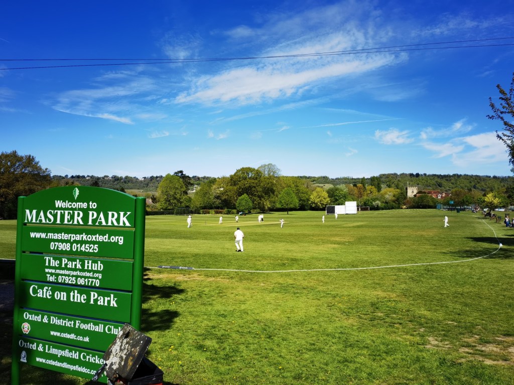
Our route from here leads us past a very traditional English cricket green complete with players and then into Oxted’s town centre, which is also very traditional and English.
Think Dad has this on his n-gauge train set. Oxted: you probably can’t afford to live here.
It’s also the best place to get lunch, and those who don’t already have it disperse to get supplies. This is fine at first but then stretches on. In the notes I take so I remember what to put in these posts, I have just written “We wait around for f*cking ages sorting lunch.” Those who know me probably know what mood I was in by this point.
Richard’s reward for bringing a packed lunch is dog duty.
Eventually enough of us regroup to form a collective and we set off, confident those behind will catch us up. Our route takes us through some quaint suburbs, which Will is quick to point out don’t feel at all like our group’s natural environment. “The Walking Idiots in Suburbia.” Ugh.
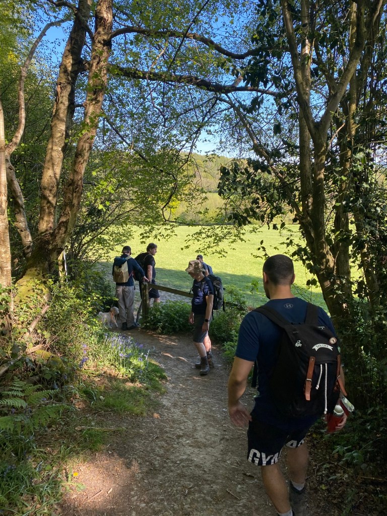
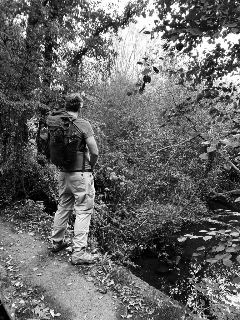
It’s not long before we return the leafy woodland that we’re used to. A fairly chilled, if hilly, few miles follow, with one particularly noteworthy landmark an absolutely immense house on Pains Hill which we hope is at least a school, because the council tax bill would be sickening.
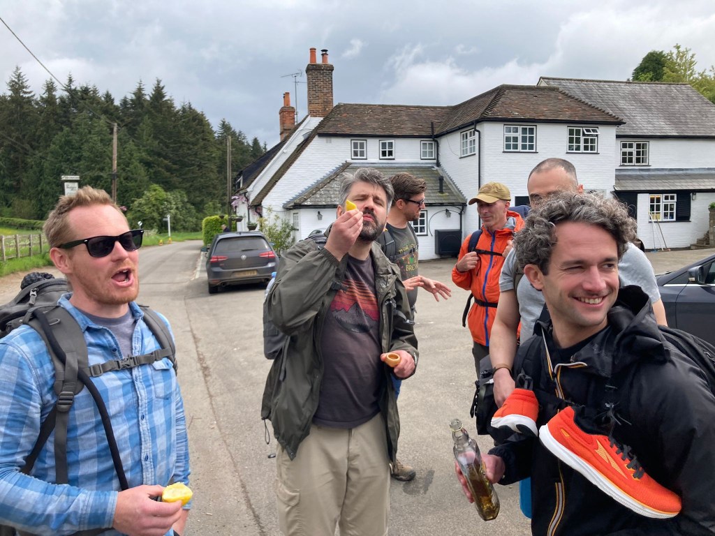
The Carpenters Arms is our next stop, only four miles later. As we approach the improbably-named village of Limpsfield Chart, a local quickly gets the measure of us and succinctly says “the pub: not far,” which earns a good chuckle.
The Carpenters Arms is busy but we’re served quickly. It has an excellent beer garden which easily accommodated over a dozen new arrivals. Matti sneakily orders cheesy chips which go down a treat with the crew. After a couple of drinks and the reapplication of suncream we’re good to depart and head off once more, although we notice John has secured a cheeky bottle of red for the road, the scamp.
This next stretch of the hike is probably where it became most challenging. Normally it’s in the evening, when we lose the light, people get tired or, let’s face it, shitfaced. But the stretch that followed here was harder because of the hills and the sun.
Pacing’s varying, we naturally fracture into what I think was three groups. The heat intensifies, and the shade is only intermittent. When we find ourselves in woodland it’s okay, but on exposed areas like fields it gets quite full on.
Just before things got tough.
We face three significant hills back to back as the altitude continues to climb, seemingly without end. The fact we’ve fifteen miles in our legs already doesn’t help, and my four hours sleep the night before reminds me I’m not dealing with a full battery.
There are other issues to contend with too, but I won’t go into details as Alex won’t thank me. They were mercifully resolved at the next pub.
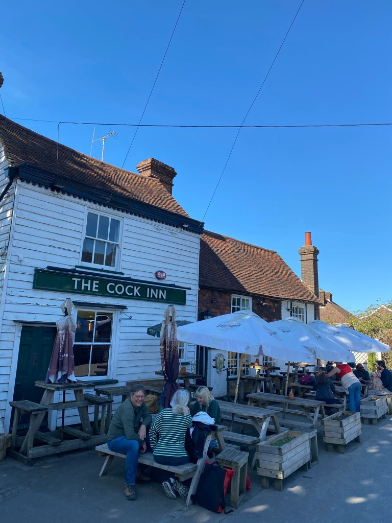
The next pub, The Cock Inn (honest) is our penultimate stop and sorely needed.
There’s a smutty joke lying around here somewhere, I’m sure of it.
We gain a new arrival – Adam and Bert’s mate, Anjay – and we realise sometime later, lose one, as Johnny pulls out.
The confusion that sets in (to misquote 90’s post-grunge band, Live) is because only 9 of us have made it to the pub, we’ve no idea where the others are, and absolutely no signal whatsoever to contact them.
We pass our time the only way we know how: with beer.
Our biggest obstacle now is tiredness and getting hangry. Over the last few miles Adam and Anjay tell me about their band, which has a couple of tunes on Spotify and sounds awesome. Kayne and I had made it to DC Comics by now on our nerd-fest.
An hour passes. We debate whether the others are even coming, and whether to carry on without them. People are cramping up. Others are even starting to get cold now they’re out of the sun. Kayne distracts us by giving us the rundown on how intimacy scenes are filmed (he’s an actor) and they sound thoroughly unerotic.
Hopping on the pub’s wifi we receive a voice note from Max: “I left Johnny in the competent hands of a blonde at the stables… I will have a pint of ale please.” A few minutes later he appears, but without the others, who appear eventually. John informs us that they had been circling the pub for ages trying to find it but without success.
Finally, the group is reunited, except for the aforementioned Johnny, who is medically retired for the day.
Shortly before we depart, my watch dies, depriving me of the route I’d been quietly keeping an eye on. Max is quite pleased at this victory of the analogue over the digital, and having one less navigator (Angus also has the route) and a tricky part route-wise to follow encourages us to stick together for the final stretch.
Even with a few delays we’re still absolutely fine for light and while the route meanders from hill to hill, it’s nothing we’ve not seen before.
See? Loads of daylight left.
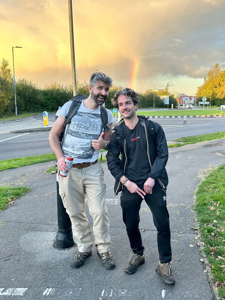
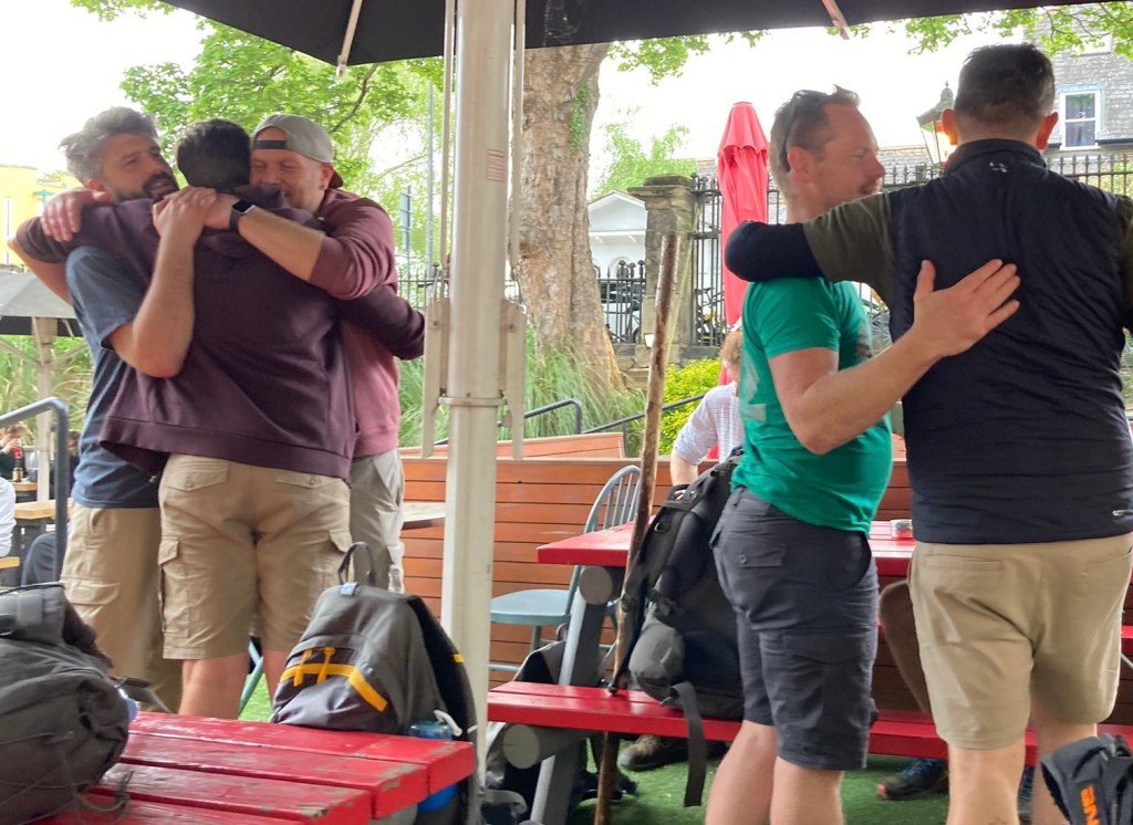
Outside of Sevenoaks, we encounter one final split when Richard and Evan decide their way to The Chequers (our final stop) is closer than ours and peel off, while the rest of us stick together. We’re feeling very smug as we get to the end before them, the pub we intended to finish at for the last hike, the –
Oh crap this is The Restoration, where we finished last time! (It was shut then). Whoops. Best keep moving!
Still, Max gets to redeem himself. Last time he was on this bench with us he was barely conscious.
Anyway, we leg it over to the Chequers to reunite with our crew, and it doesn’t take much work to persuade some patrons to very kindly take our victory photo (people tend to do this when you tell them you’ve walked 23 miles to get there).
Pints and chips follow.
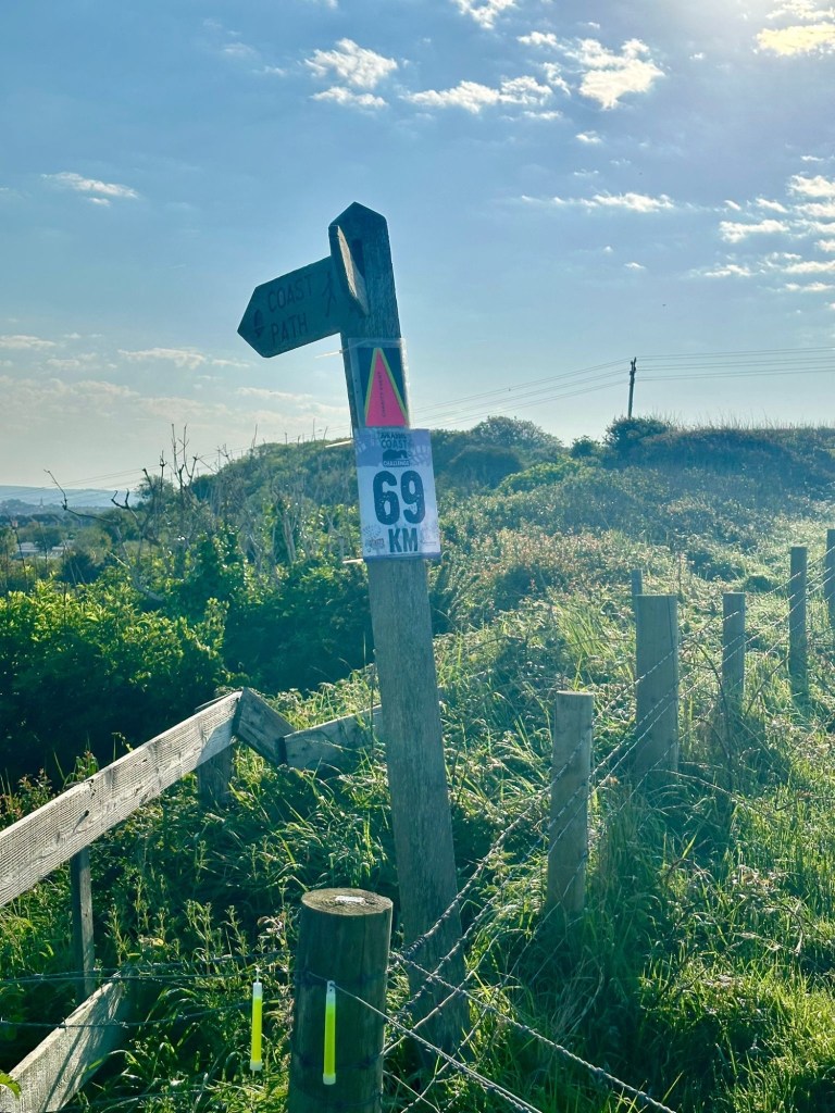
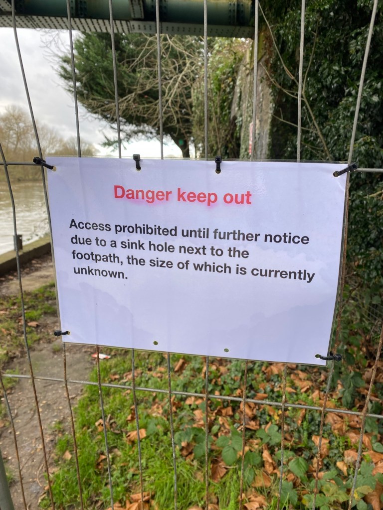
The North Downs Way is nearly done now. The last major stretch is Alton to Winchester and then we’re almost done, barring a few optional extras.
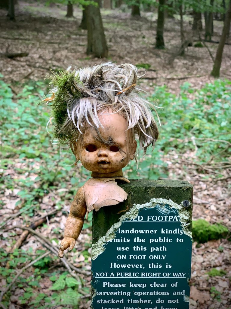
Soon we’ll no longer be looking out for these signs.
It’s only taken us 7 years. Please join us for the next one. We need you.
Enjoy the colour while it lasts, because we’re going black and white for Hike Noir!
Following the coast for a relatively short distance proved to be remarkably successful for our last outing. So empowered with a renewed sense of vigour, we decided to… do the opposite. Instead, we spliced together a new route that was both long and (relatively) complex. Because it’s all about enthusiasm at the end of the day.
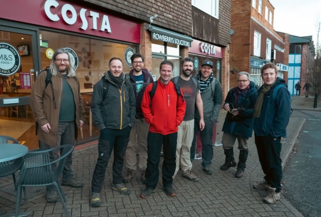
Sticking with Kent, a roughly 24 mile route was plotted from Rochester to Sevenoaks that took in a few local sights and a generous helping of woodland and fields. Just what you need in autumn. A date is agreed and attendees fluctuate and flake as they always do until we’re left with a cohort of nine, four of whom are new to the group.
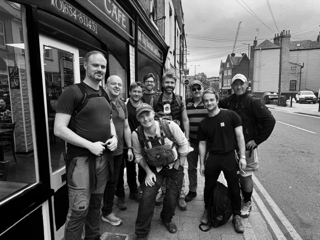
After the standard-issue shocking night’s sleep the night before, we drag ourselves out of bed and convene at the Legends cafe in Rochester (because Wetherspoons didn’t open until 8, and this would make us later than we needed to be, dammit).
The Legends staff weathered the arrival of 9 blokes in hiking gear and their large backpacks and silly banter very well, and pretty soon we had manspread across a good third of the cafe, before consuming a significant amount of fried food. The bubble and squeak on the veggie option was particularly good.
Bubble and squeak already consumed.
As per usual we get a departure photo, taken by a rather confused local lad who had to wait for us all to finish using the bathrooms…
Idiots for today: Alex, Andrew, Richard, Max, me, John, Evan, Mati and Johnny.
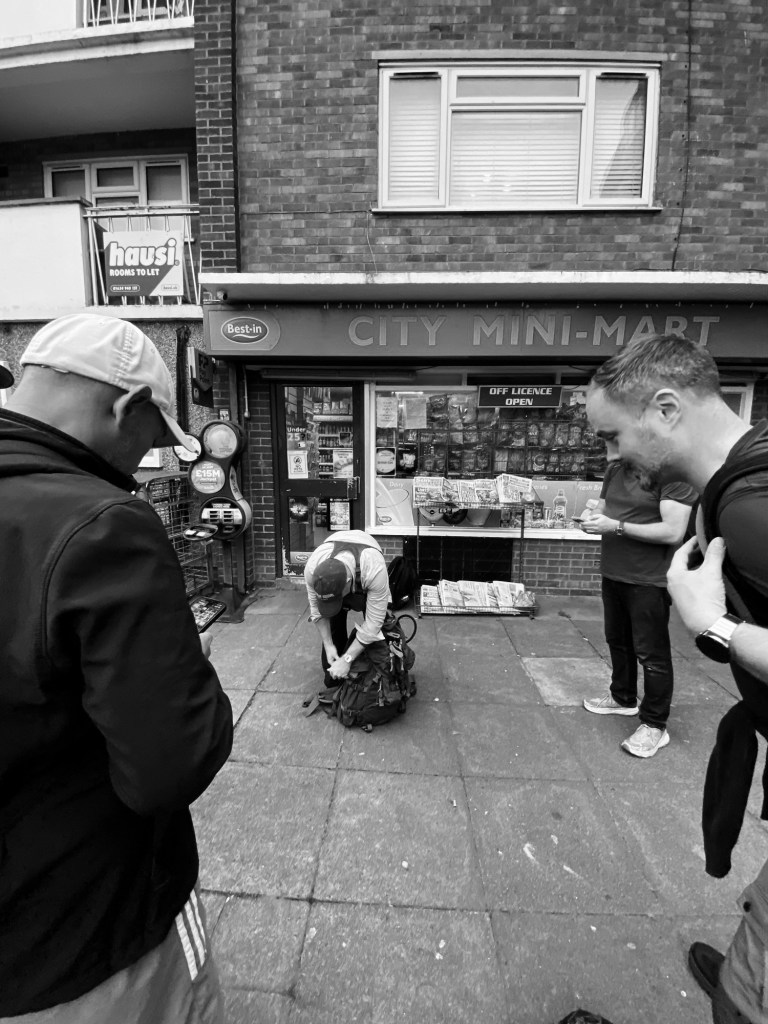
And then we’re off! Also as standard we make it about three minutes before we stop, as some of the crew decide to get supplies, this time in the form of tequila. This will in no way bite anyone on the arse later, no sir.
And at such a reputable looking location, too.
Wandering through the Rochester suburbs we go past Max’s charming allotment and after half an hour and nearly two miles of walking we join our route.
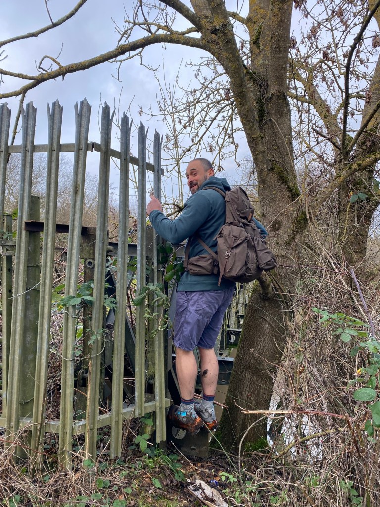
What I mean by this is, just to be safe, for this one I uploaded the route onto my watch. I’ve only done this for one previous Walking Idiots hike (it’s a bit faffy) but after having spent a bit of time doing it over the summer I’ve just about got the hang of it. John and Max have a good local knowledge and had decided to go retro with a paper map, but an insurance policy couldn’t hurt. Especially at night, where the slightly wobblier parts of the route would be impeded with poor visibility. At the 30 minute mark our walk locked in with the plotted route and would continue to guide us for the rest of the day. We’d need it later.
After the allotments we soon crossed the Medway, over the bridge which had been fitted with tall metal poles along the edge to prevent people from jumping off it.
How cheery.
Clearing the bridge and leaving the industrial sprawl we are soon treated to some lovely autumnal colours which will be present throughout the hike.
We follow some very pleasant footpaths through fields and woodlands at a pretty competitive pace until we stop at 4 miles and shed a few layers, it’s warmer than we were expecting.
“Beer, John?” Mati offers, opening his supplies.
“It’s 9:30 in the morning!” John replies.
Mati looks at him, confused, wondering what the two things have to have in common.
Those who feel inclined imbibe and even for those of us who don’t, the next hour is a peaceful meander through woodlands, one of the nicest parts of the day.
Soon after that we leave our route temporarily to head downhill into a valley which hosts the Moot Brewery.
Our conversation got extra geeky here.
The Moot Brewery is everything a trendy microbrewery should be, but even for us, probably not the place to be at 10:30 in the morning. I would definitely return at a more appropriate hour though. Some of the crew pick up supplies to take with them and I nearly pinch a coaster and then we head off, rejoining our path.
Look at that range! … just not at 10am.
Soon after that the hike gods punish us for deviating from our route so early and we’re treated to the first of several significant hills that get everyone’s heart rates good and racing.
Several more miles of woods follow, as well as a fair bit of both ascent and descent. All good stuff but not worth dwelling on in terms of hike details. The miles add up.
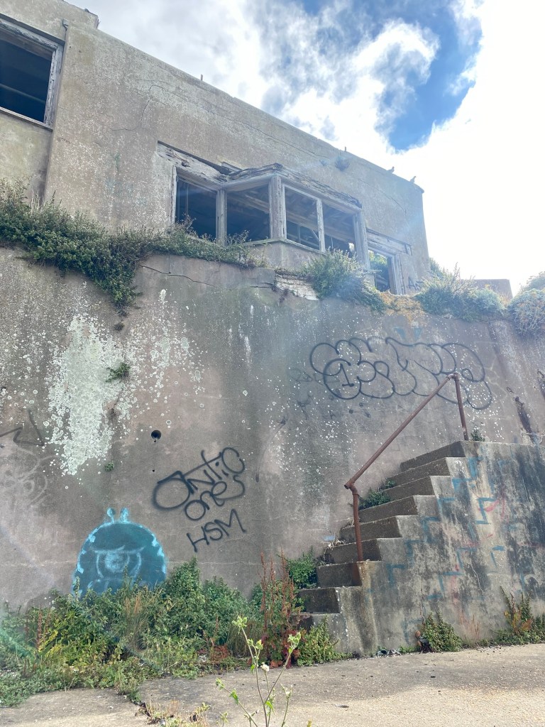
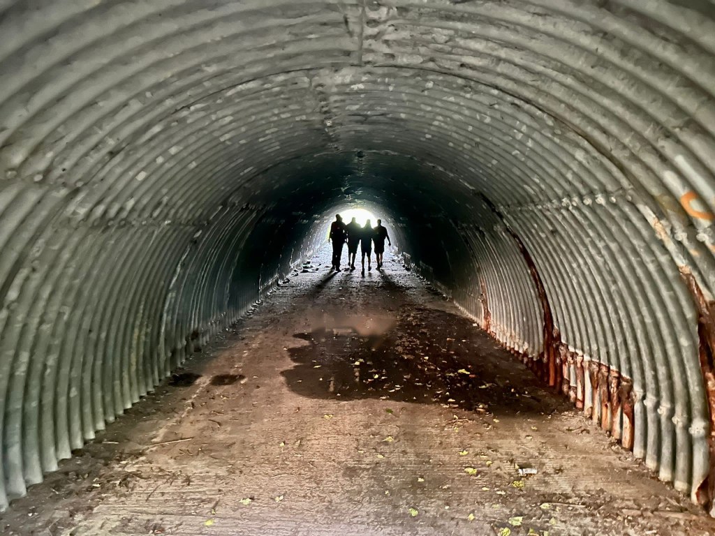
At the base of one of the hills there’s a pretty grotty bunker looking thing, which ticks the Walking Idiots hikely requirement of a nice bit of urban decay.
Remarkably, black and white actually makes this look less bleak.
After a while we reach the top of Holly Hill, where a handy plaque tells us that in the distance the Shard and Canary Wharf are visible. On a past hike we’d seen this from another angle, near Bagshot, so it was weird to see this from the other side.
I probably made an Eye of Sauron joke when we saw this on Hike X.
It’s not long after that we find another sign that announces we are on the Pilgrims Way. Returning readers may remember it was our initial plan to walk the entire Pilgrim’s Way, but we’ve now amended it to be a long-term ambition to do the North Downs Way – very similar, but the former has large stretches with are road and can’t be walked. Looking at the map and reflecting on what sections we’ve already covered, we realise we have maybe only 3 or 4 hikes left to do before the North Downs Way is completed.
I’d include this in the Walking Idiots boxset if we ever made one.
Speaking of exciting, it’s not long until we then stumble upon – or should I say past, we have to go back – the ancient and excellently preserved Coldrum Barrow. We spend a good few minutes examining the stone structure on the mound and reflecting on how much history this thing has seen.
No wights try to capture us.
From one man-made spectacle to another of a completely different nature, it’s not long after this that we encounter an enormous quarry, complete with signs that say not to play on it. We don’t, but it’s close.
Are we sure this isn’t a play area?
Shortly after this as we close in on the halfway mark of our journey we reach our first pub stop of the day, The Angel at West Malling.
You know, one time I’d like to see a pub called The Angle.
First impressions of the Angel are positive although the lady behind the bar looks at our unannounced arrival with an expression of dread and waxes long and lyrical about lack of space, seating, and what is no longer on the menu. It takes a longer time than expected to explain that we would just a few beers, please, (no food) and once that sinks in we accommodate even further by sitting in the lovely and inexplicably empty beer garden and even provide our requests in writing. Our drinks are gradually delivered by a series of smirking/despairing barmaids. Highlights of our stay here included Alex’s Heineken which tasted almost exactly like Thatchers cider (because it was) and everyone taking a moment to appreciate that Richard had brought his contingency crowbar, which made Max look practically unprepared in comparison.
The signs across the arch obviously say “speak friend and enter.”
With our glasses drained we set off in a pretty excellent mood. Soon we cross the A20 and spend the next several miles encountering plenty of charming houses and villages. We go through the village of Basted, which everyone has a delightful time saying.
Go on, you try. It’s pronounced “bast-ted!”
It’s not long after this that approaching the 17 mile mark we reach pub no. 2, The Plough. We arrive in two batches, with the second contingent arriving all carrying improvised walking sticks to deal with the hills that were determined to slow us down.
On reflection, this hike should probably get an award for least inspired pub names. We just need a Red Lion to complete the set.
The Plough was fine. No complaints. Rather local but not so-local-the-piano-player-stops-when-you-walk-in-local. I’ve probably used this term before but I’m sure you’ll forgive me. Some of the crew are experiencing stiffness and we administer a few stretches and some painkillers before we head off for the final leg, ignoring the fact that they’ve been drinking for most of the afternoon. Johnny also takes about four electrolyte tabs which I’m assuming has the same texture and consistency as Calpol.
This might say something about their clientele.
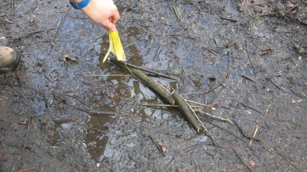
Our departure from the Plough’s progress is short lived when we see a very charming little brook which we cross, and investigating it further, we find…
… a rope swing!
Our pace slows to a halt as a good few of us (yours truly included) give it a go. I’m relieved no one came by to witness it, we are FAR too old to pull it off really.
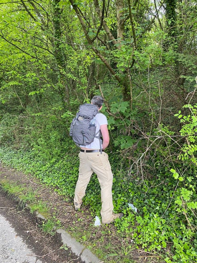
Speaking of relieving…
Soon after resuming we cross a few orchards, which is a bit of a novelty for these hikes, at least at this time of year. We enjoy a rather muted golden hour and plenty of woodlands and as the sun starts to set, we reach Ightam Mote.
Ightam. With moat.
Ightam Mote is one of two National Trust properties that we will pass on this hike, both of which have public footpaths which let us go through them. While we stop to admire it, Evan deliberates over when to leave us, and when we agree on a place where he can be collected, we enter what we hope will be the last of the elevation of this hike.
Oh boy is there elevation here, and as expected, it nails our pace. We should be okay as long as we keep moving, and 7 of 9 of us reach the top of the final hill with the last of the twilight.
We’re twenty one miles in. Three to go.
We wait a few minutes for [REDACTED] and [REDACTED]. Then a bit longer. After ten minutes we call, but the signal in the woodlands is appalling. We have our ears peeled, and when we try getting them to shout, we realise we can hear voices… but not coming from the direction we came from.
After half an hour of waiting, Richard unleashes his emergency secret weapon. No, not the crowbar, but a rather nice bottle of Tallisker which gets passed around those of us waiting. Finally our missing brethren show us, quite a bit worse for wear but determined to keep on going. Evan sees us off, deciding to get picked up. He obviously knew something we didn’t.
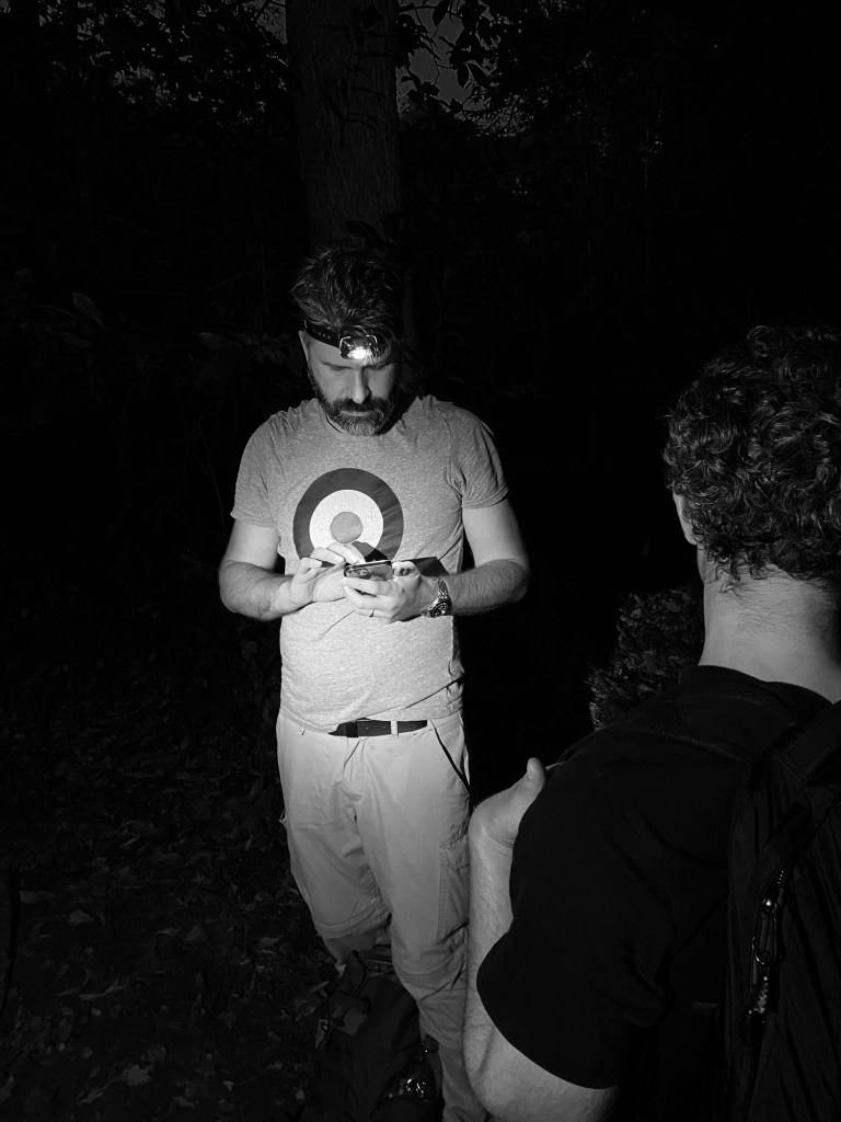
Now the twilight has properly gone we are utterly in the dark. Head torches are donned and we set off.
Naturally John still looks handsome wearing a head torch, the bastard.
Our visibility is of course completely lost and we are relying on our navigators and the route uploaded to my trusty garmin, whose battery is slowly draining away. One of our navigators, [REDACTED], has fallen victim to the meds/tequila combo which negate his ability to contribute to steering us. Worse, my watch tells me we are veering further and further off the plotted route on the map. Signal is non-existant and Google maps is no help.
Finally, after a quick pause and discussion, we agree on a route which at least seems to run vaguely parallel to the route, so we head in that direction. According to my trusty garmin, once we rejoin the route, there’ll only be a mile to go.
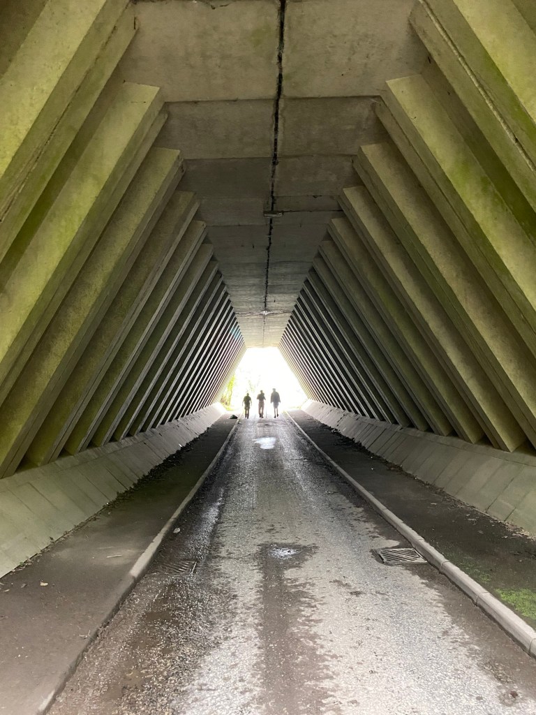
The other problem with hiking in the dark is this is basically all the photos you get.
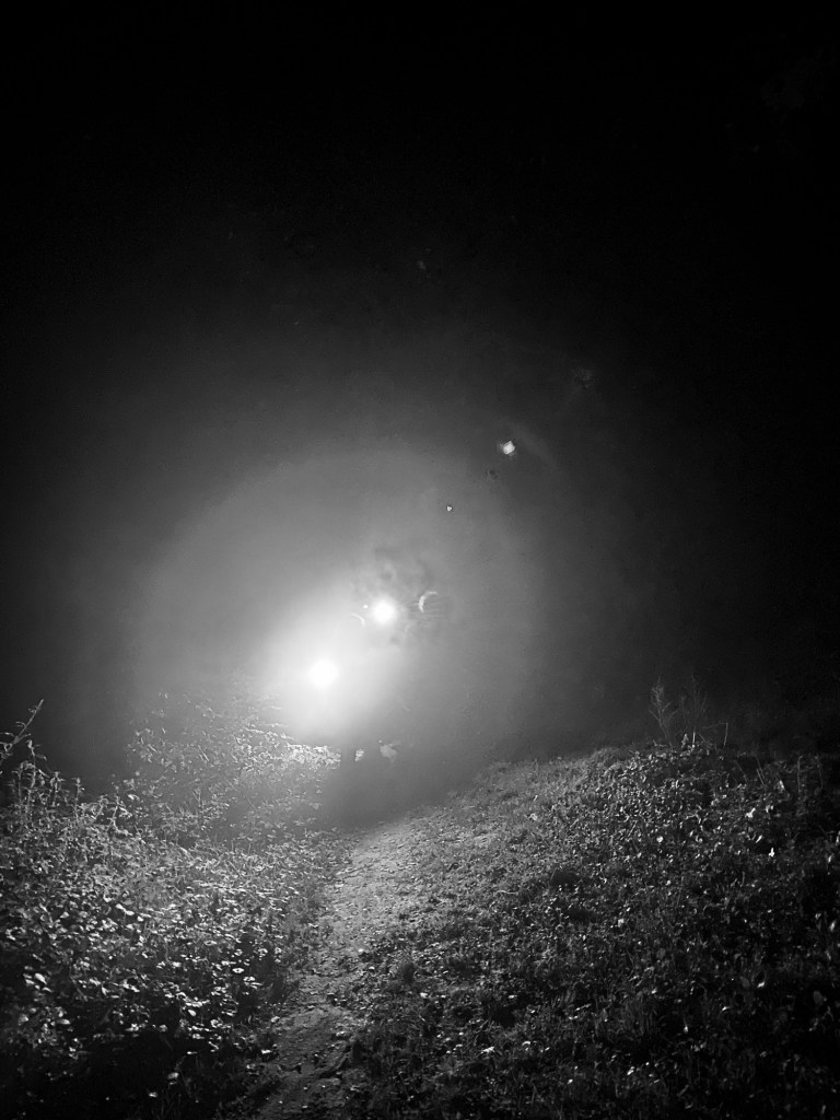
We have a target in the darkness: the gates of Knole Park, and it’s with huge relief that we find them and (briefly) rejoin the plotted route with apparently only a mile remaining. Unfortunately in the darkness it is almost entirely impossible to find the path through the parkland, and we quickly fall off route. The whole thing is looking increasingly Blair Witch Project. Through sheer force of will we head in the approximate direction we’re meant to go, but are made to pause when we realise we’ve somehow reached a golf course. Is this… right? We’ve no way of knowing. We have at least a vague indication of where to go, so we should probably keep moving.
Then we hear the growling.
I’m pretty sure I’ve heard deer growl before, but this is either extra close or extra loud, and it sounds like lions growling in movies. They sound thoroughly unimpressed, and their eyes reflect the light of our head torches to impressive effect. Best we crack on, we don’t want any trouble.
We’re just passing through here.
We stumble on through the darkness, serenaded by angry deers. The group fractures a couple of times, as some of the more, um, afflicted, have fallen behind. Andrew runs behind to encourage them, and I might have to admit I was getting a bit fed up by this point.
Richard’s whisky was definitely needed.
Oh well, only one mile to go, the group remind John and I with only a mild hint of irritation.
Finally, after what feels like ages, we realign with the route, as my garmin gives a little bleep of satisfaction. And it tells us we only have… a third of a mile to go!
After what feels like a lifetime, we finally emerge from Knole Park. We would never have seen it in the light even if we haven’t fallen behind, but the Beatles fan in me would’ve liked it (Strawberry Fields Forever and Penny Lane had their music videos shot there).
Despite my watch assuring me that the elevation on the route was done, we’re treated to one final short, sharp hill, and then all of a sudden we’re out in the open in Sevenoaks. What relief.
Our pub is just around the corner, so we take advantage of some strangers kindness to get a victory photo of us. The relief on our faces shows here.
Yep. All present.
We head towards our final pub, The Restoration, finally one with an original name.
And it is, of course, shut. Honestly. Private function. Flipping great. Some of our crew seek alternative shelter at the Anchor, while the rest of us look after [REDACTED], who probably wouldn’t be warmly received in a public house. Instead we enjoy a can of beer while we wait for the taxi, but actually after what turns out to be 26 miles (not 24) we’re pretty much happy to call it a day.
Still, end of hike hijinx aside, this was one of our better walks. Good route, some autumn colour, a bit of history, a healthy amount of silliness and a nice crew. Can’t fault that.
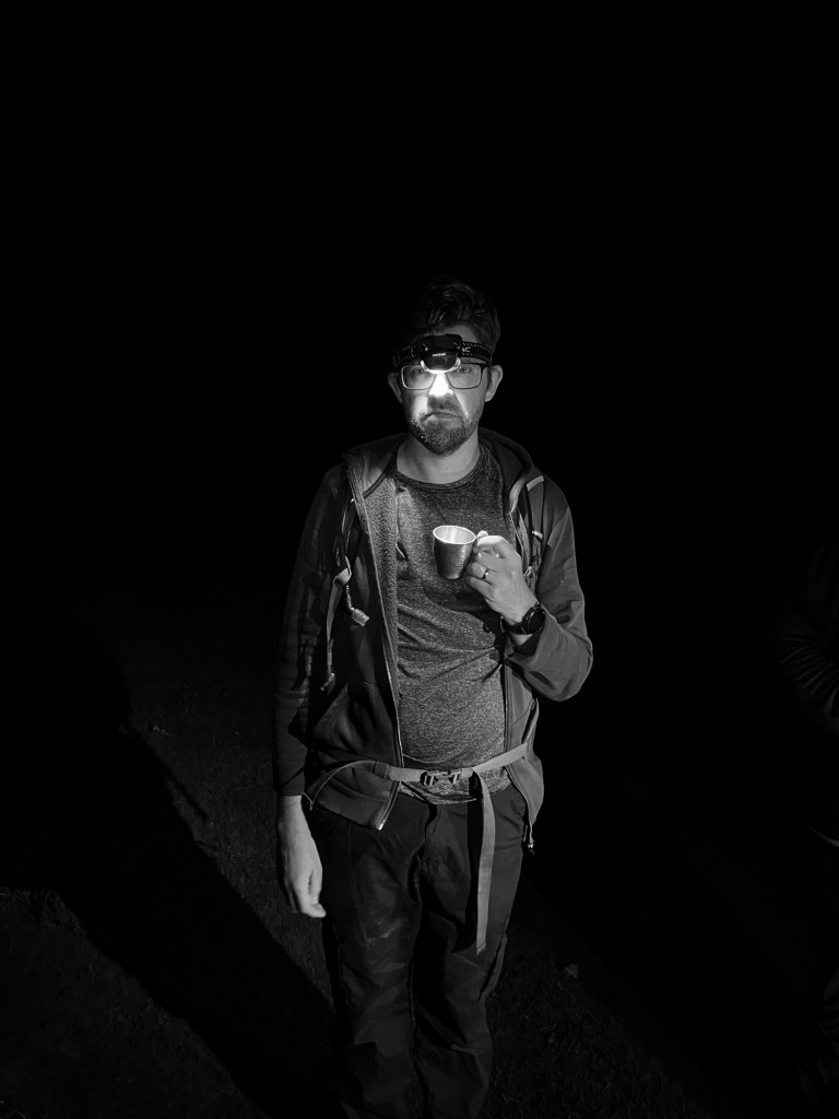
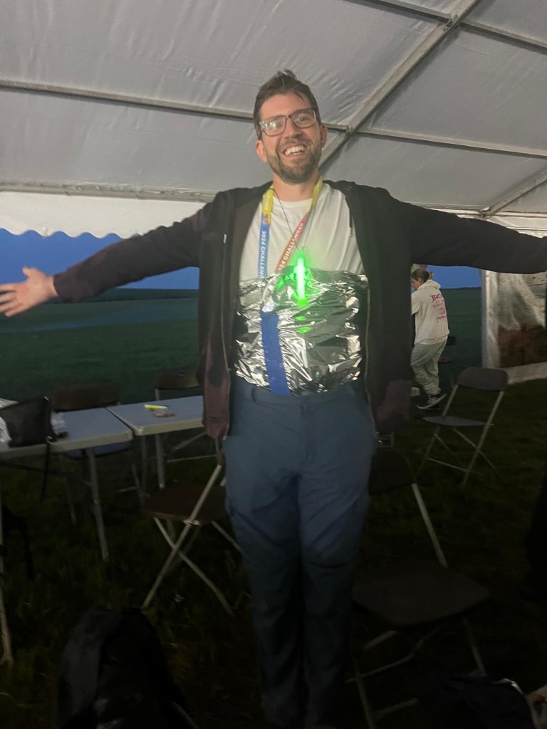
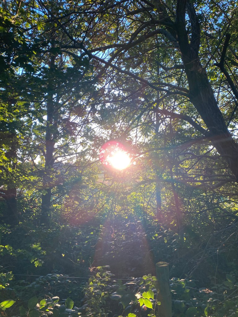
There was a point on this hike, The Walking Idiots twentieth organised shuffle through the south of England, where I watched plasma flares five times the size of the Earth pulse on the sun’s surface and I thought, “I wasn’t expecting to see that this weekend.”
(To clarify, I’d only had two pints by this point, but we’ll come back to the details later. I was also not on mushrooms, in case you were worried).
I was not watching the plasma flares when I took this photo, it’s just a nice one to start the blog with.
One of the main stresses with long distance hiking is getting lost. As much as you want to keep an eye on the route, if you do it too much you end up missing out on where you’re actually walking. Admittedly it’s not most of the crew’s headache, just those organising it, but from our experience if it can go wrong, it probably will.
So we couldn’t really go wrong with a coastal route: just keep the sea on your left. Fool. Proof. It was all part of our plan to reinvigorate the hikes, which have had a rocky time of it lately in terms of morale, enthusiasm and conflicting priorities. This was an alternative to our well-established and still unfinished attempt to trek the entirety of the North Downs Way, which although worthwhile, wasn’t something we wanted to be stuck doing. We’d already done a stretch of the Kentish coastline with Sittingbourne to Whitstable and it turned out to be one of our favourite hikes, so continuing that route seemed natural. If you kept going from Whitstable, in under twenty miles you’d reach Margate: it was ideal.
As the date of the hike snuck ever-closer and we went through the inevitable dance with attendees dropping out or enlisting last minute we kept a close eye on the weather, more so than normal. While our route was shorter and flatter than many previous ones, the UK was in the midst of a heatwave, with London and much of the south experiencing 30+ degree temperatures, not something you want to expose yourself to for eight or nine continuous hours, without shade, while drinking. Concerns were expressed by attendees and loved ones alike (hi Caroline!) but mercifully the coastal weather was forecast to be a bearable and possibly even overcast 21 degrees.
Unlike Rochester or many of the other locations we’ve started from, Margate’s hotel offering was both slim and expensive so I (via Jen, who I’d recommend for all your travel needs) sourced an airbnb for five of us to stay in. Five quickly became six and finally seven as other accommodation plans dried up, but we all fit in there well enough.
Those of us staying there foolishly decided to go for a few beers the night before, which was fine in principle, except we were unable to find food until we left, so we wound up being approximately six pints deep on an empty stomach before we sourced volcano-temperature food from Pizza-GoGo at midnight.
Taken after 10pm with only one bag of crisps between six being all the food we’d had at this point…
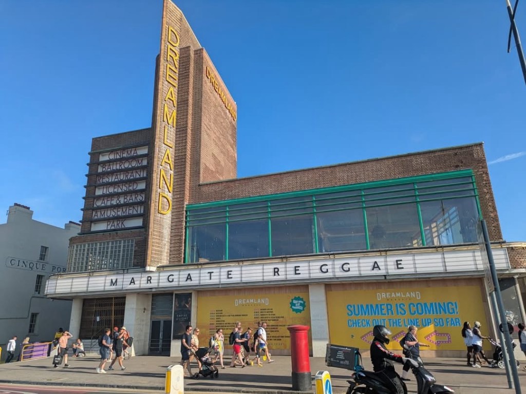
We were perhaps not our best selves the morning of the hike, our trek to the station through Margate’s streets reinforcing the initial impression it made the night before of sort of trendy/hipster, a bit shabby chic, and in some parts, seaside crack den.
Dreamland, legendary Margate venue, somehow embodies all of the above.
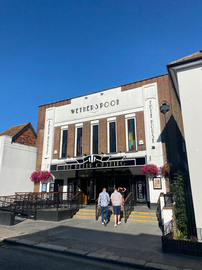
The crew convened in Whitstable at The Peter Cushing, a stunning Wetherspoon pub (honest) decorated in an art deco fashion, having been a bingo hall and most likely a cinema in a past life.
You Tarkin to me?
The Peter Cushing is full of film posters, coloured glass and film paraphernalia, and offers a treat for the eyes as you power through your five pound fry up. Apparently Peter Cushing was a resident of Whitstable in his latter years, leaving me to wonder what the odds would be that he would move to town bearing his own name. Was he aware? Did he know?! How did he react?!?! The mind boggles.
This was on the way to the loo’s. Mental.
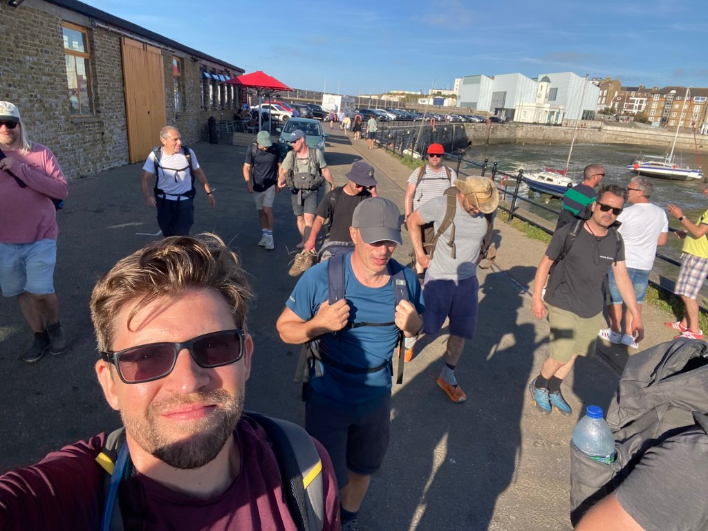
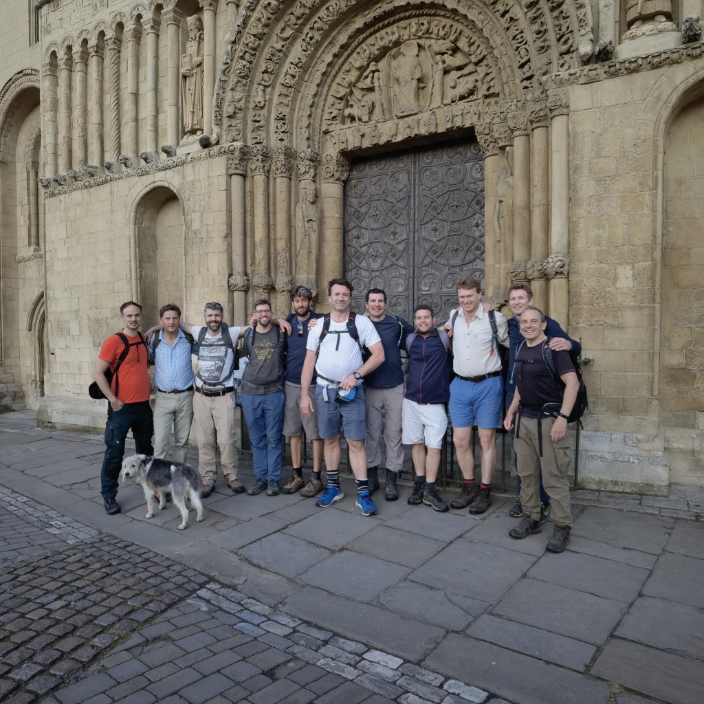
After breakfast we took our standard issue pre-departure picture and set off. Presenting your Idiots for the day:
L-R: Alex, Adam, Jack, Richard, Tristram, Max, John, Matti, Will, me, Nick and Flora, with Rob behind the camera and Alan and James not getting the memo.
And when I say set off, of course I mean the hike standard of walking to the nearest Little [Insert name of supermarket here] to buy our packed lunches. We took delight in watching John wander round the Sainsburys with a basket, wondering if he was doing his weekly shop.
As mentioned above, and probably will be later, the mantra for the day was keep the sea on the left, so it was near impossible to get lost. Most of this was on a coastal promenade, which was of course incredibly convenient and enabled us to keep a good pace but on occasion grew a bit monotonous, the pavement pounding threatening blisters.
Our first milestone on the coastal path was Herne Bay seafront, complete with pier, which in the interests of time we sensibly abstained from.
(We didn’t have space in our bags for all the change we’d need).
On the other side of the road we were treated to a DJ in a rather industrial looking space blasting out tunes at impressive volume at 11am. Said DJ used incredibly colourful (and incomprehensible) language while also releasing masses of bubbles, leading us to wonder who his audience was meant to be. Or had we misunderstood? Could this mystery simply be resolved if we concluded he was still going from the night before, like some Flying Dutchman of Dance?
Beyond the Damned DJ, Herne Bay abruptly turned beautiful with a gorgeous terrace of colourful houses, which only served to confuse us further.
The orange one was called The Orange House, which is a bit on the nose but probably is for the best.
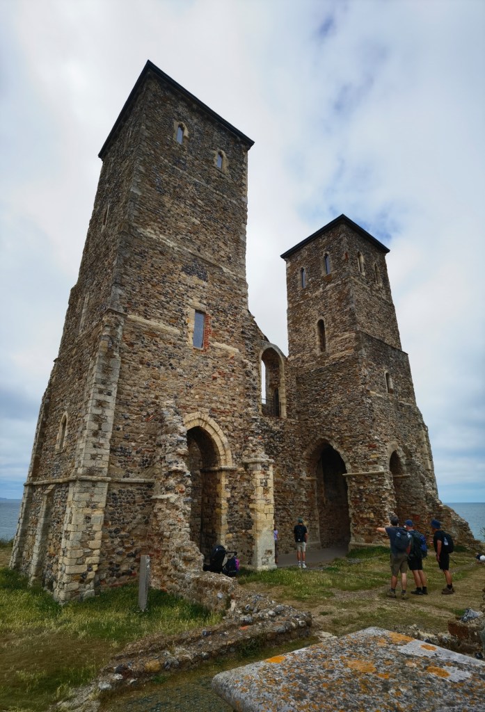
Continuing on, the route offered us some variety as the coastal route moved in land and we opted to take the beach on the way to Reculver, where we tiptoed over masses of seaweed and hopped over rocks, the ruins of Reculver monastery looming in the distance with more than a fleeting resemblance to Castle Greyskull.
It took ages for it to become life size.
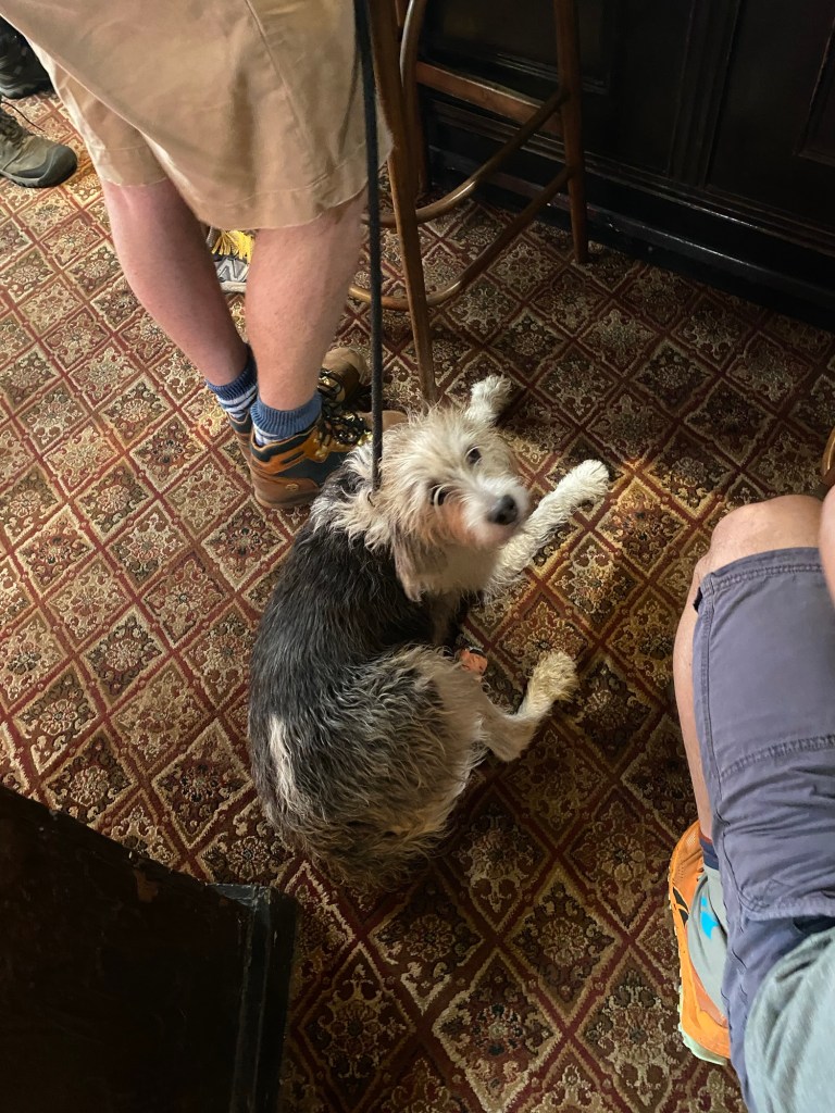
A moment of drama emerged on the way up off the beach when Flora, Nick’s faithful hound suddenly lifted a back paw in pain, having torn the skin on her pad on a sharp rock. A subset of the group convened to help, and soon enough they had fashioned something to cover her paw until we could get somewhere to take a better look and clean it up. Fortunately for us the first pub, the improbably named King Ethelbert Inn, was just beside Reculver, so we were able to assess it while we took a break and got a drink.
The beer was calling us. Don’t worry, Flora was fine. Utter trooper.
The pub was nice. Lunches had, beers sunk, bit of hike lore discussed as standard. Perhaps most importantly for a Walking Idiots hike pub, they refilled water bottles and my rather annoying to fill bladder without fuss.
Pictured: not a house.
We could’ve stayed longer but another drink would’ve been our undoing, so Max made his one mature decision of the day and declared we should depart, so depart we did!
… for about five minutes, because we had Reculver to explore.
At a glance, Reculver is pleasant and interesting enough. An Anglo Saxon monastery built on the site of a Roman fort, its ruins basically consist of the front and back wall, with two towers on the sea facing wall.
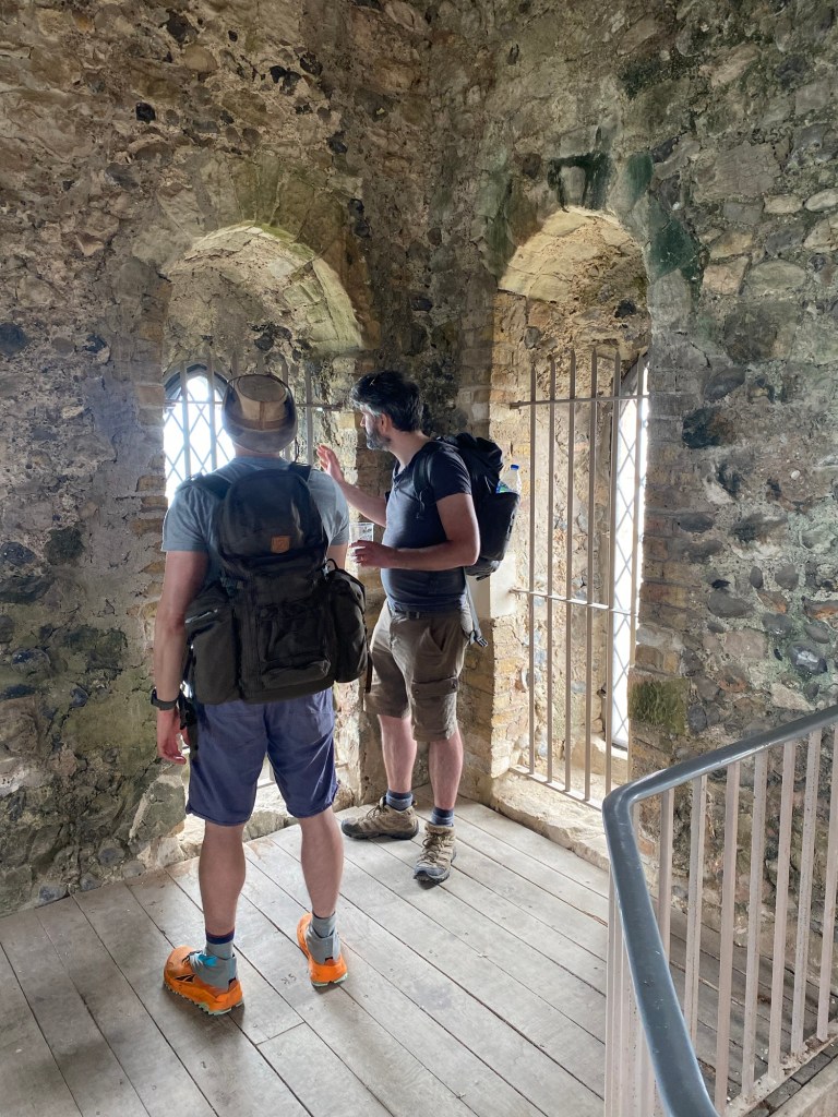
Where it gets interesting however, is that one of the towers are open to the public, so of course we had to go up it!
Imma climb that. It was quite cosy actually.
As we descended, Alex noticed that the tower staircase ran anti-clockwise, which would be inconvenient for defence. We questioned this with the two very nice English Heritage volunteers who were posted at the base of the tower, and they explained that the tower was anti-clockwise because the stairway to heaven is anti-clockwise. Despite never hearing Robert Plant tell me this, we took it at face value and moved on, only realising we had no idea what this meant until it was too late to go back and ask. Suggestions in the comments section, please.
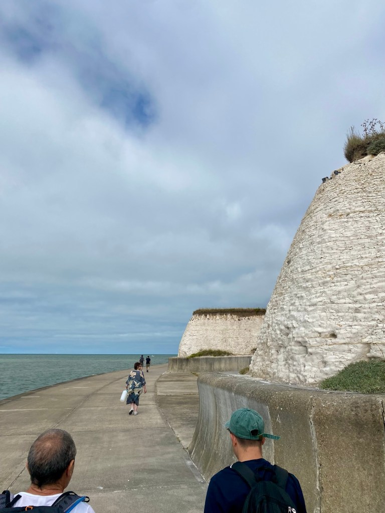
The route from Reculver east was another coastal path, but this one was refreshingly positioned between the beach and the marsh lands, giving us a flat, clear view of landscape to the south.
This would’ve been great on rollerblades. My dog does this, too.
More importantly, it provided Rob with an opportunity for some nonsense, and let me capture my hike staple photo that I can no longer stop doing under weight of precedent.
Thank you Max for getting this in the name of blog continuity. Sssh, it makes him happy.
The only downside of this glorious coastal path is that here more than anywhere we’re prone to having to move out of the way of cyclists. Oh well, you can’t have everything. It doesn’t stop John and I from divulging ten years of hike mythology to welcome newcomer James, who is polite enough to act like he’s enjoying it.
Pub number two is only four miles from our first, but we’re having a lovely time and are in no hurry, so we decide to stop for a quick pint at our next stop, The Minnis Bay.
While King Ethelbert was a traditional English pub that happened to be near the coast, The Minnis Bay is a proper open plan seaside bar with more picnic benches and outdoor space than indoor seats. The Minnis is like a transition from coastal path to promenade, and as soon as we leave it we notice a marked increase in families and people in general.
In case anyone wonders how I write these things, I tend to make notes as I go, and for the next stretch I’ve just written “Lots of promenade,” and this is indeed our landscape for the foreseeable future.
Lots. Of. This!
Our route continues like this for a while, the sun shining on us as we experience a range of seafront walkways, some more industrial than others. Our progress is paused for a while when Max drops a wine glass (one of two, purchased along with a bottle of red from the Minnis) and we rally together to pick up the remnants. Fortunately for us we find a pan and brush from someone nearby and leave no trace.
Why?
A short while later we pause at the West Bay Cafe and Beach Bar. John kindly gets a load of beers in – in plastic cups, intended for carrying, we’re not stopping – however we end up stopping for far longer than intended because just outside the cafe are two men from an astronomy society (I can’t remember which one but I’m pretty sure it was not NASA) who have an enormous telescope trained on the Sun.
Ah, telescope fwend!
Given what it was trained on, this telescope is configured differently to ones for nighttime, blocking out something like 99% of the light and 100% of the UV (note the tinfoil over the lens). These astronomers are of course very enthusiastic to share their fancy toy with outsiders, and several of us lined up politely like school kids to have a turn.
Some of us have success, some don’t. It took me a while for my eyes to adjust but eventually I noticed on this great white circle small black squiggly shapes pulsing, reminding me of the patterns lugworms make on the beach. Or maybe it was just eye floaters, who knows.
We bid our new stargazing friends farewell, take our walking beers and shuffle on, it can’t be far to Margate now. We get to leave the promenade and go down on the beach, everyone grateful to be off the pavement, especially Flora who has a fantastic time rolling on the sand and generally acting like a puppy in the best way possible.
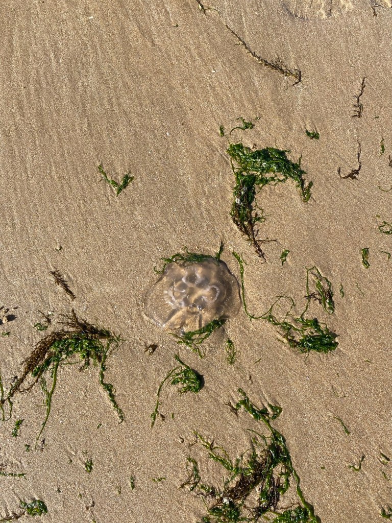
Amongst visual highlights on the beach we see plenty of jellyfish in one patch. I say highlight, it didn’t exactly make anyone happy, but whatever, it happened, I documented it, you’re reading it, you know the dynamic by now.
Here you go. Satisfied?
The closer we get to Margate the busier the beach becomes, but after a peaceful day wandering we don’t mind a few more people about. Not to mention walking on the beach itself was great fun.
Sadly this isn’t a picture of Alan climbing on something as per most hike blogs. Which reminds me…
Where was Alan? Along with Tristram and Jack we couldn’t see them about, and we knew they’d stayed at the cafe to finish their drinks, but hoped they had caught up by now. A rule in the Walking Idiots manifesto is we finish as a group, but if we can’t find them, it’s not happening. We decide to wait for a bit and enjoy the beach, while Nick and Flora decide to head home, which is totally fair – we’re not far from Margate now and they owe us nothing.
Including this picture just because for once we all look great at the same time.
Rejoining the promenade for the last time, we find a worthwhile way to pass the time waiting for Alan and the others when Max accidentally drops his and Matti’s bottle of tequila. It of course shatters, and a handful of us spend ages carefully picking up every bit of broken glass we can.
Note Matti deciding he’s not getting involved in this bullshit.
Many swear words are groaned in exasperation when, having nearly finished, a wine glass slips from Max’s belt, causing us to start over.
At least we found a use for the leftover cups from the cafe I guess.
Feeling quite pleased with our efforts to correct our inadvertent antisocial behaviour, we dispose of the glass responsibly, noticing more broken glass nearby. Ah well, at least we left no trace.
As our final mile takes us along the Margate seafront I am trying to find a better word to describe it as than carnage.
Civilisation has peaked.
It’s an early Saturday evening in a heatwave in July, there are people everywhere and the noise coming from some of the bars is pounding (the only acceptable volume for ABBA is mute). Forget what I said earlier about not minding more people, this is ridiculous.
Here’s all the culture we found.
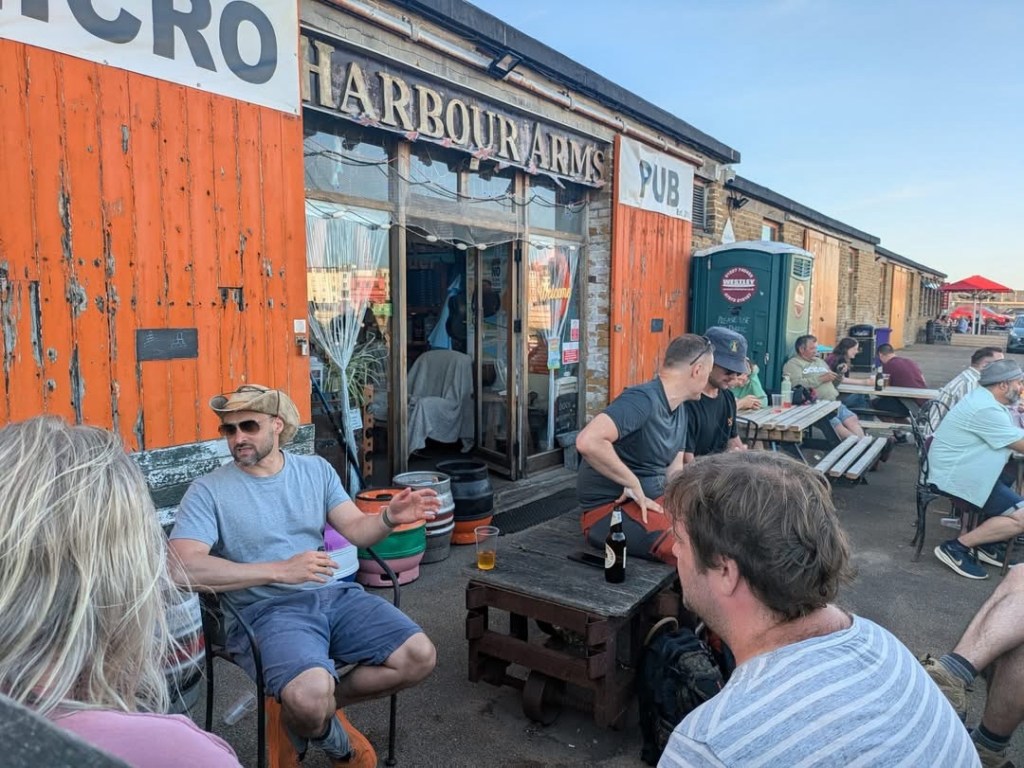
We crack on, our hopes of finding somewhere relatively quiet for a drink diminishing as we go. There is some debate about where to finish, but I for one remain undeterred that we need to finish at the Harbour Arms, located on the harbour wall on the other side of the beach. Not only was it our original end point, and we hate changing it, but it’s far enough from all this Margate madness that it might actually be quiet enough to get a beer and rest legs that are getting a little weary after 19 miles.
Our salvation!
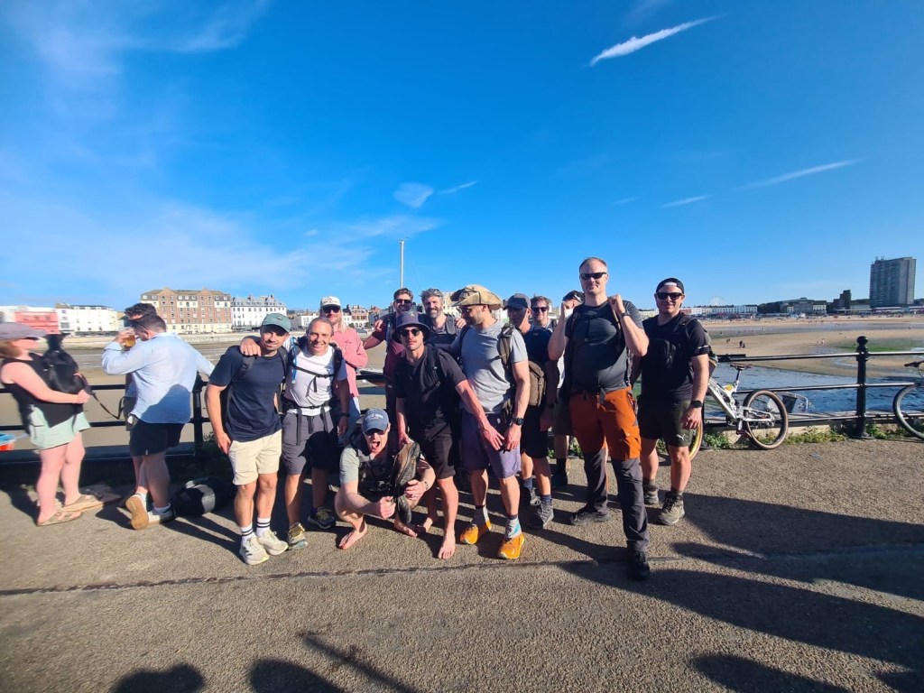
As we leave the seafront and reach the start of the stone pier, Alan, Jack and Tristram appear on the beach with perfect timing, and as a unit the group finishes as a team.
Don’t we look chuffed?
We stop for our obligatory end of hike picture before claiming our victory pint(s).
This felt more organised when we were posing for it. Yay more plastic cups!Still our best option though. The Harbour Arms is dead class.
As always, after a couple of drinks the group disbands, bonded by Fellowship, etc etc. The Margate contingent return to the pub from Friday to actually get food this time and we are successful.
So there you go. Twenty hikes. Over 400 miles. More than ten years of long walks with good friends, scintillating banter and haphazard documenting of them. They’ve been great and we’ll keep doing them for as long as we’re able.
I’ll sign off with the only photo Tristram took of the day, which articulates how we feel about Margate nicely I think. Always good to see the best in everything where you can.
In which the Idiots tackle the Surrey Hills (kind of), struggle to retain group cohesion (for a little bit) and make a wise decision (for us).
After a brief flirtation with ultra marathons we were back to BAU on the Pilgrims Way, by which of course we mostly mean the North Downs Way. Did you know most of the Pilgrims’ Way between Farnham and Canterbury is now road? I’d always been a bit confused by why we weren’t doing it until I read up on it. That’s progress for you. Still, at least we have the North Downs Way (NDW from now on) to use instead.
There was absolutely nothing wrong with that plan at all.
The route at first glance didn’t look massively inspiring until I realised Jen and I drive through a fair part of it when we head down to see my parents, and once you get past Guildford there’s some really nice sights. That route (mostly the A283) runs through some stunning parts of the South Downs (think Chiddingfold, Petworth, Bury Hill and Arundel) and when we’re done with this NDW shenanigans I’m going to lobby the group to explore some of that. Or just do the Lake District, because I’m a little fixated with that at the moment.
A spot of planning followed courtesy of Angus (first seen on Hike XVIII,) who kindly helped us optimise the route mapping, having grown up in the area. This definitely came in handy from the off and continued to prove invaluable as the day unfolded.
As the hike approached we realised with a degree of mounting dread that although Guildford isn’t too awful to get to, for most of us, getting back from Alton was going to be a chore. Creative solutions were employed with the most attendees choosing to drive for the first time.
(I say Guildford isn’t awful to get to but for my part I had a cancelled train at Reading and anxious staff fretting that the next train might not come either, which wasn’t easy on the nerves. I consoled myself by getting a McDonald’s breakfast in Reading town centre and foolishly giving my spare hash brown to a homeless guy who was actually pretty grateful.)
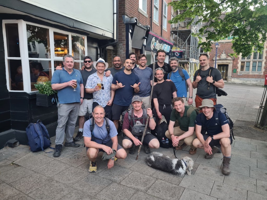
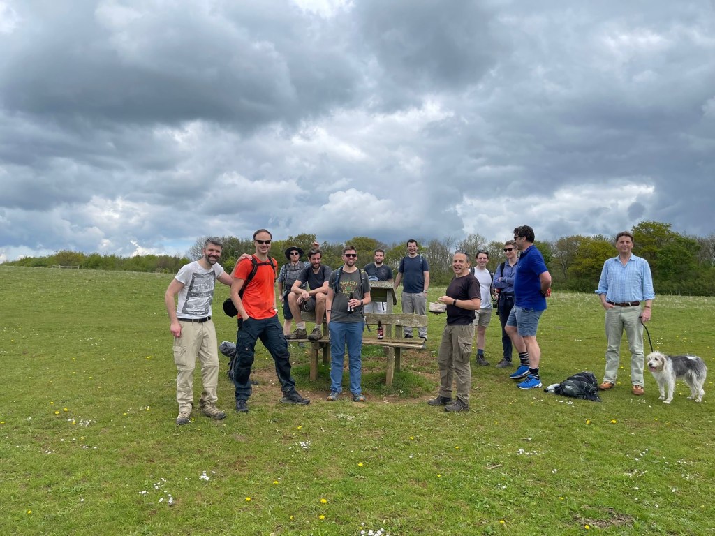
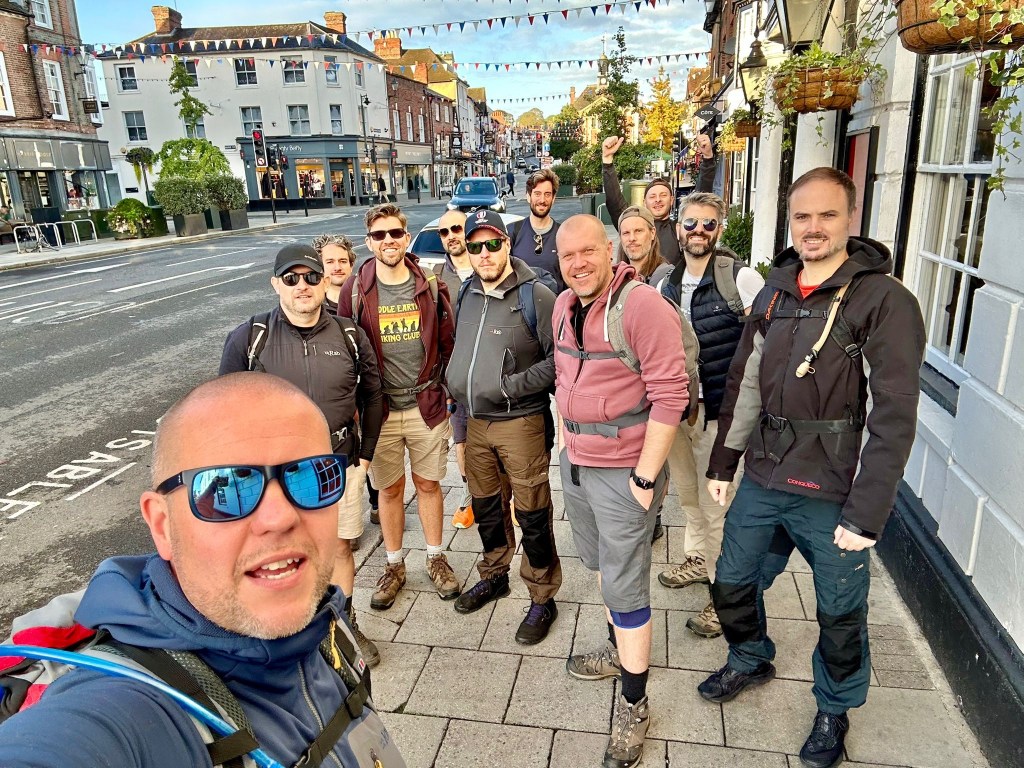
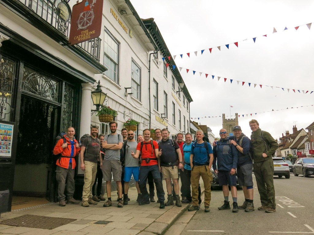
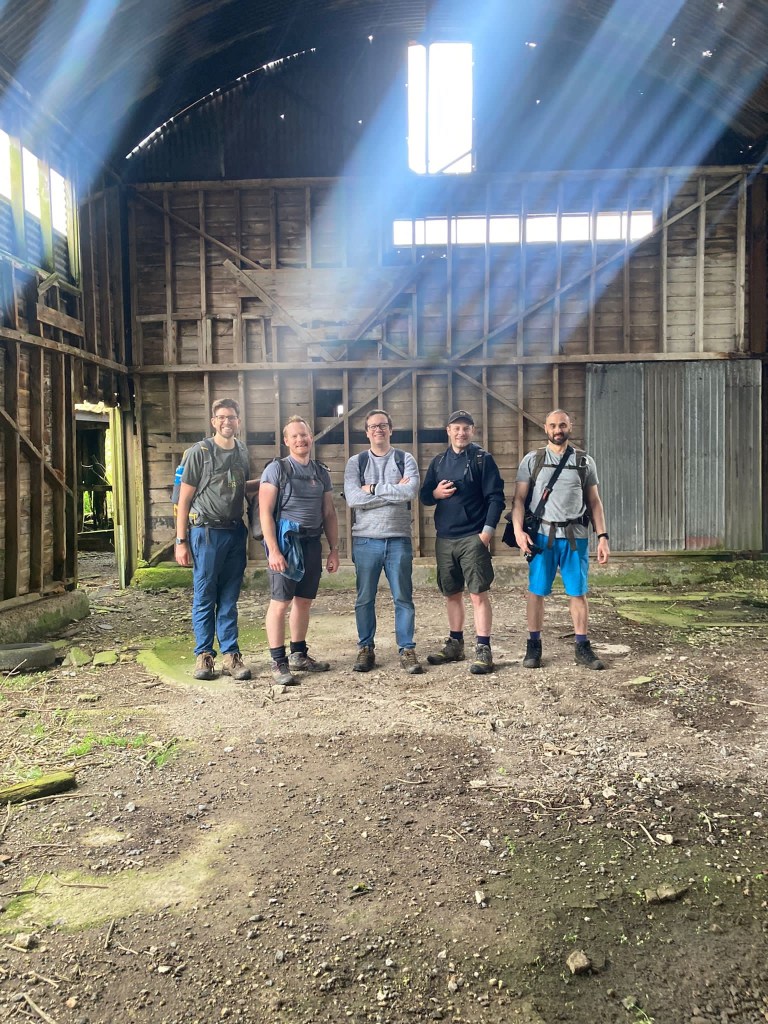
Anyway, we convene at Wetherspoons as is tradition and after some prep we head off, taking our obligatory start pic:
Idiots Assemble! Elliot, Arran, Henry, Angus, John, Alex, Alan, Mat, me, James, Steve and Mike with Rob behind the camera as always.
Well, I say we head off. What actually happens is John declares he hasn’t got lunch, so he nips off to get that from Tescos, but that’s less cinematic isn’t it.
This Tescos, in case you’re interested.
And then, with sandwiches purchased and the sun rising blearily behind the clouds, creating a silvery autumnal pallor, we start our hike.
For once (and again thanks to Angus) we have the option of uploading our routes to our watches, which I am definitely doing from now on as it just made life immensely easier. Until we go off trail, at least, but we’ll get to that later. I’m not saying we’ve been doing these for a long time but when we started it was all print offs of Google maps.
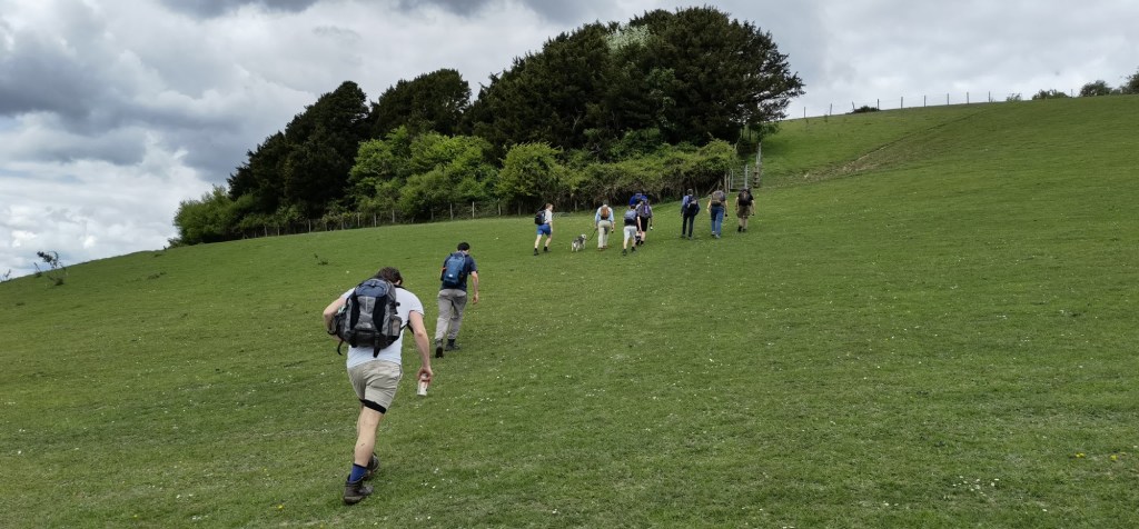
Our route out of Guildford unfortunately doesn’t follow the river (it would’ve added too many miles too early) but at least took us past several of those rather posh Surrey houses I know I’ll never be able to afford but always like to look at.
Case in point.
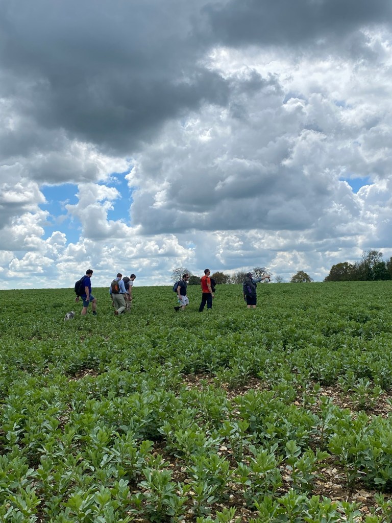
Heading south of the Farnham Road and past the Watts Gallery, we cover a stretch that runs between holes at Puttenham golf club before we emerge at the base of the Hog’s Back, where we follow signs into Puttenham.
Puttenham is one of those places where each time we drive past it I wonder where the road leads, and for once I get to find out.
It takes us past another collection of charming Surrey cottages briefly and then on, along a long smooth road that we follow for miles.
I always think of roads like these as country death roads (which wouldn’t be a bad name for a song) just because there’s no footpath and cars can rocket down them at incredible speeds, but honestly the risk was mitigated by how quiet the road was and how straight it is, giving us full visibility. It also gave us a remarkable view of the countryside on both sides, but without having to worry about wetness underfoot, which was likely given all the recent rain. The only drawback was all the cyclists – the natural enemy of hikers – who often passed us by with a grimace as they had to move slightly into the centre of the road. Or because their Lycra was too tight, they didn’t stop to tell us which one it was.
This is definitely a good idea.
Any doubts about following the road are quickly dismissed as we do our first bit of trail walking by the river, quickly having to tip toe over and around bog and puddles and scoring a few of us our first wet feet of the day.
Give it a month or two and we probably would’ve all needed piggybacks from Angus and Henry. Hands up if you love nettles.
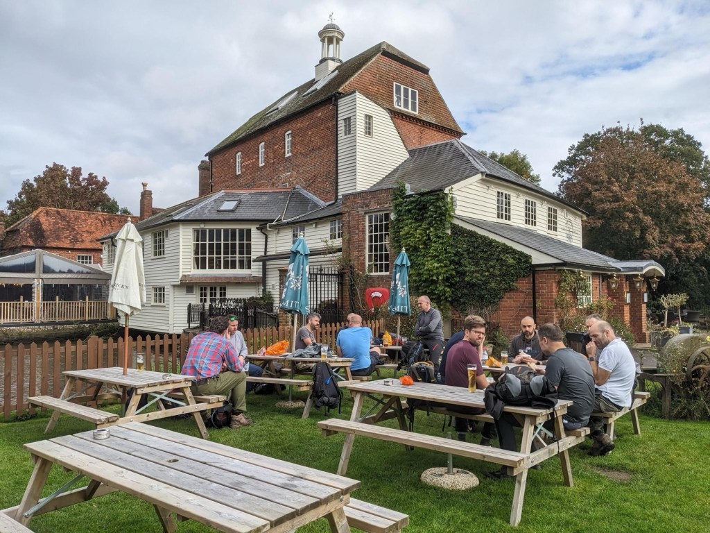
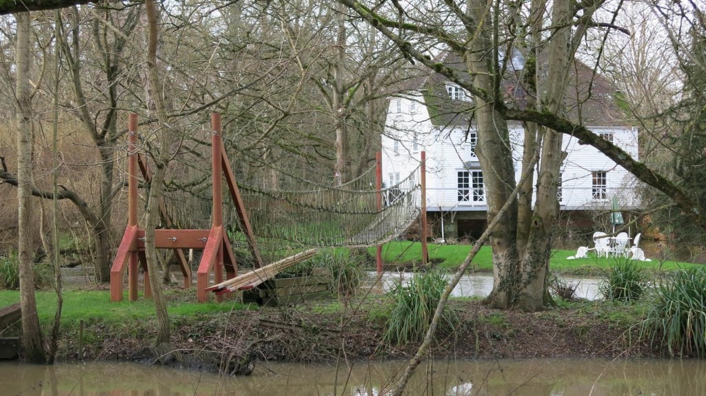
Somehow nine miles have flown by and it’s not long before we make it to our first rest stop, The Mill at Elstead.
This’ll do.
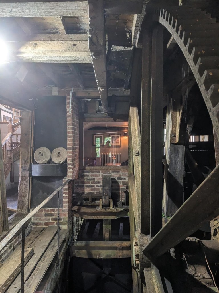
The Mill is quite beautiful. Beautiful enough to also be a wedding venue, and there’s a moment where we wonder if we’ll be allowed in or even shooed away. The original mill burned down in 1647, the same year it was occupied by Cromwell’s Roundheads (coincidence?) with a new one built the following year. It also served as a hospital in the Second World War, although presumably it wasn’t a pub then.
The original wheel is still preserved in the pub behind a large glass screen, and a few of us spend our recovery pint time admiring it before we move on.
Cool, innit!
Deciding to get on before any of us get roped into ushering at the wedding we get back on to the NDW and heading properly off road. The landscape takes quite an interesting turn as we climb, with a noticeable drop below us as we look down on the River Wey (pronounced “Waaaaaayyyyy” when we did GCSE Geography).
Throughout the afternoon the rain continually starts and stops, with one particularly vicious shower forcing everyone to hastily put on their waterproofs, including Alan’s epic whaling coat, which could comfortably host a family of four. Here it is in action on my favourite accessibility-challenged walkway to date:
This counts as my obligatory picture of Alan climbing on something, right?
I loved this health and safety nightmare so much (the walkway, although I of course love Alan too) that I had to make the boys stop for more pictures of it:
Arran looks delighted to stop for a quick pic.
Soon after we realise we’ve lost Mike and wait as he catches up – despite the path being relatively straight he went off trail and confused us with a bunch of golfers. After playing a few holes he rejoins us.
From here we begin to approach Frensham Common and its lovely ponds (which are more like lakes). The common is National Trust owned and the ponds (Little and Great, respectively) were originally created in the 13th century to provide Farnham Castle with fish.
It is rather pretty.
We go off trail for the first time here as a particularly steep hill holds appeal for those of us in the lead, (it’s a barrow, what can you do) but as we come down the other side, we realise we’re missing almost half of our members. Bugger.
Was it worth it? Kinda, yeah.
John, Angus and Henry decide to head on to the next stop, the Frensham Hotel, only a mile or so away, while the rest of us wait around for our missing crew. After ten or fifteen minutes and a few calls and messages to them we realise they aren’t coming the way we did, instruct them to meet us at the hotel, and we head off.
Our enjoyment of Frensham Ponds is a little marred by the fracture in the group and the realisation we’ve got ten miles to cover in three hours, but it’s not long before we rejoin the route and pass over various hills of heathland. Sailboats can be seen on the glittering ponds in the distance, and the sky finally clears up as we reach our second stop, the Frensham Ponds Hotel.
Much to our amusement/frustration (delete as appropriate) our missing five members have somehow overtaken us and made it to the hotel already, and everyone is sat in the lobby with a pint. John tells me if I’m getting a drink to make it snappy as the hotel’s vibe isn’t what we’re looking for, and the Bluebell pub (approximately a mile away) is far more appropriate. I mishear pretty much all of this and just register the point that if I’m to get a drink I have to rush it, and give what I refer to as The Stare (like what Paddington Bear gives), or as Rob describes it, I break character. Fortunately the situation is clarified and I’m mollified once a beer is in my hand. Alan is similarly fuming until he realises us lot who have just arrived were just behind, and hadn’t decided to march on to the end without stopping.
Silly boys. Silly, silly boys.
The issue of daylight and distance persists, however, and we discuss alternatives. Alluded to in the opening of this post, for the first time we make a smart decision and decide to shorten the distance, ending in Bentley rather than Alton, reducing the remaining distance from ten miles to a far more manageable six.
Inheriting the mantle of fury from Alan and I, it’s now Alex’s turn to be livid as he has counted on finishing in Alton and has planned around it. Unfortunately for him he doesn’t (yet) have a seat on the committee and his protests are ignored, or more accurately, we laugh at them.
The decision made to now head to Bentley we leave with renewed vigour (or bile in Alex’s case), although misfortune strikes once again as we pass the Bluebell, and John, Alan and Henry decide to stick to John’s initial plan to get their “proper” drink there. I leave them to inform the others who have gone on ahead, except the group consensus now is that we’re not stopping, having done so only a short while earlier. We split once again.
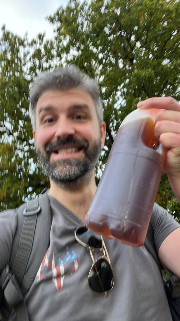
To say that mine, Rob and Mat’s anxiety levels spiked here is putting it mildly, and we catastrophise a rift in the group and the threat of fury from those we’ve left behind. Not having the amended route to Bentley (the original one on my watch now out of date) I stick with the main group and try calling and messaging John to let him know what’s going on enough times that I’m pretty sure it legally counted as stalking. To everyone’s great relief I receive a message that just says “yes” when I ask if he’s got the map, as well as this picture:
But what’s in the bottle?! We’ll find out soon enough.
Not to mention a there’s a much more welcomed follow up message that says they’re just behind us. Everyone’s buttocks unclench and the sun comes out again.
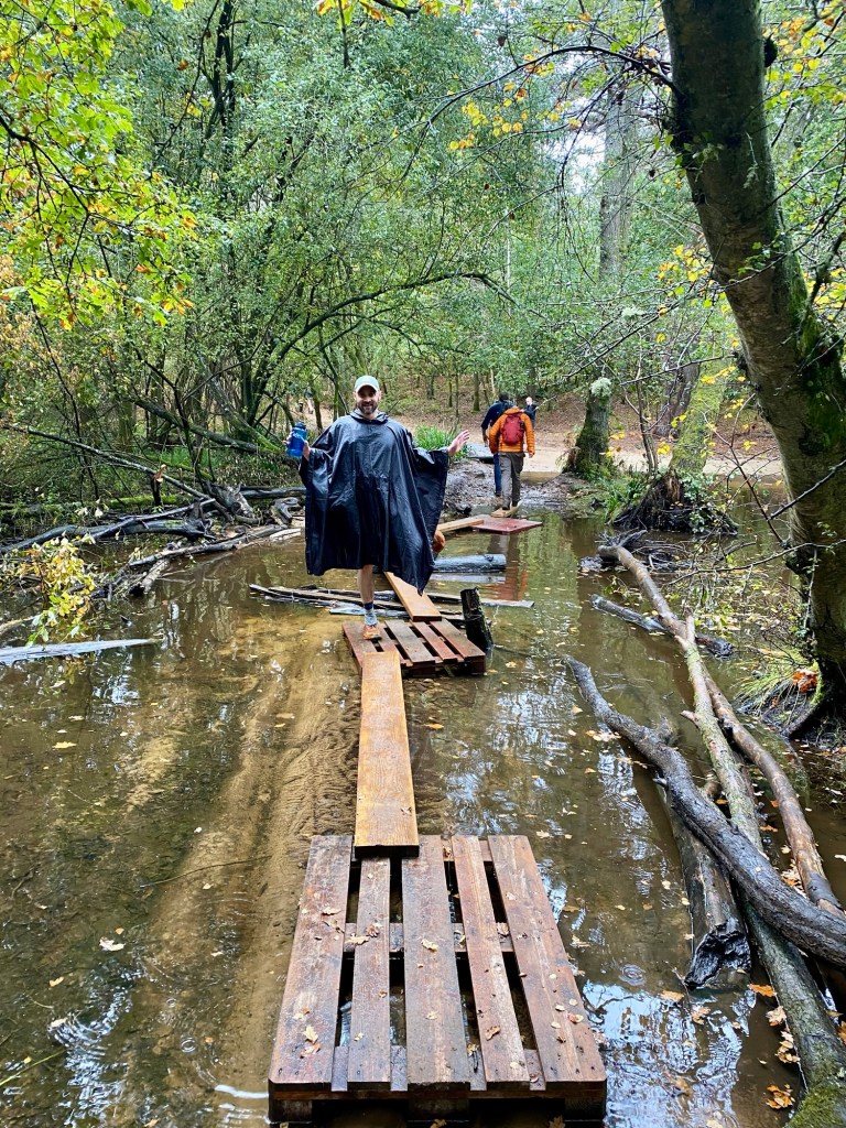
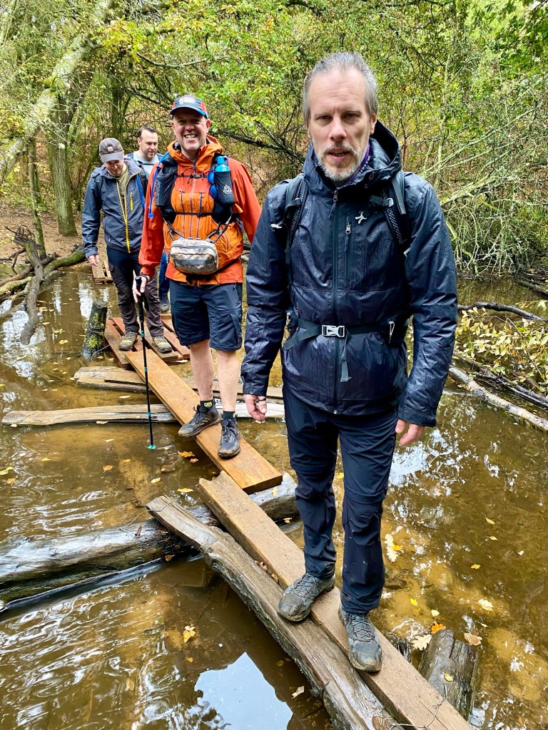
However, any further thoughts about our missing brethren are quickly set aside as we head deeper into the Blacknest Woods. Significant logging and felling has taken place, and the vehicles going over the main track combined with all the rain have managed to turn the pathway into one long stretch of bog.
Our pace slows down astonishingly as we pick our way through. I place a foot on what I assume to be a solid mound and am taken aback when I realise it has the consistency of stacked liquid (Arran and I both made reference to the soup tower joke from Black Books, if anyone remembers that). This misery continues for some time but we make our way through for the most part unscathed.
These were new shoes, too. Un.Im.Pressed.
Better than unscathed actually, because miraculously as we regroup at the next corner, we find our missing crew, the gang reunited once more. Just as importantly, we learn what was in John’s bottle. It was, of course, a beer to go. Naturally.
In some ways what follows was almost as hard as navigating the mud, as our path is covered by loads of discarded branches of various sizes.
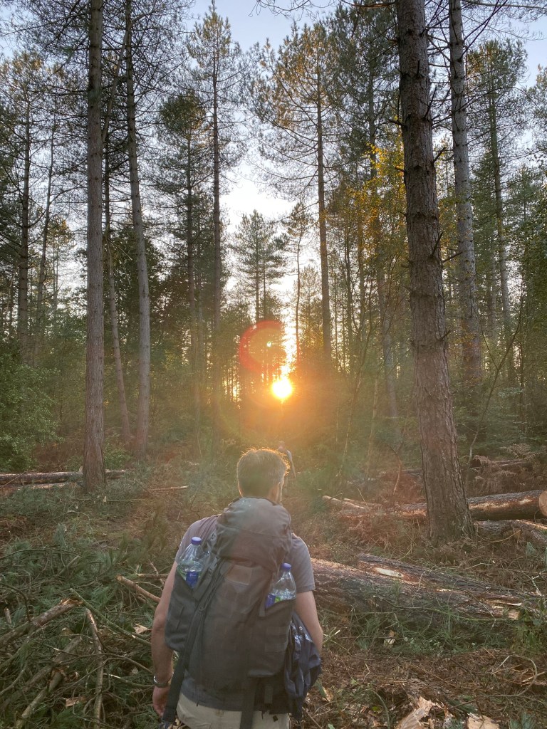
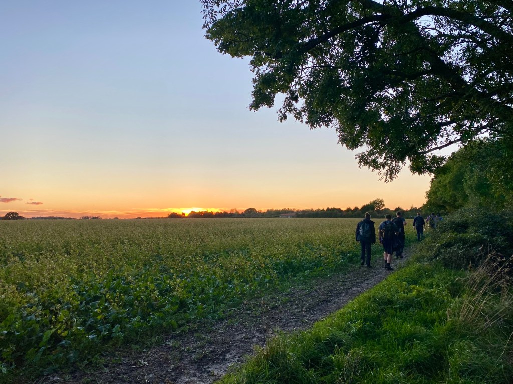
The ground becomes incredibly treacherous as we have no idea what the branches conceal (I’m picturing a pit with spikes for some reason) but miraculously we make it through and see out the rest of the woods enjoying the golden hour as the sun begins to set, always my favourite part of a hike.
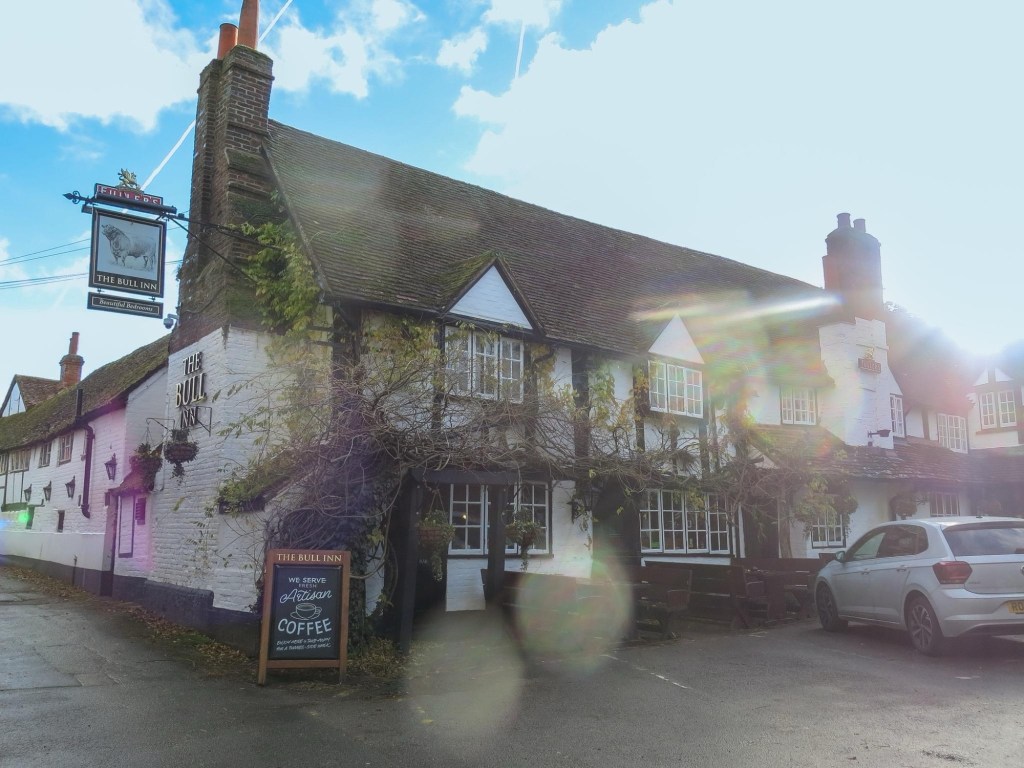
From there it’s all very relaxed as we watch the sun set while walking through fields and pathways, until after the last of the twilight has faded we arrive at The Star Inn in Bentley.
This is why we do it. Can’t get enough of this.
We stop to get our obligatory in front of the pub finishing selfie, which unfortunately could be misconstrued as Mike taking a picture of the girls in the house over the road, but the police never come so we assume they understood.
Is this evidence?
We see the evening out in the Star, a lovely local pub with a pretty good menu and a range of beers. Mostly importantly the staff were welcoming and there was even an enormous table in a nook which could accommodate our raucous bunch with little disruption to the locals. John even got a round in for everyone, which was a lovely gesture.
As the evening wound on the ever-looming decision to head home came upon us, and a small fleet of ubers were called to get those of us not going from Bentley train station to wherever they needed to go. All we needed to do now was get home, sort our feet out, rest up, and wait for John’s wife’s inevitable sarcastic comment when Rob posts hike photos on Facebook.
So I guess the big question now is… is our next hike, the prestigiously titled Hike XX, going to be all four miles of Bentley to Alton?
A few years ago I was on a zoom call at work and one of my colleagues mentioned that her friends were doing the London to Brighton ultra challenge. I didn’t even know this was a thing, and after a hasty burst of research, the idea was stuck in my head. Within a few weeks had signed up to give it a try.
I half heartedly mentioned it to a couple of my friends but it got very little traction, and honestly for some reason I thought it was something I would want to do by myself. I’m still not sure why; my friends and I hike together all the time, as I’m writing this we’ve done 18 x 20 mile hikes in the last decade plus numerous other smaller walks too (all documented in meticulous detail on this very blog). But I was determined, I could do this by myself.
As it turned out, at the eleventh hour my uncle got wind of this challenge, and being a similar sort of lunatic, expressed the desire to join me. As soon as we did the challenge it became clear to me that if he hadn’t come too, I wouldn’t have finished it. It was excellent, but so gruelling.
Now the problem with these challenges is once they’ve got their claws into you, they’re never letting go. And I don’t just mean psychologically. I mean tailored ads, mailings lists, all the sort of stuff one needs to be gently persuaded to maybe consider one again even though last time you swore that was it forever.
This time, however, I wouldn’t be looking to do it alone.
I shared a few of the options with the hiking core crew and Mat got very excited. Before I knew it, he was inviting people too. Before long we had a crew of seven determined to give the Jurassic Coast Challenge a try.
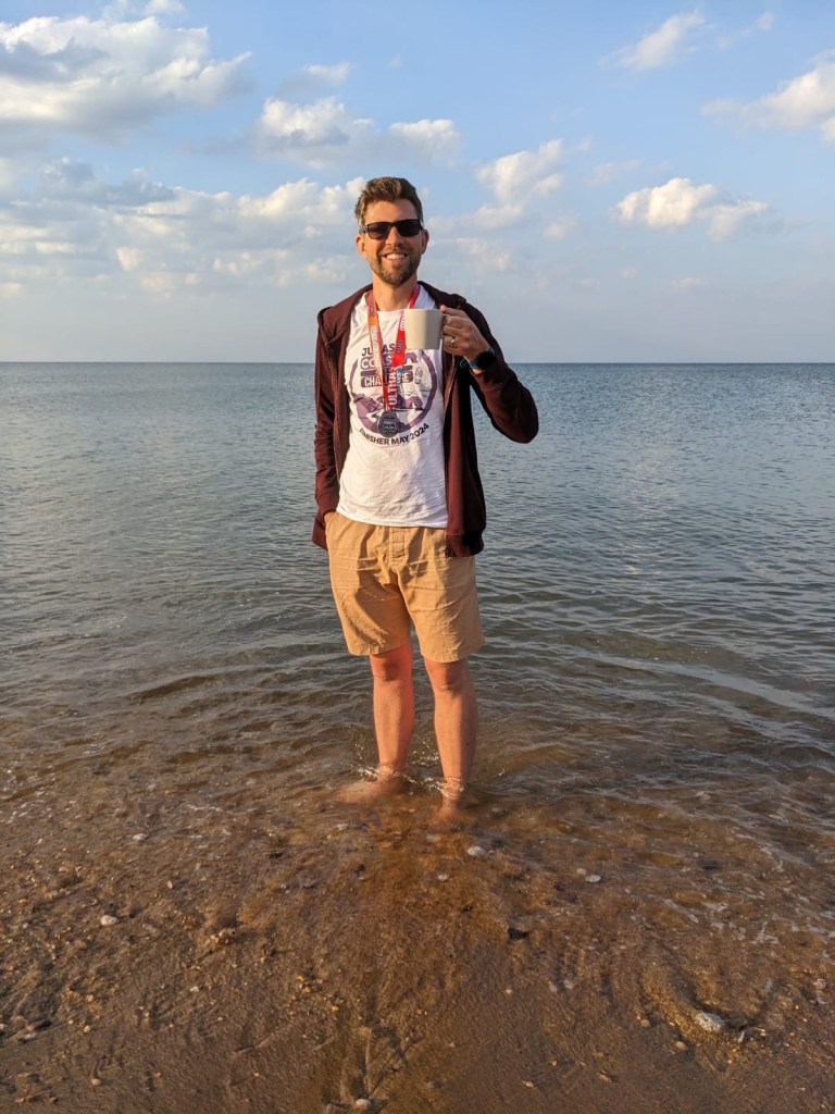
The enormity of the task ahead of us – combined with how badly I struggled the year before – inspired us to come up with some serious training treks, and we ended up doing five training hikes of approximately twenty miles each, covering locations such as Langston Harbour, the Knepp Estate, and the Hambleden hills. We bought hiking poles (something I hadn’t bothered with on London to Brighton until the end) and learned to use them. We bought bladders and appreciated the value of staying properly hydrated (as well as the value of finding convenient woodland places to nip to the bathroom). We found a decent looking Airbnb that could accommodate us all in Bridport about ten metres from the beach. We were ready.
The night before the challenge began we registered at the challenge, checked in at the Airbnb, went for dinner, and then packed our final bits. Impressed by how close the Airbnb is to the beach, I tell Rob that first thing Monday I’m going to stand in the sea while I drink my first tea of the day. Arran arrives short on supplies, having had a break in the night before and having hastily packed. There’s a moment of horror when we realise Rob has forgotten the top part of his bladder, rendering it useless, and we all scramble to find additional water bottles for him to carry. (It was, apparently, on top of the microwave. Which is good to know but not tremendously helpful).
I never sleep before hikes and ultras are the worst. Before London to Brighton I managed about 90 minutes, this time I grabbed a far more satisfying 3 hours and 20 minutes before the 5am alarm, and we headed off to get the transfers needed to get us to the start (which I won’t go into detail about because honestly they’re really useful to have but boring to read about).
Let’s get to the good stuff.
What you want to read about is the challenge starting, right? So we’re guided into this pen, given a very wholesome dance themed warm up (Mat and I loved it, the others looked somewhere between indifferent and furious), count down to the 8:30 start time and then finally we’re off (after lots of shuffling as we get past the start line)!
Let’s gooooo!!!
The first few minutes are really quite cramped as we head off through a few fields and pathways, and naturally it starts to rain so we stop to get the waterproofs out, immediately getting overtaken by everyone around us, and losing the crowd, which is quite nice actually. Mike leaves the group in the first ten minutes of setting off to go for a wee, which is a habit he becomes remarkably consistent in maintaining over the course of the challenge.
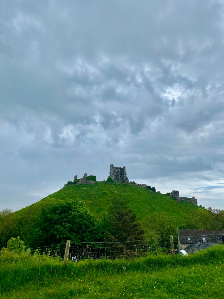
Our route leads us under Corfe Castle, which was built by William the Conqueror (you might have heard of him) in the 11th century. It’s a visually stunning sight, and a lovely way to start our journey.
Personally I think Will outsourced it.
As we leave the coincidentally named village of Corfe Castle we immediately realise our mistake combining layers with waterproofs as the elevation kicks in and become a hot sweaty mess, but once we get our attire sorted we’re on our way, climbing high up over the hills that look down at the valley below, the steam train from the Swanage heritage railway occasionally passing through the valley (although not enough for Rob’s liking).
This stunning route eventually lowers us down into the Ulwell Holiday Park, where Jen and I once spent a week on holiday. I have very fond memories of reading the last Game of Thrones book there while drinking cider in 2012 and hoping George RR Martin would release the next book before the show caught up with him. Or at all, would be nice.
Just before Swanage we reach our first rest stop of seven, where we break for a snack and a reflection of the walk’s start before we’re off again. There’s not too much to say about this stop really given how early it was in the hike, and it’s fair to say none of us needed it at this point, but the pastries were nice and it’s always good to top up the water.
The route then led through Swanage, which is nice but honestly no one likes walking through towns on a hike; it’s just weird and you feel like you’re dressed like an idiot when you’re back in civilisation. The route then leads uphill once more towards Worth Maltravers and loops us back to the second rest stop at Corfe Castle (both village and structure) where a strangely purgatorial feeling sets in the closer we get to where we started.
The second rest stop provides lunch and I’m pretty happy with the food on offer (in addition to sandwiches, fruit and crisps they have proper satsumas as opposed to those weird easy peelers). Most of the team get to work on their first sock change and we’re treated to a visit from Becky, Mike’s wife, and their daughters Sophie and Maisie. We take a bit longer here but it’s a worthwhile break to get ourselves sorted.
Leaving the second rest stop we’re almost immediately treated to an amazing uphill climb near Church Knowle that takes us up onto the Purbeck Ridge Path.
Head for the cow!
The Ridge is, quite frankly, bloody stunning. It runs for miles with views as far as the eye can see in both directions. It’s sunny but not too hot, and everyone is in a good mood as the path gently rises and lowers over the hills. If the whole thing had been like this we would have had no problems.
Big ridge energy.
A short while later Mat gets a call from his wife, Hannah, who cryptically tells him to turn around. He does and she’s a short distance behind us, having driven down to support him for the weekend. He is, of course, absolutely delighted.
Someone’s chopping onions. It’s probably Mat to go with his next steak.
We carry on and walk for a few more miles, the group splitting into smaller units and regrouping on and off as comes naturally. One of the nice things about the Ultra challenges is meeting new people and we all end up chatting to various groups as we go, including a very nice lady who apparently has a decent side hustle selling pictures of her feet online. I could do the same after this walk, but only to medical journals or horror effects enthusiasts.
Then, as Arish Mell beach appears below us, things get interesting.
We hear a crack and looking behind, see the sky above us is black. It’s likely to start raining any minute now, and we make our way down some of the steepest descent we’ve ever faced. It’s so sharp it’s almost comical, and the air is filled with the sounds of hikers giggling as they try a range of ways to handle getting downhill, from walking in a zig zag (and nearly bashing into one another), walking like Mr Soft from those Softmints adverts that used to freak me out as a kid, or in some cases even jogging down (I tried this, would recommend).
Weeeeeee!
The further we descend, the higher the next hill seems, and the more the rain slowly starts to make its presence known.
We’re meant to climb… that?
At the base of both hills we pause to regroup, hastily throwing on our waterproofs as the rain comes. We do one of those hands-in huddle things before ascending – it was meant to be ironic but the hill is so intimidating that we do it sincerely – and as the storm begins, we start to climb.
Dig deep, Robbie.
I heard another participant refer to this monster as Heart Attack Hill and I can certainly see why. The ascent was like nothing we’d ever done before, made all the harder as the rain intensified. Everyone set off at their own pace, with Arran storming ahead, Swatty, Rob and I moving in a similar pace behind, and Mike, Clyde and Mat coming next.
Basically everyone behind you was left for dead. Nothing personal.
If we’re hoping for respite when we reach the top we don’t get it; the storm is worse than ever, with thunder cracking loudly over our heads, reminding us that we’re incredibly exposed and carrying metal poles too. The rain couldn’t possibly get any worse, and yet it does, the track rising and the descending, and becoming more and more water logged.
The rain decides to adopt a new strategy here and tries striking from the side, all the better to get into our hoods. Then it turns to hail, because at this point why not. The sun glows sickly behind sepia clouds.
The whole thing is borderline apocalyptic and really quite incredible. Everyone is marching at their own pace now and when I catch up with Swatty for a bit I tell him this is greatest and worst thing I’ve ever experienced and he wholeheartedly agrees. It’s fair to say we’ve lost the plot by this point.
As if things couldn’t possibly get any better, as the hill descends the chalk path turns into a stream, and with the grass bank too slippery to walk on anymore, we are forced to walk a considerable stretch of it in ankle deep water. Splendid.
Finally, as Swatty, Rob and I reach the bottom, as if on cue the rain stops and finally the sun breaks through. We take what we refer to as a soggy selfie and later check the time of that picture against the ones at the base of the hill: the whole thing took fifty minutes.
It felt longer.
Finally leaving the hills we enter the village of West Lulworth. If we’re hoping this will be drier we’re as foolish as we are soaked; the road has completely flooded, to the extent that water is entering some front doors. We’re left with no choice but to cross, with pretty entertaining results.
Nope.
A small ascent out of West Lukworth into some farmland and a pretty sunset gets us to rest stop three, where Hannah meets us once more and our hearts collectively break as we realise how wet our bags are.
They are soaked. Almost everything in them is drenched, certainly all our changes of clothes, and I die a little inside as I wring significant amounts of water from the hoodie and towel, both of which I needed for the next, night time stretch.
The challenge has been well organised until now but in some ways the wheels did come off a bit here. The storm has clearly taken everyone by surprise; there are mass drop outs, and some of the staff announce that there is the option to take people to the next rest stop (the halfway point, where the people doing the challenge over two days are camping) but for us guys doing the continuous challenge, there’s little point. Worse, given the time (9pm or so) we’re starving and there’s very little food, especially for those with dietary requirements. Even the pot noodles have gone and at best there’s only a few biscuits and hot drinks to tide us over. For vegans, the only food choice is a cup of tea. Morale is at an all time low.
And yet we’re not done. We want to see this through, weather and warmth be damned. We use the silver blankets the organisers have provided us with to whip up some improvised insulation and before we know it the boys have created a range of silver capes, ponchos and jacket liners.
Or a girdle in my case.The Shiny Boyz
Hannah kindly offers to source us some clothes that aren’t reflective and heads off (the local area was not accommodating despite a sterling effort) and we in turn decide to resume, donning our head torches and glow sticks and vanishing into the night.
The night section of ultras are weird. They’re fun at first in a night-hike-with-the-scouts kinda way, and it’s entertaining looking out for the next glow stick and the one after that to guide your way, and occasionally spotting nocturnal wildlife, but the novelty wears off soon enough. You’re spending so much time looking at where to put your feet that delights such as the night sky broadly go unnoticed.
It probably didn’t help that early on we reached Durdle Door, the beloved limestone arch, but could only see its silhouette in the darkness. Our route after that involved more hills and elevation, made harder to tackle with such poor visibility.
Worse, the battery on my head torch died after about an hour and a half, leaving me with Mat’s (kindly donated) bike light that I had to hold, making it harder to hydrate or walk with poles, which are incredibly useful on the uneven ground (take Arran’s word for it, he got taken out by a tree root that caught his foot as he was walking, although to be fair I’m not sure the poles would’ve saved him). This all sounds trivial, but believe me after the last few hours this stuff adds up.
It’s around here that we finally reach halfway as we see the 50km sign. It’s a welcomed sight, but doesn’t lift my spirits as much as I would’ve hoped.
Glass half empty and all that.
My own personal saviour at my 50km dark time is Swatty, who asks “Do you want some reasons to be cheerful?” and explains to me why he’s doing this walk for the Junior Diabetes Research Fund, about how his son was diagnosed with type one diabetes at three years old, and how brave he’s been getting through it. It’s a fascinating, inspiring chat that completely pulls my head out of my arse and compels me to keep going.
It probably helps that around this point we left the hills for a while and the path opened out into a level track that enabled me to put the torch away and rely on the others’ light (there’s probably a metaphor for the last few hours here).
At some point – and I might have my chronology wrong here, things are starting to blur in the memory – we pass a residential street and see two occupied parked cars. One was definitely not filled with drug dealers, the other definitely didn’t have a couple being inappropriate in. Both did, however, provide unintentional entertainment, so we’re grateful to them for that. Certainly more appreciative than to the competitor we saw who kept trying to tell us what was ahead. I’m sure they were trying to be helpful, but we can do this ourselves, thanks.
Another stretch of hills ensues and Rob reaches his own dark place. He’s absolutely tapped out and still has a few miles to go before rest stop 4. In some ways it’s harder for him than us; unlike the rest of us he signed up to do the halfway challenge, and there’s something about knowing the end is in sight that makes the last few miles all the longer. It’s also worth calling out that due to the position of rest stops, half of 100km is apparently 58km. We take his bag from him, get him to drink as much as he can and take it one step at a time, and slowly he comes around, regaining his energy as we approach Weymouth. A natural divide in the group emerges owing to energy levels but we crack on, undeterred.
The hills end and our last stretch before the halfway point is a primarily a beachfront promenade where Rob, Clyde and I manage to regain some of our lost pace. We enter the park where the rest stop is based to little fanfare (its way after 2am by this point) and Rob concludes his ultra challenge.
Rejoining the others, we’re dismayed to see what remains of the food options, although maybe they were more appealing earlier in the day; the thought of eating anything at 3am is pretty abhorrent, we would all prefer sleep. I know as a celiac Clyde had to actually wake one of the attendants to see what food was gluten free, as for some reason nothing was labelled.
One saving grace of this stop was that we had left halfway bags here, either booking through the extras or in Rob’s car, and although it was cold and we had no way of getting properly dry, having a change of clothes – dry ones at that – did us a world of good.
Well, some of us. Unfortunately Clyde’s halfway bag didn’t have enough for him to change into, and feeling the cold on his chest, the ultra has absolutely done him in. He’s seriously unwell by this point, trembling, and there’s no way he can continue and decides to retire. Although he comes down hard on himself for it, it is however worth calling out that he had walked 58km already, by far his personal best and far longer than any of the organised hikes we’d done before. After Rob wakes from his power nap they both depart, and we’re incredibly sorry to lose them both.
Mike is also tempted to leave, but Mat fortunately talks him out of it, reminding him he’ll hate himself for it later. He agrees to stay on, for now.
Shortly before we leave Mat tells me he spoke with one of the Marshalls and got a medal and t-shirt for Clyde; he’d completed the halfway challenge after all, and should celebrate that, saying he’d give them to him at the end. It’s an incredibly considerate thought which for some reason I found really moving.
But it was time to resume, and with the dawn just starting to break, the remaining five of us departed the rest stop for Weymouth.
Back to it then.
Our pace is pretty impressive as we head off, driven by clean clothes and the promise of a new day. I remember when doing London to Brighton the previous year I didn’t feel any better when dawn came, worse if anything, but this time around it comes as a huge relief. The route leads us along the sea front, and we pass a guy sleeping on the beach and some girls who absolutely should’ve been in bed at this time, one of whom slurs “I wish I had the energy to do that.”
We loop around the harbour and up some stairs into a nicely landscaped public park, where Mat decides to reapply Vaseline to his more intimate areas, seeing as no one is around at 5am.
Just be grateful this is the picture I chose to share for this section.
As we ascend higher we see the sun rise, pausing for a moment to appreciate the start of a new day as we set off.
Our route turns decidedly residential here, and it’s weird walking through streets at this time; when it’s light but no one is up yet. We encounter a couple of dog walkers but that’s about it.
Before long we come to the fifth rest stop at Wyke Regis. Set next to a campsite and only 8km after the halfway stop it feels a little premature and not really required, but we’re finally able to get our pot noodles… and then remember why we don’t normally eat pot noodles. Ah well, at least I use the time to keep my 462 day Duolingo streak going.
Mike’s crisis deepens, and we convince him that this stop is no place to drop out – if he can get to the next one at Abbotsbury at 82km he can claim the 3/4 medal, but also at 82km in it’s only 18km to the end.
“Only.” We may come to regret that.
From Wyke Regis we go round the back of some military base, a friendly soldier on guard having a brief chat with us, and soon after we’re passed by clusters of runners doing the two day challenge and have caught up with us.
One nice thing about the second day of the challenge – and there’s not much other than it finishing – is how nice everyone is to those of us doing the continuous challenge. Over the remainder of the challenge we will be told repeatedly that they don’t know how we’re doing it. We don’t know how we’re doing it either, and would rather not think about it too much in case the wheels come off.
Oh, grow up.
The military route leads to a beach, which is nice to see from sea level for a change as opposed to from the cliff tops.
From there it’s another mix of roads and cross country. At one point we cross what I think was a holiday park, where a Marshall politely and preemptively warns us to be quiet as residents have complained about the noise before. We pause for a few minutes to tape up Mike’s feet and then cross a few more hills before we reach Abbotsbury, our sixth stop.
It wasn’t up there, as cool as that would have been.
It took a lot longer than I’m describing here, but the second day is a strange beast; we’re all pretty tired and now the scenery is so much more level it’s hard to create milestones in your mind beyond the rest stops and any photos taken, and funnily enough the desire to take photos diminishes significantly on day two. Hopefully I’ve got the point across. It was certainly long enough that I realised a few miles from the rest stop that I had drank my bladder dry.
Rest stop 6 is meant to be breakfast, but we arrive around 11am, our timings all over the place by this point. We don’t care. We just want to finish the bloody thing. Arran’s knees are nailed by now, and he’s forcing himself on with a limping gait, refusing to quit.
Hannah, Becky, Sophie and Maisie join us for the Abbotsbury rest stop, where we’re all taking stock and handling repairs. Personally the blisters are coming in thick and fast (after the storm they were inevitable for me with trail shoes) so I’m liberally applying tape to anywhere I can stick it to. Fortunately for me I have an assistant in Sophie, Mike’s eldest, who seems to take great delight in shuttling each and every piece of the tape’s discarded backing material to the bin for me. I’m really grateful for the distraction, but finally there’s no putting it off any longer, it’s time to head off for the last 18km, with only one more rest stop before the end.
The main concern now (other than feet, energy and all that good stuff) is the heat. The sun is shining brightly, there’s barely a cloud in the sky, and our route is incredibly exposed as we walk along the base of some hills and then down a road running parallel to the beach.
Then we hit Chisel Beach, and the fun stops.
You know when you’ve walked 85km and you could just do with an easy few miles, but instead the race organisers decide to send you along a shingle beach where your feet can’t get any purchase, and you basically slow to a crawl, thighs, calves and the soles of your feet burning? For three kilometres? Don’t you hate that?
We certainly did.
No one had a good time in this stretch. It sort of became funny because of how ridiculous it was, then stopped being funny, then was funny again, at least in my mind. Swatty nicely articulated it as “Day one was the best hike ever. Day two is the worst,” and I can’t fault his logic here. This sapped every ounce of our resolve. We suddenly understood why the organisers had (inexplicably until now) put another rest stop 5km from the end. We now craved reaching it.
As soon as we left the beach the soles of our feet felt like they were on fire, and it took a while before this passed. Where the path led us next was full of boisterous young cows, many of whom were curious about the masses of people limping by them. I think we were all too tired to tell whether they wanted to play or were being aggressive and took no chances here.
The heat continued to persist, but given where in the day we were, we found ourselves surrounded by all sorts of challengers, from other continuous walkers, to those doing it over two days, to those doing day two only. We were able to share in our collective misery and trade war stories as we went. I’m so tired by this point I’m telling people about Heartbreak Hill (not Heart Attack Hill) and getting polite but confused nods back.
A short while before the final rest stop we see Swatty’s family arrive and we chat to them and Hannah for a while, but we’re all mindful that to stop for too long might mean not resuming at all. We bear down and march to the final rest stop at Burton Bradstock.
Despite the hazy memory that persists over large portions of day two, this last rest stop is very clear to me. It was all about getting the bladders filled, soaking our neck gaiters and putting them round our heads, eating whatever can give us energy to finish, and getting on. No point changing the socks, I wouldn’t get my shoes back on again if I did. One member of staff tells the lads about the number of continuous challengers who have finished already, but we’re tired and grumpy and don’t think his maths holds water. I remember one lady asking me as someone doing the continuous challenge how I feel, and me replying I felt euphoric, tearful and sick. It was definitely time to get going. Last push.
The last 5km of course feels like 15km, and consists of some hills which look far steeper than they were on the elevation chart. Two in particular are really brutal and one goes on forever, both up and then down. I’ve tried my best not to count the miles as we go and just focus on the walking, but since the 85th kilometre there’s been lots of observations like “less than 10 miles to go… less than 10k to go,” and so on.
A particularly harsh blow to the confidence is delivered when a competitor in front of us is on the phone to a friend of hers. I hear her friend ask “Are there any fit men around?” She looks around, sees us, I shake my head and she says to her friend, “Nah.”
Hey, you try looking like Chris Hemsworth after a total of 3 hours sleep over 3 days and 98km walked, mate.
We follow the path down and suddenly we’re back in civilisation and on the 99th kilometre. We just have to hold on.
We’ve waited a long time to meet you.
We walk past a pub’s beer garden where a musician is singing and playing violin. The audience gives us a huge cheer as we pass which moves us all, but also gives us another push. We’re nearly there now.
Round the corner from the finish we see Rob and Clyde have come to meet us, and the whole crew reunited, they escort us towards the finish line, the air full of cheers and celebration. Swatty and Mike’s kids join their dads to cross the finish line, and Hannah, Kayleigh and Becky cheer us on as we reach the end.
We’ve got the touch. But don’t touch us, we’re gross.
We cross the finish line and receive our medals and basically after that everyone completely falls apart. Either we don’t know what to do with ourselves and are pacing around, or dropping to the floor, or the emotion gets too much. The sense of euphoria is ridiculous. There are tears, I won’t say from who.
Dunno why the kids were in the picture, they hadn’t walked 100km, the lazy buggers.
The post finish experience consists of mostly searching for food, taking bags off, taking advantage of the excellent free massages and so on. Mat touchingly gives Clyde his t-shirt and medal and more hugging ensues. We find the adrenaline and euphoria is enough for us to eat, chat and head back, but some wobbles occur – Mat looked like he was going to faint while waiting for his burger and annoyingly they had again run out of gluten free burgers.
Swatty is taken home by his family (after lots of sweaty hugs from us) and the rest of us head back to the Airbnb. It’s not especially long before we all pass out.
The next morning I wake after a very satisfying sleep and, true to my word, have my tea in the sea.
Worth it.
A short while later we convene for a well earned fried breakfast and a final group shot, Swatty added in post because we couldn’t bear to leave him out.
“No one saved me any hash browns then?”
And then our fellowship, though eternally bound by friendship and love, was ended.
Unless we do one again later. They’re saying no now, but I can convince ‘em…
Despite the success of the post-Christmas hike, the Walking Idiots were still recovering from the disastrous Hike 17. We needed a win.
Am I smiling in this picture because the hike went well, or is this a weary grimace? Read on to find out!
Fortunately Hike 18 showed hints of promise. Hiking in Kent always goes very well, and the Lenham to Rochester route had been on John’s itinerary for a while now. This seemed the time to do it.
As always, the growing number of dropouts in the run up to the day did little to help ease our anxiety. In addition to some of our beloved regulars, we also lost core crew Mat (roped into counting local election votes), Rob (Covid, bless him) and Alan (other), their absence casting an unhealthy pallor over the walk to come, but the wealth of new attendees give a glimmer of hope.
A flurry of activity over WhatsApp ensued – primarily a mix of arranging a taxi for some of us to get to our start point and John repeatedly but necessarily telling people to bring a packed lunch as we had too many miles to cover to allow for long breaks – and the day crept closer.
The morning of the hike those of us waiting for the cab receive a particularly unpleasant shock at 7am: the taxi has been cancelled, John having received an email from the company at 4am with no context or remorse. Absolute dick move, A1 Taxis or Rochester Cab. (Owing to online booking systems we are unsure which one it was, but both are now on our revenge list. No one tampers with our hike logistics except us. Count your days).
A panicked call from the taxi batphone in my hotel brings salvation and two cabs soon rock up to ferry us to Lenham. Our driver remains impassive as we inadvertently brag about the distances we cover, until he modestly shares that he used to be a postman, and that sort of mileage was all in a days’ work for him. Impressed, we ask if he wants to join us today, and he politely (wisely?) declines.
The meeting point for the crew is the Dog and Badger in Lenham, the same starting point as our Lenham to Rochester walk, exactly half our hikes ago. The pub has a quiet, almost cordial ambience as its guests calmly go about eating their breakfasts. Within moments we noisy buggers shatter this atmosphere, but no one seems to mind, or if they do, they keep it to themselves.
A particular shout out to the lady who took our orders – for those of us having the vegan breakfast she expressed her opinion on the egg substitute (oggs, best avoided apparently) and sagely observed later, “I can tell you’re eating, you’re all quiet!”
With our bellies full and the bathroom soon ruined, it’s time to head out, our last contingent of attendees joining us outside.
We get our standard departure picture before we go, although with no Rob we politely request people take as many pictures as they can over the course of the day. The pictures were great but I may have received more than I was expecting, something I come to regret as I compile this…
Here we are, your Idiots for today: (Nick, Henry, Adam, Pete, John, Max, me, Richard, Ed, Angus, Bart, and Paul with Alex taking the picture. Shout out to Flora, the first canine Walking Idiots participant.)
Anyway, off we go!
A quick check on the map tells us we’re not supposed to go over this serene looking hill…But through this tiny pathway.(Although the steps are pretty cool).
Once the field is crossed we spend the next four miles walking along a road marked as Pilgrims Way, but might also be the North Downs Way.
(The Pilgrims Rest statue implies it might be the former).
A short while later we reach Hollingbourne, a charming little village which could have offered us an early pub stop, The Dirty Habit (great name), but it had sadly burned down. We leave the route for a moment to go see a very fancy Manor House, and a local stops us as we’re walking down to suggest we try the cafe for refreshments. “Otherwise we burned the pub down for nothing,” he chuckles, and we laugh along, unsure how serious he is, deciding it’s best we get on our way, just in case.
Bought with pub arson money?
Back in the woods, some of us witness Paul slip and fall yet somehow manage to not only stop himself from falling into the nettles but also not spill a drop of his beer. I’m still not sure how he managed it.
Coming up on 11:30, we stop for a moment, Max disappearing far deeper into the undergrowth than is required to go for a wee, and to our amazement returns holding a stash of beers he’d planted there earlier in the week. Like a magnanimous pirate captain he distributes the booty amongst the men, all of us grateful and amazed; the beer is even still cold.
“Ooh yes, what a lovely vintage.”
Mad cat beer because we’re on the approach to Cat’s Mount, we learn.
Only a few moments later we stop for a few minutes at a rather delightful viewpoint to enjoy our spoils.
I had multiple choices of group pics, but Flora and I look better in this one.
From here we face the wrath of the North Downs’ elevation (always a challenge when you’ve got a beer in you) and head up and up.
Leg dayyyy!
However as we once more re-enter the woods there is one particularly sensory treat ahead.
So much wild garlic. Looks stunning, smells amazing. Proved none of the crew were vampires, which is always useful.
Reaching the top of the hill we leave the woods and follow the footpath along the fields and into the field until the path… vanishes.
Some furtive checking for the path on OS maps and all the other apps ensues, until we reach a consensus that the path is around here somewhere, and we’d best head in its general direction until it either presents itself, or we find the next bit of our route…
… straight through the broad beans.
Fortunately we’re not wading through legumes for too long and we’re soon back on track, although we allow for a brief diversion to stop at Thurnham Castle, the ruins of a castle probably from the eleventh century, according to the helpful yet uncertain plaque.
Nice place for a snack, this.
Back on track we clamber up possibly the world’s most dangerous stile and continue uphill, walking for several miles over the contour of the North Downs, looking down over the vineyards below.
This tried to kill us. Bastard.
Finally we reach our first pub stop (bottles in the woods excluded,) The Cock Horse at Detling.
Oh, grow up.
The Cock Horse was a decent pub. Pretty good range of beers and they filled up my water bottles and bladder without protest (the latter is a real pain to do so and I spilled a load of it like a right tit). We got the impression the pub is a bit of a rest stop for hikers from the amount of people in backpacks who optimistically approached the pub only to look crestfallen to see a dozen sweaty men hogging all the benches.
(Not to mention one tired dog).
Still, it provided a great spot for a sock change, a quick lunch and a pint or two. Paul sadly took the opportunity to leave us here, needing to get stuff done, and we reluctantly bid him farewell.
Drinking up, we cross Jade’s Bridge over the main road and head back into the countryside to enter Boxley Downs.
It’s not massively later that Max once again performs some magic and from under the nettles whips out two bottles of wine, which help pass the next stretch of our amble, which is admittedly much smoother going than our hilly first section.
Swoon.
While hills might not be a problem, the nettles are starting to become an irritation, until we realise that there’s a parallel path in the woods to our left, which we hop down into pretty much as soon as the rain starts.
Fortunately for us the hike gods are smiling on us today and the rain doesn’t last, and we enter woods full of Yew trees that drops steeply downhill, triggering John’s knee injury, something we haven’t seen kick in since Hike 2, nearly ten years ago.
That or he just wanted to use a Gandalf staff. Which is fair.
Aside from us, the woods are utterly silent, and John points out that Yew is toxic, so everything living has the sense to stay away, except for us.
Yew don’t scare us.
Regrouping at the bottom of the hill, Richard consoles John about his knee with a chilling anecdote about a sternum injury unsuitable for print and we pause briefly to admire the White Horse Stone and resume.
No Alan to climb it. Sad.
Here’s a picture of us crossing a railway bridge, as these pictures are far too rural at the moment.
Actually here’s some more urban grit:
Aaaaand one more for good measure:
After that we climb a hill known as E2, which apparently is classified like this because it’s such a bastard to climb, and at the top we stop to admire a slightly more impressive stone or two.
Tetris done right.
This is Kit’s Coty House, or The House of the Dead, a six thousand year old burial chamber. This thing was two thousand years old when the last of the mammoths died. It’s one thousand years older than the Egyptian empire. It’s old. You get the idea.
From here we close in on pub no. 2, The Robin Hood at Burham.
Less chortling with this pub name.
The Robin Hood offers a good break as our legs are starting to tire and we’re grateful for a rest and a beer, but with the end only a quarter of the hike away no one feels the need to pull off a sock change or relax too much. Max sadly departs us, also having places to be, and we’re sorry to see him go after his above and beyond services to hiking and drinking on this day.
Leaving the second pub is always a challenge and with the golden hour approaching none of us are particularly moving fast.
We’re too busy taking arty pictures like this of a beer barely filling Alex’s bladder.
Anyway, tired legs be damned we power through, becoming increasingly aware that we’re somewhat over the expected mileage we had planned for the day, but that’s okay. Got to get those steps in.
Taking a moment to appreciate the valley before us, we descend onto the Medway, walking under the impressive bridge last seen on Hike 7.
“The cunning work of giants.”
Walking along the river pathway as the sun sets is a nice change of landscape, and as the path ends we pass through a park full of never do well kids who ask (yell at) us what’s in our bags. Alex deftly earns their respect by replying “Just booze, man.”
Nice to finish (just) before it gets dark for a change.
Coming up on mile 24 (of a planned 20) we pass Rochester Castle and reach our finish point outside the Cathedral.
Inexplicably, Max’s wife, Emma turns up at that moment and takes our victory photo, which was greatly appreciated.
Everyone had all their limbs here, so it’s a win.
Our hike happens to coincide with Rochester’s Sweeps Festival, and we can hear the noise from the town as we approach. The pubs are packed out and the group goes in search of well earned beer and a bit of rest.
As much as one can rest here.
Well, I say rest. The WhatsApp messages exchanged the next day imply anything but. I think my favourite phrase might be, “I am slowly emerging from my husk-like form.”
So there you go. The perils of hiking and drinking. Totally, totally worth it.
Let’s end this on a nice picture: here’s Richard, stoically looking down a valley, able to cover any distance. With me next to him, spoiling the picture by taking a photo that didn’t make the final edit of this post:
Things got a little rocky last time, didn’t they? But the Idiots’ annual between-Christmas-and-New-Year-slash-for-Rob’s-birthday hike is a set in stone event, and nothing was going to derail that.
Plotting for this one was pretty easy – we knew we wanted something around 10-12 miles in length and we kicked around a few options before Rob decided he liked the idea of a trek from Twyford to Henley. We did a quick roll call of attendees and most of the usual Christmas line up joined us, Rob’s dad sadly missing out as he had a cold and John having to take a pass owing to a job interview. I love hiking with the boys but I’m not sure how much I was expecting with this one given the short distance and (I assumed) familiar setting; I pretty much figured it would be a pleasant but uneventful amble and we’d be back shortly after lunch.
We’ll see. (Alan, me, Mat and Big Al, photo by Rob).
We convened at Twyford (no relation) train station and off we went, walking a short distance before entering the woods.
The first thing to bear in mind about hiking in winter is how damn muddy it is. Even simple pathways through the woods are suddenly like ice rinks.
We definitely did not skip leg day.Poor Mat managed to rip his trousers within the first two miles, too.
The second thing is that not only is winter muddy, but (obviously) wet. And sometimes the wetness can get a little out of hand, as we learned within the first hour.
Mat had to hastily re-route us to avoid the misery this genius found himself in. (Note the open door: why, though?)
So after a short discussion, we were off again, our success guaranteed. Right? Almost.
The third thing to note is that hiking along the riverside footpaths in winter is that sometimes there are no riverside footpaths.
Bugger.
So we decided rather than turn round again, we’d do some discreet trespassing through the adjacent field and loop round to where the pass resumed.
Aaaaand lunge.
It was fine though, all we had to do was cross the next bridge –
(This bridge)
– and we’d be back on our way –
Oh, come on!
Fine. We’ll just keep going. Sure the worst is behind us.
Well, it kinda was. The route was almost passable, only mostly flooded, with lots of felled branches piled up along the side. So Big Al decided to use his construction skills and assembled a bridge to get us across, the rest of us acting as an assembly line to pass the raw materials his way.
I love this photo.
Annoyingly I forgot to get a picture of Big Al’s masterpiece, but Rob and I recreated a scale model of it for your benefit:
Just sub out banana for Idiots.
Fortunately no more floods present themselves for a while and we were able to continue, although we now found ourselves wandering along an extended stretch into Woodley for a mile or so. Just before it we saw my new favourite back garden…
Whoever decided to build this rope bridge from their garden to their island deserves their fortune.
Anyway, once we clear Woodley we entered Sonning and were back on track!
Sonning is seriously impressive. Jerome K. Jerome of Three Men in a Boat fame called it “the most fairy-like little nook on the whole river,” which is a beautiful description, with its charming old houses and cottages, many of them listed. Presumably JKJ never saw it with the traffic piled up behind the lights waiting to cross the bridge anytime roughly approaching rush hour, but commuting gripes aside, he may have been onto something.
Even the bus stops are classy. Although the wreath is a little obvious.
Our route takes a short diversion into the local graveyard (my request, I’m quirky like that) and we briefly try and work out what the symbols on the below headstones are:
You’ll have to zoom in, I forgot to get a close up.
The symbol, if you can make it out, cleverly spells IHS, or Iesus Hominum Salvator, which refers to early Christian monuments. Jesus starting with an “I” gives us our second Indiana Jones reference of the day after the rope bridge, a sign that things are going very well indeed.
And then, to only make it better, we find a pub! And it serves us! Before noon!
Yay!
The entrance to the Bull isn’t massively obvious (multiple doors, duh) and we milled around for a short while until the bartender kindly poked his head out the door and asked if we’d like to come in.
We did not need much encouragement.
The Bull and its staff were charming, I got my water bottles refilled (all that mud worked up a thirst) and we stayed for a short while to soak in the ambience (and a pint) before heading off. We liked The Bull a lot, would strongly recommend it.
Overcoming the desire to stick around for longer, we said our goodbyes and passed through Sonning, crossing the bridge over the Thames and walking along the Thames Path, the mud returning with a vengeance. Rob finds a set of car keys which have a phone number on, so he gives them a call out of the goodness of his heart. And the promised £10 reward. The owner is very grateful and agrees to collect the keys from us when we get to Henley.
He did not throw them in here.
The stretch between Sonning and Shiplake college was probably rather beautiful, but I don’t think any of us saw much of it as we were too busy trying to power through the mud. We did see a couple on a barge asking if we’d see (what we assumed was) their dog, but that was about it. Finally we got to the end of the mud, and was rewarded with this sight:
Alan was, of course, delighted.
Returning to something resembling a path, we found ourselves at Shiplake, and this rather impressive door.
We’ve all got one of these at home, right?
Annoyingly around this point we find ourselves detoured one final time, and have to amend our route once more, the reason for the footpath being closed only becoming apparent a short while later.
Eek.
Still, post cryptic and indeterminately-sized sinkhole we’re back on track once more and happy to carry on, with only five miles left to go. Surely it’s just a sprint to the finish now?
Come on, you know it’s never that straightforward. Within minutes we find ourselves crossing a field which isn’t so much mud as just water, the water sneakily having risen up to the level of the grass, meaning the only way to even try to stay dry is to keep moving and aim for the denser patches of grass. Maybe if we kept moving we’d make it without incident.
Okay, it doesn’t exactly look like The Dead Marshes, but take my word for it, it was wet!
However, much like the owner of the keys Rob found (generally believed to be Keira Knightly at this point) we found ourselves presented with someone in need.
This time it was a family, who despite being prepared enough to be wearing Wellington boots (and therefore having drier feet than us) also were trying to carry a buggy across four hundred metres of waterlogged fields. We were all more than ready to do our share, but Big Al got in there first and refused to quit, and helped the sheepish dad lug buggy and passenger (who was pretty chilled out about the whole thing) to the other side.
“He’s a granddad,” was Mat’s rather concise summary as to why Big Al wouldn’t share the load.
Leaving the (rather grateful) family to it once we’d cleared the water, we ducked under the low hanging railway bridge and entered the final stretch of the way, which mostly consisted of admiring the very posh houses and buildings built along the riverside on the stretch to Henley.
Like this fancy bridge, made from the stone of Reading Abbey, because Henley.And this stunning garden railway, which left quite an impression on one of the group
Finally though, Henley came into sight and with it, the Angel, a pub we had last visited all the way back in Hike 4. Short of indoor seating for the five of us, we opt to sit outside and commemorate our success at a decent day’s hike.
That’s better.
Mat and Big Al depart soon after, and Rob, Alan and I head inside to wait for definitely Keira Knightly to collect her keys (okay it wasn’t, but she was very nice). Alan and I pass the time by drinking more hard earned beer, because what else are we supposed to do in this situation?
Oh yeah and key lady gave Rob some booze, which was nice.
And that was Twyford to Henley; full of mud and mishaps, detours and diversions. Exactly the sort of nonsense we love.
The world was our oyster. And by world, really I mean southern England. We want to be more adventurous but logistics need to be considered, especially for those of us with young families.
The reason for this one being local however can be traced to me as, in the process of trying to move house, I was convinced the move date would fall on the day of the hike, a date not easily decided upon with busy calendars all around (there’d been some drama around this already).
So, in my wisdom, I requested a route I wouldn’t be sad to miss, full well knowing I’d be sad to miss any hike. I figured a hike local to Crowthorne (an area that still holds appeal to the others) wouldn’t be the end of the world to sit out of, and let events roll on.
Perhaps inevitably, I underestimated the inefficiencies of the house moving process in England and as the months dragged on, the hike crept ever closer with no move date in sight. Looks like I’d be going after all. This was a good thing.
Otherwise I miss sights like this.
I felt relieved and contributed to the planning with the others (the bulk of it mainly falling to Mat), examining a workable route. Henley to Crowthorne this time, taking in a stretch of the Thames and a familiar pub or two with a questionable third or so towards Bracknell. Looked pretty promising, although after the 40 mile beast we’d done now where near as exciting. But back to our roots, which was no bad thing.
Planning anxiety kicked in as we wondered if certain parts, especially round the north side of the river, would be accessible to the public, but after some meticulous street view checks and a feeling that things normally work out don’t they, we decided it’d probably be fine.
On the eve of the hike, as per usual, we’re hit by a wave of dropouts, the reasons at least being understandable; for the most part sick wives and kids. We’re especially knocked back by John saying he wouldn’t attend, but he’s pulled this BS on us before and made it, so we’re quietly confident he can make it.
As per last time, breakfast is at The Catherine Wheel in Henley, because Weatherspoons breakfasts absolutely fit the bill when you need something quick, dense and fried (there’s a euphemism here, but damned if I can think of one). Alan has boldly opted for trail shoes rather than boots, a first for us, and is confident this new approach will be successful. Mat however has forgotten his cap, also a hike first, and not a good sign. Moments before we’re due to leave John appears with Pete, cheering everyone up immensely.
Final checks (and by checks I mean poos) are done, a quick laugh is had at poor Mati’s expense for getting ID’d at Sainsbury’s by an overly diligent member of staff, and we head off.
Here we go: Mike, Tom, Mati, me, Alan, James, Pete, Mat, Arran, Rob, John and Alex, all off in search of adventure.
Our hike starts beautifully, we breathe in the cool early morning air and feel the warmth of the October sun as we walk along the Thames, rowers gracefully gliding past us on the water, the colours of autumn all around us. Capitalising on this quintessentially English scene, Mati and I take a deep dive into classic literature, while everyone else probably discusses utter smut if I know them as well as I think I do.
Owing to the heavy rain the day before, the ground is exceptionally wet and permeates several boots far too early on for my liking, although there are some fun (and accessibility challenged) bridges to cross which are both rustic and elegant. As we clear the riverside, the Chilterns loom in the distance, looking stunning.
It doesn’t look it but it was f*****g wet. You’re probably not getting a mobility scooter across that. No words. Just vibe.
A short while later we find ourselves at the weir at Hambledon Marina that leads us to Aston and onto Remenham. Crossing the weir is a delight, the footpath over the Thames long and meandering with the light shimmering on the river. The roar of the water as it flows under the weir is tremendous.
This but loud.
Once across the river we find ourselves in Aston, where you will never be able to afford to live. We pass the Flower Pot inn, both the best and worst pub we’ve ever visited on our hikes. It’s too early in the day to stop in and prove whether either experience was a fluke. Shame. I’d love to have seen all that taxidermy one more time.
Continuing now along the south side of the river along Remenham we’re treated to more elegant countryside, as well as a rather majestic herd of white deer. Finally though we leave this behind and start heading south.
Majestic but lazy.
We walk beside the paddocks at the base of Ashley Hill for some time, until we climb over its edge and descend into a series of fields. One field in particular holds particular appeal for Rob as it contains a series of train tracks used for demonstrations in the last century. Rob, Mat and I found the field earlier in the year but sadly six months later the flora had decided to smother most of it, making it hard to see.
This’ll have to do for the “Alan climbing things” shot, a harbinger of things to come.
It’s not long after that that we leave the fields, cross the footbridge over the A4 and find ourselves at our first, unplanned, pub stop of the day, The Royal Oak.
The Royal Oak is a fine enough watering hole, especially if you’re a local, but it doesn’t have much appeal beyond the fact it serves beer. The wooden interior is quite nice, and they served Atlantic Pale Ale (which to be fair is a great beer I don’t see in enough pubs).
The barman didn’t so much look annoyed at us as he did just confused to see people in his pub and didn’t really know what to do with us. The stop is unplanned as we were intending to go to Bell at Waltham St Lawrence, which is only a couple of miles from the Oak. This is still the case, John just wanted to squeeze it in to a) get an extra beer and b) antagonise Mat, who likes to keep things to schedule.
The pints go down quickly and we head for the Bell, getting caught in the day’s only patch of rain while walking between the long wooded footpath that runs through the Castle Royle golf course.
We cross through farmland, over the train line and get surprised by some turkeys along the way.
Enjoy it while it lasts, guys.
Preparing us for the classic Hollywood movie vision of early 20th century England that Waltham St Lawrence so nicely represents, some vintage planes fly overhead, Alex somehow managing to get some cracking photos of them.
Aged better than the dog’s name in Dambusters.
It’s here we stop at our actual first stop, The Bell. We stopped here on Hike 12 so I won’t bang on about it but it really is a cracking pub, with deep history, an original range of beers, and friendly bar staff. As before, they cheerfully filled all our water bottles, including the bladder in my backpack, which is flipping huge. It’s nice enough that Rob quickly changes his mind about having a second beer in an hour.
No regrets.
At the start of this post I mentioned this was a hike of two halves, and while the first half ended here, it’s a slow transition into the second. Leaving The Bell we enter some pleasant fields and progress through the Waltham area towards Shurlock Row. It’s countryside I’m pretty familiar with, and pleasant enough although not massively exciting. We tackle a stretch of road, cross the M4 (fortunately by bridge) and find ourselves at Billingbear Park golf course after having gone through a croquet lawn (something we find ourselves doing more than I would expect).
There’s a lot of money on this hike, and the world doesn’t really want anyone to see it.
In the midst of Billingbear I learn that John, Alan and Alex have gone on ahead to get supplies and we will catch them up. Some sore feet are becoming noticeable in the group and a difference in pace is noted. Apparently there are to be no more pub stops until we get to Crowthorne now, which will be the early evening, so the supplies are to tide us over ’til then. I’m not a fan of this decision as I like a mid afternoon pub stop for no other reason than to do a sock change, but we soldier on, tackling several stretches of road. With little to see, a fractured group and slipping morale, the whole thing is, frankly, a bit of a grind.
At the end of our road stretch, Tom leaves us, needing to attend a birthday party that evening. It’s a further knock to morale but we can’t blame him. He’s done close to twenty miles by this point, and at least he hasn’t sustained the same injuries as last time (he effectively degloved his heel on our 40 mile monster. Don’t google it).
It’s not long after this we regroup with the others, who hand out some welcome refreshment. James leaves us as well, his feet worse for wear. Not a bad stab at a first hike on his part, sure he’ll be back.
From here, we run out of countryside and country lanes and enter the suburbs for our last half dozen miles. Our route twists and turns around Binfield and the outskirts of Bracknell. We enter an estate I’m convinced is Jenette’s Park outside Bracknell but apparently isn’t, you can insert whatever gripe about modern estates you like here.
At least Alex was having fun.
Within half an hour we manage to see the delights of the Coppid Beach roundabout, before climbing a hill that revealed Bracknell in all its glory.
The Fujitsu building, where my dad used to work, lurking behind the trees like Godzilla in Tokyo.
After that it only gets better, walking beside the A329M, and then a fetid boggy pathway that ran underneath it complete with emaciated horses that looked like they would pray for death.
“Please… end it.”
Rob described it as “the nastiest place on Earth… a stench ridden mud hell hole that not even a pig would want to take a dump in.” Let me know if you want the location and I’ll send it on.
Also this tunnel.
Escaping this we enter Peacock meadow and follow some quite pleasant back routes to Great Hollands.
And now we know what lies at the end of a rainbow: physical perfection.
We pass through a park Jen and I often take our nephew to, and soon we’re on the approach to our penultimate pub, The Golden Retriever.
But there’s a catch.
By this point the light has run out, and we’re basically hiking in the dark. Not a huge deal, we’ve done it before, but The Retriever is only a mile or so from The Prince, our end point. It’s at this point the group fractures once more, and more severely.
We’re now 24 miles in. We’re a little later than we intended to be. We’ve wives and friends meeting us at The Prince. Mat’s conscious he’s parked the car a fair distance from The Prince and wants to move it closer so he can get home once we’ve finished in good time, owing to sickness at home. Rob’s legs have given out, so the two of them and Mike decide to cut out The Retriever (hereafter referred to as The Dog) and head straight to The Prince.
It’s fair to say this breaking of hike etiquette is not well received by the others, and an angry pint is “enjoyed” at The Dog. For my part I’m getting anxious as the route from here is intended to go into the woods and along The Devil’s Highway, which could take some time. It’s actually great fun in the dark, but time is getting on especially if we want to eat at a reasonable hour, and I’m mindful that Arran’s last train to get him back to Southampton isn’t that late. I lobby the others with all the charm and reason I can muster and they swiftly and kindly agree to amend the last stretch of the route so we take the direct route back (or they just took pity on me. I don’t really care either way at this point).
The route amendment having gone through, we drink up and power on through, making surprisingly good time along the Bracknell Road, where we used to often stumble in search of a Muzzy’s kebab, the finest kebab in the south farthing.
We pause at the Prince for an end picture, although only a portion of our number are there for the photo, a rather generous yet verbose patron taking it for us. We then enter and find our missing brethren (as well as Jen and Holly, who’d come to meet us.)
Done. Now beer.
The Prince is Crowthorne’s best established watering hole (for what that’s worth) and has been done up in recent years and looks really nice now. The beers are fine and the pub grub is good and quickly served (for some of us at least.) Top quotes come from Holly, who asks Mati, “Are you actually French?” and Arran, “Are you actually a vegan?” (The answers to both are yes, btw.)
Possibly my favourite quote of the evening comes from Arran, who remarks that going to Crowthorne with us lot is like finding yourself in the Shire. We seem to invite that comparison a bit. No idea why. For my money half the people in the Prince more resemble the patrons of the Prancing Pony.
After a couple of drinks some of the crew decide to head for an Indian next door and slowly the group disbands.
So that was Hike 17. The first half was pretty enjoyable, the second, pretty shit. We’ve some lessons to learn for next time but that’s okay, we’ll probably work it out. Or not. It’s not like anyone died.
Henley to Oxford had been long mooted as a potential hike but because of its extended length (40 miles rather than our regular 20-25) we knew it needed a worthy occasion to happen. Fortunately for us, John, Alan, Mat, Alex and I all turn forty this year and the phrase “40 over 40” seemed to stick.
I want to say that the route seemed relatively self explanatory but then I didn’t get involved in the planning at all, that was all Mat, and we were pleased to see that the hike split neatly into two instalments of 20 miles (more or less) with the first half ending in Wallingford, giving us an ideal overnight stop off.
We put the word out and attendees started to gather. The net was cast wide as ever but the drop off rate seemed lower than usual because unlike with our normal hikes the accommodation situation forces people to book up and pay in advance. So attendance was looking higher than usual, closer to twenty than our usual ten-twelve.
The evening before the hike, people started making their way down; a contingent staying in Henley, others camping in Wallingford. I gather the Henley crew managed to control themselves and there seemed to be no noticeable hangovers when we arrived the next day.
On Friday morning our attendees converged at the Catherine Wheel in Henley. A bunch of us parking up at Wallingford and (collecting the campers) we all pile into a minibus to take us to the start. We struggle to overtake a painfully slow car on the quiet Oxfordshire roads, and when we point this out, our driver sagely replies “Maybe if you lot weren’t so heavy…”
Also, it looked like a previous passenger had been chewing the headrests, which was interesting.
Breakfast at the Catherine Wheel is the Weatherspoons standard, (which isn’t necessarily a bad thing) although not messing around Alex orders a large breakfast with a side of Eggs Benedict which earned some respect.
He did leave some of that rocket though.
Final preparations are made (mostly destroying the toilets) and we are almost ready to go. We stare in awe at Max’s endless, almost Tardis-like bag, and Tom’s brave choice of hiking jeans. Then, finally having waited for John to take care of some business, we get our obligatory start photo, set the runtrackers and are off!
Today’s Idiots: Will, John, Mathias, Pete, me, Alan, Max, Alex, Tom, Tom (no longer fictional as I’d been led to believe), Swatty, Dave, David, Mike, Mat and Henry, with Rob behind the camera.
Leaving Henley along the river we march along the walkway until we learn it’s closed, and have to double back on ourselves, following a diversion.
That’s fine, we’ll just bloody turn round then.
An early challenge appears when we see the recent rain has turned several of the fields into marshes, and we have to get creative to avoid getting wet.
Like the floor is lava.
Spring is in full flow though and Swatty is more than eager to drop some nature knowledge, which we all eagerly absorbed.
This is, um, a pink flower.
After a couple of hours we’ve blasted through six miles with ease; passing by fancy houses, sneaking through idyllic woodland and crossing numerous fields in places with names like Tokers Green and Craysleaze.
We also saw a plant called Herb Robert, creating a trio of names that are equal parts twee English and gangsta speak.
Somewhere called Gallowstree Common was also on our route but we didn’t see much of interest there or it’s cool name (history here).
Eventually our path leads us to an enormous field of rapeseed oil that we have to walk right through the middle of.
POW marching pose optional. Swatty got to do his “walking through the fields in Gladiator” tribute, too.
Finally reaching the end of the sea of yellow we crack on for more fields and woodlands, spotting two small things:
This guy was hard to understand as his voice was a little hoarse. John doesn’t take many pictures on the hikes but of course he had to get this.
Then, at the end of twelve pretty productive miles of marching, we reach our first stop, The Highwayman.
Does “eating house” just sound strange to you too? Is it because it’s so literal?
Dating back to the 16th century (or so it says on their website), the Highwayman has a traditional-meets-gastropub vibe. The staff seemed pretty undaunted to have nearly twenty gross and noisy hikers arrive as they wisely usher us into a large room towards the back, presumably so we don’t disturb the other patrons. Uncharted territory for a Walking Idiots hike is entered as most of the group order lunch, and the majority of the team have three pints. (Call it perks of a relaxed distance with an overnight stay).
Eventually Walking Idiots management acknowledges that if we remain there any longer we’d never leave, and a five minute warning is given.
Stood in the pub car park that once was a blacksmith’s forge, the group are poised and ready to set off when Mathias whips out a bottle of tequila. Along with a lemon someone had brought and some salt liberated from the pub, the group forge (stretched that) some shots for morale, and finally we set off once more.
“For morale.”
As hiking karma tends to do to us, almost immediately after leaving the pub we find ourselves ascending a pretty steep hill which wakes everyone up a bit, and shortly after we cross a field full of young cows, which Max and I immediately befriend.
It helped Mat had left the field by this time so they felt confident they wouldn’t be eaten.
A short while later we reach the church of St Peter and St Paul in Checkendon, a mild detour but well worth it – it’s a Grade 1 listed building with parts dating back to the 12th century (made by the Normans) with Gothic additions.
So quite old then.
Before entering I see Rob checking out an unusual gravestone and when he moves closer to take a look he does a sort of tiptoe step/dance over some graves to get there, saying “sorrysorrysorry” the whole time. I would’ve loved a photo of him doing that.
The church is great inside, with a decent 13th century wall painting…
(Probably this)
… and a brilliant modern (well, 1960’s) etched glass window which is hard to see unless you’re at the right angle, and then it pops.
Basically don’t look at it with a white background. Couldn’t think of anything clever to say about this. It is pretty cool though.
Departing the church, more tequila is consumed and we vanish into the countryside.
Seeing this rather non-PC sign along the way.
The woods are achingly quiet, devoid of the road or aircraft sounds we’ve come to expect even when walking in local woodland…
… for a while at least.
Come on Rob. Everyone’s waiting.
Our path across the road heads straight up a low rise hill topped with trees called Watch Folly. It contains pretty much the only history I found in researching this hike that’s of interest (this link about the ghost of a shepherd boy) but the hill itself is pretty unremarkable and before I have the chance to recount it, we see something that’s much more The Walking Idiot’s bag.
Not this…That’s more like it.
The (what we assume was an) abandoned grain store didn’t have a sign saying no entry, so really it’s on them if a group of tequila-swilling miscreants choose to enter it. It would’ve only been to bring you high end blog content if so.
I mean, just look at that lighting. Not to mention the zombies. This doesn’t look terribly safe though, they’d best stop people going in really.
Having finally enjoyed this enough we decide to rejoin the others, who by this point are understandably worried sick. They forgive us though and only seem slightly jealous. The route leads us on through North Stoke, which has quite a pleasant bridge/mill combo and like everywhere else on this hikes looks like somewhere I’ll never, ever be able to afford to live in.
After that we head up through The Springs golf club, cross an unsafe, damaged bridge that has the same density as cheddar, cross the bridge at Winterbrook and arrive at Wallingford with only a few aches and pains.
Not that you can see even an inch of discomfort here.
The Boat House has a lovely setting, an adequate range of beers (we’re not fussy) and a passable interior, so we take our drinks out and celebrate the first day of marching.
“Same again tomorrow yeah?”
After a beer or two the group gently disbands as a couple of our one day only people make their way home (thanks Tom, Pete), others stay out for more drinks and a burger, and the rest of us check into our hotel.
Normally this would be the point where I’d wrap this up, but we’re only halfway through our two day outing, so just to throw out a few more highlights, I’ll add Mat and Swatty’s not-domestic when Mat told Swatty off for complaining (“Stop. Crying.”) and Rob’s opinion on where we should go for drinks later (“I don’t wanna go anywhere where they call me Granddad.”)
Also, lazy option as it seemed at the time, the bar and food at the George Hotel was pretty decent, the staff were lovely and overall it’s a charming little hotel with a nice coaching house-vibe.
Right, onto day two then…
The second leg of our journey takes us from Wallingford to Oxford. It’s a strange sensation (and completely new to us) to wake up the morning after a hike knowing we basically have to do it again, but despite some initial stiffness everyone seems game.
Those of us in the George grit our teeth at the prospect of the promised continental breakfast included rather than the desired fry up, until the staff serve us a cooked breakfast regardless. As Alan put it, “Everything is coming up Alan.” Can’t argue with that.
Like Pete and Tom, Mike decided to just do the one day but stayed overnight and leaves us shortly after breakfast.
We didn’t evict him for wearing crocs after the hike, but it might’ve affected the possibility of him remaining if he did want to do day two.
We’re reinforced by Big Al and newcomer Jacob.
After some logistical padding (lots of faffing with Waitrose lunches) we take our start photo…
Took Rob ages to take this
… and set off! Unless there’s a sight of historical local interest, nothing can possibly stop us now!
Shit.
Okay, we didn’t mean to get distracted by something literally less than one hundred metres from our hotel, but come on, this is great. Wallingford’s castle grounds are large, peaceful and filled with just enough ruins to pique everyone’s interest.
Also Max brought his walking staff and I couldn’t be Moria impressed. However, like this door in the ground, it was getting us nowhere, so it was time to go.
A detour owing to another shut weir means we walk along the road for a while before going cross country again, first through some fields, then into woodland, and then climbing a hilly field before ascending Castle Hill.
Situated at the top of a hill and with a raised perimeter the whole way around, I find it doubtful the name Castle Hill is a coincidence.
We didn’t need to walk the perimeter but it was fun. That said, Max climbed over the top of it, which was also the right choice. Worth it for the views, too.
Descending the hill, our route leaves the countryside and becomes what I found myself referring to internally as a country death road.
We move in single file as cars pass us by, their sense of disdain almost tangible. The feeling of dread intensifies when the speed limit changes to the national limit but I console myself with the fact that Mat and Swatty are ahead of me and their bodies should reduce the speed of any cars by the time they reach me.
For the last stretch of the road some genius had at least considered a raised platform for us to walk along, which I was a big fan of.
My dog would’ve loved this.
Finally the road ends, dropping us off at our first pub stop of the day, The Barley Mow in Clifton Hampden.
Yay for beer!
We don’t stay especially long but the bar staff are very friendly and the pub is well presented. We spare the patrons (who are in Saturday pub lunch mode) our gross unruliness and sit outside, assessing how we’re finding day two (and generally overthinking it).
With it’s impressive stone bridge, Clifton Hampden reminds me of Sonning in more ways that one, mostly because it creates an ample backlog of traffic that undermines the beautifully quaint English village vibe, but we have no time to dwell on such things as we have more fields to cross.
You probably know what fields look like by now.
The public footpath seems to be marked with a convenient trail of orange, which we assume is pesticide.
So that’s… good?
We cross another field full of cows, but unlike yesterday’s which were all juvenile cows, this is a mix of very young calves and their mothers. One especially massive mama cow makes her opinion of us known by moving into the middle of the path and bellowing repeatedly, forcing our crew at the back to have to take the long way round or face her wrath.
Probably a better “You shall not pass” moment than Max’s, to be fair.
It’s not long later that we find a place even more twee than Clifton Hampden: Marsh Baldon, which has a green more like a wildflower meadow and another pub stop, this one called The Seven Stars.
Not the best picture, but it was probably for the best we didn’t take many out the back.
The Seven Stars was very pleasant, although the most memorable thing about it will be that we were sharing the garden with a five year old’s birthday party, hence why taking pictures probably would’ve been frowned upon.
Also not appropriate for photos (although we did take one but I’m leaving it out so you can keep your lunch down) we saw the phenomenal blister that had decided to consume the back of Tom’s heel. It looked like he’d taken a potato peeler to it, exceptionally gross stuff. He soldiered on though, to his absolute credit.
(Additionally it was here that I finally clock that Mathias is buying a bottle ofred at each stop, which is new.)
Leaving Marsh Baldon we walk through a field so waterlogged it feels like an actual marsh (which is flipping great five minutes after a sock change) and then head cross country to Sandford-on-Thames.
Highlights of this stretch include a passionate debate about historical inaccuracies in movies (apparently field size is a dealbreaker) and this pylon:
Alan did not climb this, don’t worry.
We treat ourselves to a surprise pub stop, The Kings Arms, which isn’t really needed but when in Sandford-on-Thames.
It had a good range of beers but a bar area so ridiculously hot we all legged it outside to relax and stretch out a bit.
Some stretches were deeper than others.
And then we’re off onto the footpath along the Thames that takes us the whole way into Oxford for our last few miles, the way relatively busy with cyclists and walkers, and the river full of rowers as afternoon turns to evening.
We saw beauty wherever we turned. This sign provided great entertainment.
At a milestone too eroded to read, Mat’s route tracker pings to tell us we’ve hit the forty mile mark, a cause for celebration by any account.
Happy Max. Thank god I got a picture of Alan climbing something he shouldn’t or this blog would’ve been a write-off. And for Swatty’s celebratory cigar pic I told him “Give me Hannibal from A-Team when a plan comes together.”
Initially we had planned to finish at the Lamb and Flagg (it has a tenuous Tolkien connection) but given that it was on the other side of town, we were uncertain if it did food, and there were probably going to be loads of other amazing pubs that we pass by, we decide that we should stop at the first pub in Oxford that looks decent.
The Head of the River looked decent.
Many beers are bought, food is ordered, and everyone celebrates their giant collective win.
I couldn’t get a picture of the guy in the bar who got a round of applause for yelling “penis,” so this heartwarming image will have to do instead. (This is in my top five hugs of all time).
And then, inevitably, it was over, our attendees either heading home, to their hotels or to locate an incredibly well earned curry.
It’s fair to say though, that over two days, with double the distance, the bar has been raised. Let’s see what we can do next. (It’ll probably involve tequila).
Well, that’s probably the worst title for one of these I’ve managed to do so far. It can only get better from here.
We prefer a shorter hike over Christmas. We tend to just invite people who are local (not in a League of Gentlemen way), mostly because so many people are away or busy. Rob gets final say over the route, because it often coincides with his birthday, which is on the 30th December and is quite frankly a rubbish day to have a birthday. You probably know all this already, this being our fourth one.
Rob intended for us to do the last stretch of Hike XV this time, specifically from Gomshall to Guildford, because we’d been forced to power through it last time in the dark, with many of us a bit too drunk, some unwell, and no one really able to appreciate it. It was all a bit of a glorious disaster, and would be nice to do properly (and actually see it.) The route didn’t require much in the way of planning seeing as we’d done it before, and turns out the trains were not too much of a nightmare for all of us.
Well, except it was 2022, which was not a good year for train journeys. At all. The outlook seemed bleak, so we decided to cut our losses and stay local. We’ve (in my opinion) absolutely rinsed the Crowthorne area for walks, to the extent I think I’m on a first name basis with most of the trees that line the Blackwater River near the Big Tesco at the Meadows, but we had one option left, which was to re-do the interesting bits from Hike X, the controversial outing which John didn’t make back then but could now. Given that the main appeal of this hike was to have a chance to again visit the Wheatsheaf in Heatherside, but this time in non-Covid settings, we didn’t need much convincing. The route was lightly amended to shorten it owing to winter light, we settled on a date, and we were good to go.
Arriving at the Costa on Crowthorne High Street (I don’t remember that being there when I was growing up in the 90’s) I find that we’ve already lost John, who’s popped back home when he realised how unruly his enormous parka was going to be. Rob’s dad, Jim, and his brother Sam join soon after – they previously joined us for the first stretch of one of our other Christmas hikes, and are planning on doing a similar thing here. John returns, we gather our things and leave.
Your crew for today: Tristram, Rob, me, Swatty, John, Mat, Jim and Sam. Alan is taking on photography duties while Rob makes his vlog, so enjoy his tasteful snaps.
By the end of Crowthorne High Street we’ve already cracked open Mat’s homemade whisky mac. (It’s 8:15am by this point. The sun has barely risen. It’s a strong indicator of the sort of day we’re likely to have.)
Not long after we start along the Devil’s Highway, past the infamous Broadmoor estate, and into Swinley Forest, a place we’ve spent a phenomenal amount of time walking through.
There’s not much to say about the experience this time, although the sun rising through the trees was very pleasant.Everyone’s still enjoying themselves at this point.
Swatty also kindly answers all my questions about public footpaths; how new ones are set up, how some can be (rarely) decommissioned, things like that. If you’ve any questions like this, drop a comment on the blog and we’ll send them on, he’s good like that.
I also got a picture of not just John, but three of our group answering the call of nature, which I knew you’d appreciate.
Not long after this (I think, time loses meaning in Swinley) we emerge in Bagshot. We walk around a new and intimidatingly large Waitrose and enter Earlswood Park, where, upon reviewing our progress, we realise something that had been troubling me for quite a while: if we keep on at this healthy pace, we will arrive at the Wheatsheaf long before it’s due to open.
This is a grim awakening for us all as we search for alternatives to pad the route out. Unfortunately the only suggestion that seems even remotely reasonable comes from Alan (“Why don’t we just go behind that bush and drink for a bit?”) and rejecting his sage advice, we decide to risk it, and just take our time a little more.
We cross the M3 (always a pleasure) and enter Lightwater Country Park, taking our time to stop at the magnificent viewpoint on Curley Hill, where we can just about make out London on the horizon. Sadly unlike last time no hologram/ghost of a helpful tour guide appears and then vanishes to give us an overview of the, um, view, but we are familiar enough with it now to muddle by.
Perhaps this is why he didn’t appear.
Rob didn’t notice anyway. He was too busy vlogging, or at least checking out his reflection.
A tactical decision is made to eat our lunch now to pad time out, (it’s about 10:30am at this point) and a few hip flasks are dipped into. Can you tell how eager we are to have the full Wheatsheaf experience?
As before, our route from Curley Hill to the Wheatsheaf took us via Wellingtonia Avenue in Heatherside, which is notable for being lined with scores of stunning Redwoods (218 of them, according to RedwoodWorld.co.uk). The link has some good local history, but for those of you afraid to drag your eyes from this blog, the TLDR rundown is they were planted by instruction of Augustus Mongredien (great name) as part of the estate including Heatherside House in the mid-nineteenth century. Most of this estate is now housing, but the avenue still runs, uninterrupted and awe inspiring, towering over the nearby houses.
This never gets old.
This time around, however, we noticed something a little more unsettling…
Crucified stuffed toys. On every tree. As far as the eye could see. What the hell, Heatherside?
Walking until the redwoods’ end, we meander around the local housing estate (I mistakenly compare it to Edgcumbe Park, for which Alan chastises me accordingly) until finally, only five minutes before its noon opening time, we reach the Wheatsheaf. (They let us in early, even if they wouldn’t serve us ’til 12.) As expected, Jim and Sam bid us farewell once we enter. It was a delight having them along.
We didn’t really get a chance to enjoy the Wheatsheaf properly in 2020. Owing to the way the world was in lockdown, it was table service only, a one way system, and we were sat outside, so we had all of about two minutes to soak it all in before we were ferried through and out to the benches amidst a flurry of hastily imposed rules and Covid-anxiety.
It’s not really much to look at on the outside, a bit unusual perhaps, but it’s hardly the rustic village country pub you’d expect to get excited over in winter. But inside…
I’ve said this a load but it’s sort of like a Clockwork Orange/70’s brutalist thing if applied to the interior of the Tardis. The whole thing is riddled with small nooks and spaces, as well as mezzanines and sub levels. It also reminded me of a tiny Barbican, which is almost entirely inaccurate.
Apparently this thing in the middle is a chimney. I’m not convinced.
I tried to find some interesting stuff out about this one, but all I got was it was built in the 1970’s by a prominent church architect and that due to the eccentricity of the design, the site was given listed status in 2018. You’ll have to make up your own narrative.
Unfortunately the dialogue shared among us in the pub was somewhat cruder than the setting, and the only thing worth sharing is that the boys noticed how badly I’d split the crotch on my hiking trousers. Naturally I styled it out like a pro, even if my bright blue running shorts were now clearly visible.
Regardless, our pints downed, we made the tough yet probably sensible decision to not stay there all day, and departed, our route taking us into the woods around Pine Ridge Golf Club. Last time we lost about 20 minutes helping someone search for a lost dog, which fortunately did not happen this time.
The downside of having padded out the start of the hike to get to the Wheatsheaf after 12 was that we were now conscious of light and finishing in darkness, which is never fun. We had adjusted the route to go a slightly different way than before which included a pleasant stream
(Which we had to pose on)
This might be my favourite hike photo since the ill-fated Hike 11’s Idiot Tree.
And then a particularly sharp hill that we had to climb and then descend, stopping at the top where we almost had some of our snacks pinched by a very friendly dog (not the lost one from last time, as far as I remember.)
Hill: conquered. Snacks: at risk.
Shortly after this we emerge in Frimley. I wouldn’t have thought there’s much of interest to share about Frimley (no offence, Frimleans) but there was a pretty amazing series of houses on Apex Drive that are worth a mention.
Rob said “like a swimming pool or a car park… but you live in it.”
Apex Drive was designed by Laurie Abbott in 1966. Abbott was an instrumental figure on some of the most significant architectural achievements of the 20th century, including the Pompidou Centre and Lloyd’s of London, so this was quite a find (thanks, modernistestates.com)
As we progress through Frimley, we spy The White Hart, which has just the right amount of rustic looking charm/is a pub, to entice us. Well, it entices John, who heads in, then comes back to fetch us when we don’t follow. Some alpha level tension ensues as Mat is adamant (adaMat?) that we don’t have time owing to when his app says we’ll now finish and how dark it’ll be, not to mention the fact we’ve not long stopped, and a bit of a standoff follows until Rob suggests a compromise of a swift half lasting no more than 20 minutes. (It wasn’t that tense really, I’m just dramatising to make this interesting, go with me here.)
The White Hart is a far more conventional sort of pub than the Wheatsheaf. It’s got low ceilings, wooden beams, and (paraphrasing John) the bar staff had just the right amount of resentment towards us to serve us even slower than the locals (which didn’t help our 20 minute compromise.) We drink our beers and off we go again.
As tends to happen on these things, our group naturally splits into segments, with Mat and Swatty leading the way, Tristram, Rob and myself somewhere in the middle, and John and Alan languishing in the rear (they stopped at an off licence to get more beers.) It’s like this from Frimley, over the bypass, and along a stretch of the now-very-familiar Blackwater River.
Off they pop.
We briefly reconvene as a group at a point along the river where Mat realises his app hadn’t updated properly, and our 6-something finish time is now more likely closer to quarter to five, so we’re fine now. Oh how we laughed.
We set off for the final stretch. I now join John and Alan at the back, helping them to drink their beers, which are quite heavy and need to be reduced in weight. The three of us definitely don’t get into a mock play fight like we did years ago on Hike V, nor do we all definitely not cross any bridges unsuitable for crossing.
Okay, that bit might be inaccurate.
The last few miles are more of the same; reducing unhelpful beer weight, spouting nonsense, and continuing to walk as the light diminishes.
Also this.
We finish several metres shy of 16 miles at The White Swan in Sandhurst, which is fit for purpose and at least leans towards that wood panelled pub aesthetic, if nothing else.
(The wood panels do look suspiciously painted on, though).
We sink a few more beers there and start planning our next great, epic hike (here’s hoping, as long as we can pull it off it’ll be a doozy) before going off in search of a curry.
I definitely do not get so drunk I get hiccups. And even if I did, it’s not part of the hike, so it’s not getting blogged…