We’ve not done a Rob birthday/Christmas hike in a couple of years for pretty obvious reasons. I like them a lot, but what’s not to like? After a week of gluttony and a real absence of exercise it’s nice to get out with the lads and breathe some fresh air for a change. For this one, Rob decided he wanted to give West Wycombe a go, which was just fine by me. A date was agreed, Mat drew up a cracking route, and we waited for the date to arrive.
Except it’s never that simple, is it? Owing to Covid, time off, health, and a range of other reasons, everyone other than Rob and I were unable to attend. We remained determined though, this was happening. It does mean, however, that for the blog you’re about to read, photographs will be limited to just the two of us, and we were the only ones navigating the route. I’ll let you decide which of the two is more important.
The morning of the 29th, we arrived at West Wycombe. It’s an interesting village; mostly National Trust owned, which means predominantly beautiful old buildings through the (pretty small) high street. The village is overlooked by West Wycombe Hill, which has an impressive mausoleum on top of it, as well as the notorious Hellfire Caves embedded within. I won’t go too deep into the history right here but I’ll definitely touch on it as we go.
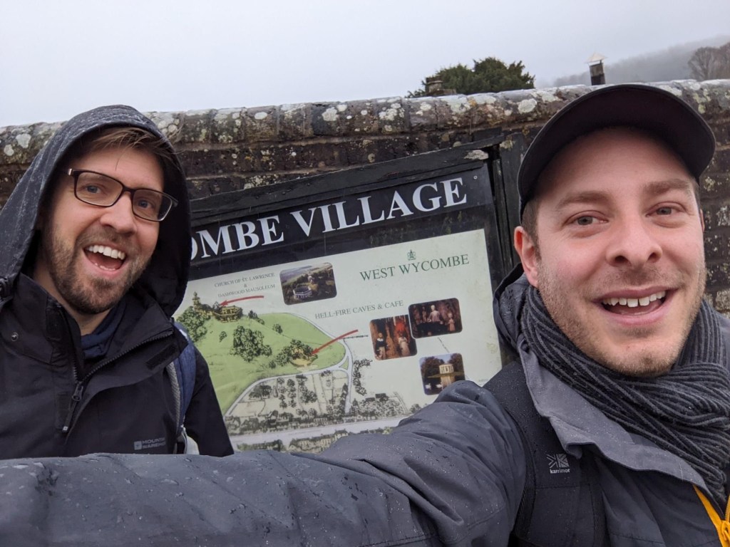
Anyway, first things first. We’ve a walk to get on with. We set off, and the first thing we notice is it’s bloody flinging it down. We Idiots don’t mind a bit of rain, but when the first thing you have to tackle is a steep hill and you’re trying to read a map off a smartphone screen as it becomes increasingly erratic in the wet, it’s not exactly ideal.
Halfway up the hill we pass the entrance to the Hellfire Caves. The caves were excavated in the 1740’s by Sir Francis Dashwood as a way of mining chalk and became the location for the Hellfire Club’s meetings. And by meetings, I mean orgies.

This is the closest we get to any of it though. Bizarrely, in the arches above we see a man wandering who looks exactly like John. We’re briefly excited, thinking our comrade in arms has made a surprise arrival, but this mysterious figure then whips out a yellow tape measure for some reason and we realise this familiar looking gentleman is not our beloved leader.
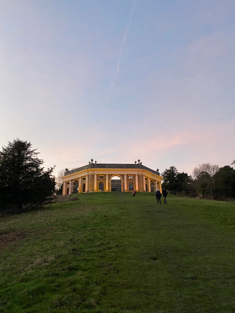
Our pathway leads up the hill, where the Dashwood family lie in the Mausoleum. It’s quite the sight, perched on top off the hill, even in the rain.

From there we follow the pathway round to St Lawrence’s Church, a pretty impressive fourteenth century church which was extensively remodelled in the mid-eighteenth century. It does however have one feature which blows our tiny minds.

See that golden ball at the top? Yeah, you can go in that. From wiki:
“The ball was reputed to be a meeting place for the Hellfire Club – it could seat 10, and was described by the author John Wilkes as “the best globe tavern I was ever in.” It has been suggested that Sir Francis Dashwood used a heliograph to signal through a porthole in the golden ball to his friend, John Norris (1721–1786), who had erected a tower, now known as the Camberley Obelisk, near his home at Hawley, Hampshire, 21 miles to the south.”
So yes, that’s just awesome. Sadly access to the ball is not available to the public, which is a real shame, because I’d kill to go up there. We kept imagining having drinks up there with the rest of the lads. Pretty exciting.
Anyway, enough history for now. We’ve got a (mini) hike to do.
If anything, the rain seems to intensify as we descend the hill, once again showing up my BBC weather app which promised that things would improve throughout the day. Rob slips and falls on the descent and yet somehow practically bounces back up again without a signal sign of mud on him. We write it off as a birthday miracle and crack on.
In our confusion with the route we realise we’re following it backwards, and decide we’re adults, we can do what we like, and opt to do the route in reverse rather than get any more confused. At this point it seems like the best option, if for no other reason than it means we can keep moving. We agreed it’s best not to tell Mat, who will surely mock us for this.

Finally getting to the base of the hill, we cross the main road, go under the railway bridge and start ascending our next hill.

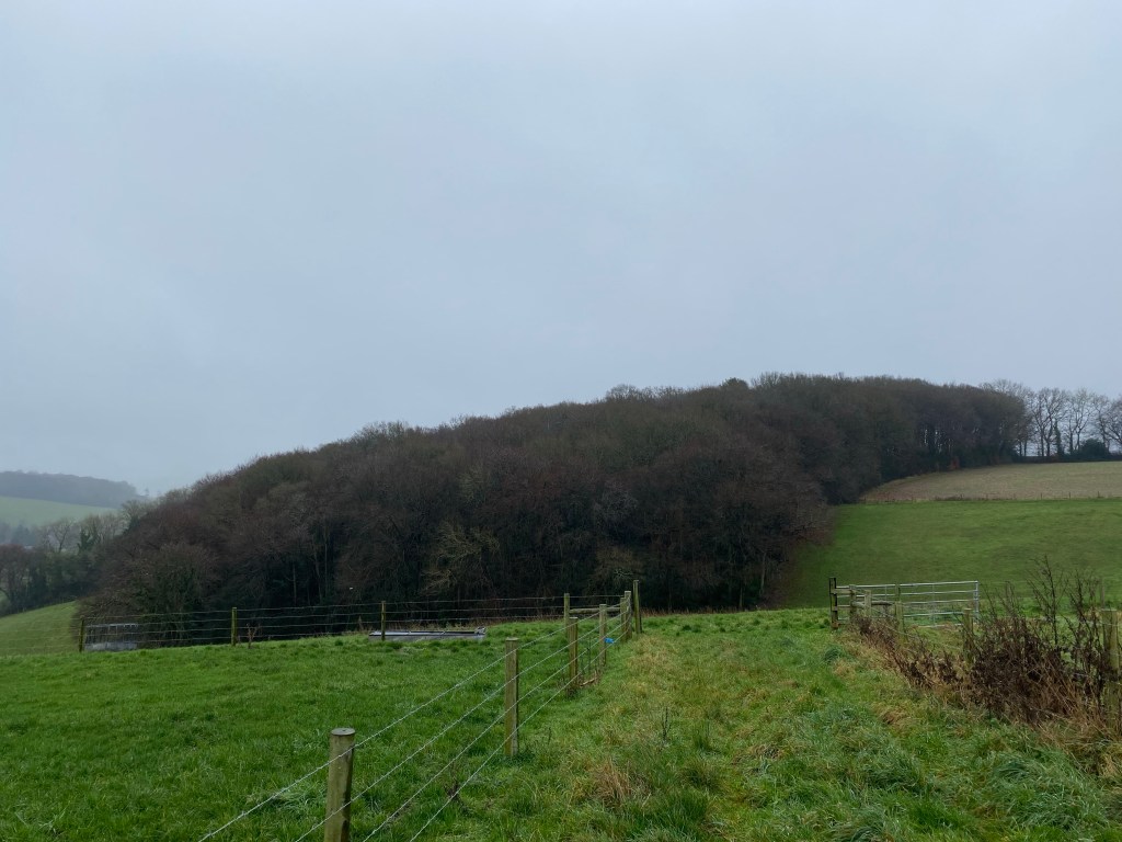
Following the railway line for a while, we eventually leave it to enter the woods. The landscape gets steep here, and between that railway bridge picture above and this one below, more than an hour passes because we’re trying not to a) get lost or b) die.
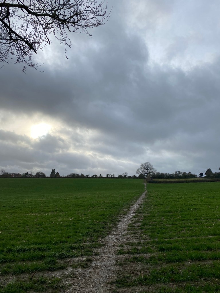
Finally, as the rain lets up, we leave the woods and reach the farmland.

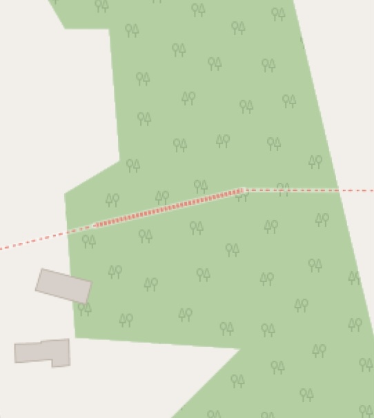
I was tempted to include a picture of the route to justify our confusion but as it’s just different shades of green on green you’ll just have to trust me. I spent ages comparing the route I was drawing on Mapmyrun against Mat’s route on plotaroute because it wasn’t very obvious where we were meant to be going. Rob even got involved and got google maps out to unpick it. Basically we left the woods too early.
Unfortunately we only realised this halfway along the edge of the field, around the time we also realised we weren’t on a public footpath. (It wasn’t going so well). We waded across the field until we reached a thin, muddy footpath, enormously relieved that we had learned our lessons from past hikes and bought decent boots that let you just power through mud rather than force you to avoid it.
At the top of the field, things aren’t looking much better. We’re in between various fields but no public route in sight. Closer examination of the map shows we need to head east.
At this point we realise we have two choices: head back (nope), or to power on with our trespassing in the hopes that we eventually find a footpath or sty to cross to get us back on track.
Descending the valley, neither are to be seen. We reach the furthest corner of the field, and with no other choice, first crawl under and then climb over two barbed wire fences, re-entering the woods.
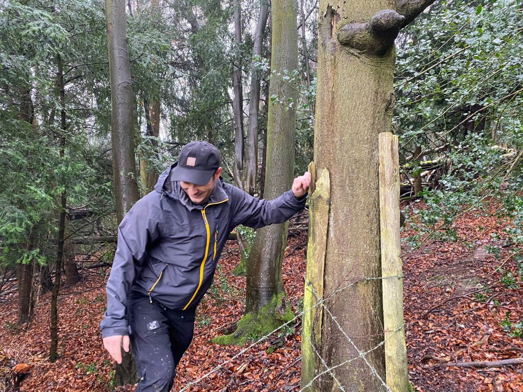
Within minutes we find a sty over another fence, into a field with an actual public footpath, and just like that, we’re back on track!
A bit more ambling through fields and woods leads us to Speen, a nice little village with quaint houses, and more importantly at this point, paved roads.
Unfortunately the paved road leads us along a rather steep, winding country lane which looks like it could be a potential death trap, so we find an alternative way on the map. It’s got some interesting red hash marks, but we figure it’ll be fine.
These, as it turns out, I will forever refer to as The Bastard Stairs, the steepest set of stairs set into the side of a sheer, muddy hill that I can remember facing in a long time. They break both of us, and we reach the top sweating and out of breath, but our reward is a smooth, flat lane at the top that allows us to try and reclaim some dignity. From here it’s a pretty uneventful but still muddy trek to our first pub stop.
Before the pub, we pass over a cricket green which had this beauty resting on it. We stop to appreciate it for a moment before deciding we need a pint (which is code for Rob looked at it for ages while I nagged him about wanting to get a beer).

Our first pub stop is the Hampden Arms in Great Hampden. Here, have a picture of it, followed by one of some beer drinking (and us drying off) and finally me eating a prawn sandwich outside the pub after we left.
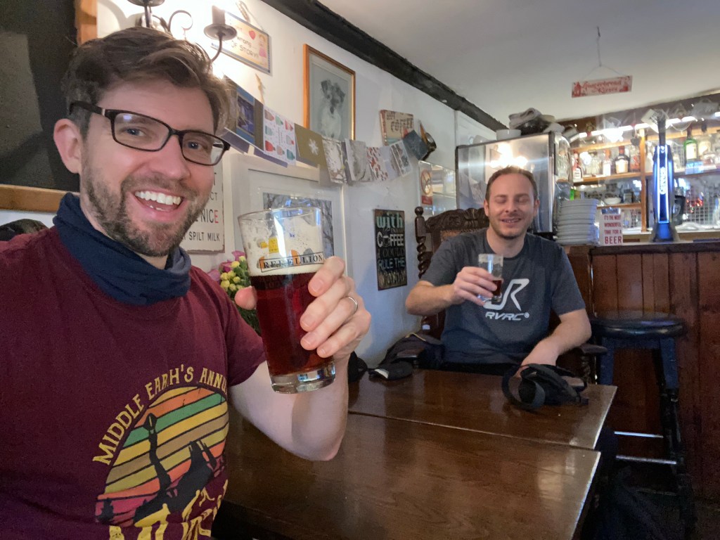

The Hampden Arms is pretty good. Nice rustic vibe, low wooden beams, fireplace, etc. Not the most exciting Walking Idiots pit stop but it did the business. But we didn’t want to linger, for there were more woods to get lost in!
A pretty uneventful hour later we found ourselves approaching Lacey Green, a rather delightful windmill on the horizon giving us something to head towards.

We pass through another church, trespassing for a second, much milder time when the pathway in the graveyard ends with an abrupt, short fence that requires a mild lunge to clamber over.
As ever with our hikes, light is a crucial factor, and with the afternoon moving on, the golden hour is upon us.


As the sun continued to make everything look even better for Instagram, we continued to head south towards Bradenham.

Sticking to bridleways, Bradenham Woods and Park Woods are crossed pretty uneventfully. We do manage to make some new friends though.

Crossing back under the train line and over the main road, we enter Hearton Wood, our final, rather stunning stretch of woodland that rises high above West Wycombe.

Our route took us back to the church with the golden ball, and beyond that on to the mausoleum, which we were delighted to see is lit up at night.

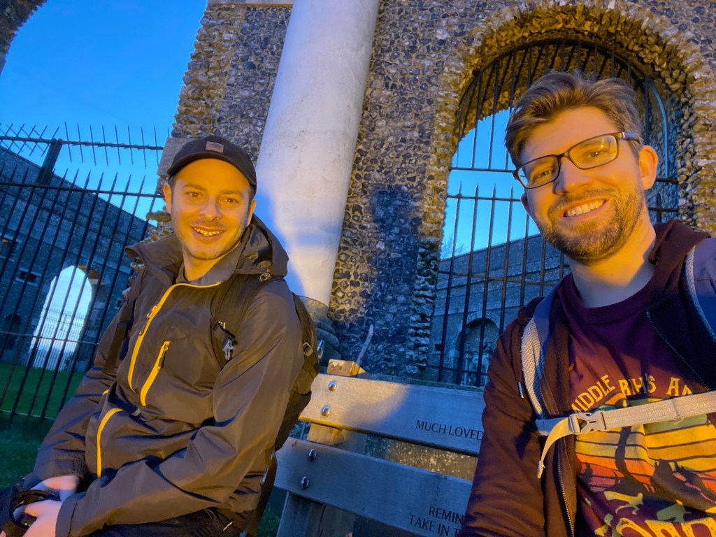
With an oddly time displaced sense of deja vu, we descend the hill once more.
This time though, we had quite a nice surprise.

We descend the hill, almost as slippery as it was that morning, but more treacherous simply because I spend the entire time looking up and gawping at the sunset, riding high on some weird euphoria owing to the combo of the sunset and the imminent end of the hike.
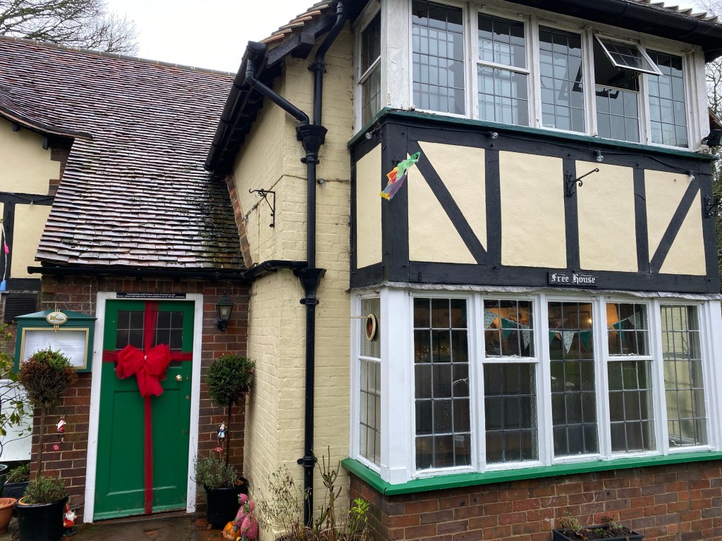
We find ourselves a watering hole in West Wycombe village. Everywhere’s exceptionally quiet, and we choose The Plough, primarily because it’s the one Mat had chosen for us on the route.

The Plough is a gorgeous listed building and a cozy pub, and they didn’t mind the disgusting state in which we arrived, so that was nice.
You know, I wasn’t sure whether to blog this mini (but still fifteen mile) hike or not. It didn’t seem right without the boys. Also, we wanted them to experience some of this stuff first hand if we do this route again, rather than read about it here. But Rob said to blog it for his dad, if for no other reason. So I said yes, knowing the others probably only read the blogs for themselves so it’s doubtful they’ll read it, anyway.

Obviously I jest. Next time it’ll be completely different. Mat will be there to guide us, John to lead us, and Alan to climb things that shouldn’t be climbed. It might also be the correct way round, if nothing else…
