Post-Margate life. Here we go.

Following the coast for a relatively short distance proved to be remarkably successful for our last outing. So empowered with a renewed sense of vigour, we decided to… do the opposite. Instead, we spliced together a new route that was both long and (relatively) complex. Because it’s all about enthusiasm at the end of the day.
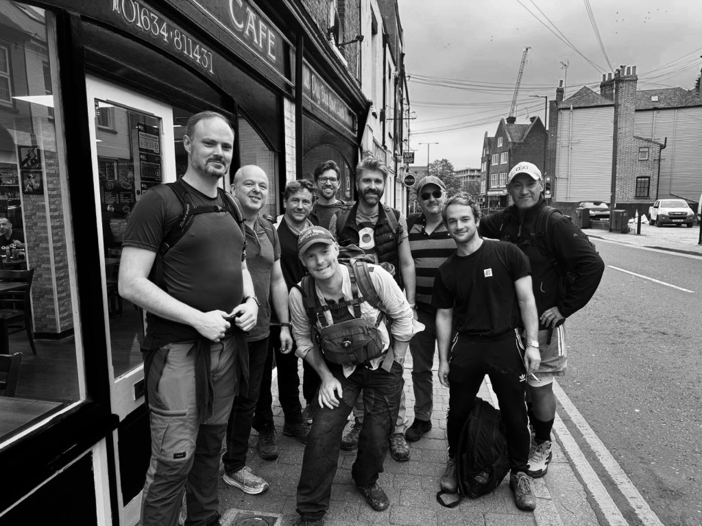
Sticking with Kent, a roughly 24 mile route was plotted from Rochester to Sevenoaks that took in a few local sights and a generous helping of woodland and fields. Just what you need in autumn. A date is agreed and attendees fluctuate and flake as they always do until we’re left with a cohort of nine, four of whom are new to the group.
After the standard-issue shocking night’s sleep the night before, we drag ourselves out of bed and convene at the Legends cafe in Rochester (because Wetherspoons didn’t open until 8, and this would make us later than we needed to be, dammit).
The Legends staff weathered the arrival of 9 blokes in hiking gear and their large backpacks and silly banter very well, and pretty soon we had manspread across a good third of the cafe, before consuming a significant amount of fried food. The bubble and squeak on the veggie option was particularly good.

As per usual we get a departure photo, taken by a rather confused local lad who had to wait for us all to finish using the bathrooms…
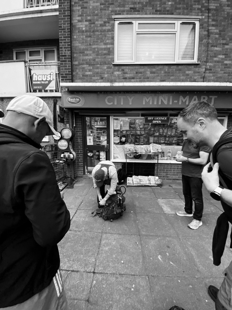
And then we’re off! Also as standard we make it about three minutes before we stop, as some of the crew decide to get supplies, this time in the form of tequila. This will in no way bite anyone on the arse later, no sir.
Wandering through the Rochester suburbs we go past Max’s charming allotment and after half an hour and nearly two miles of walking we join our route.
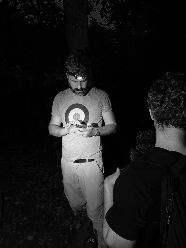
What I mean by this is, just to be safe, for this one I uploaded the route onto my watch. I’ve only done this for one previous Walking Idiots hike (it’s a bit faffy) but after having spent a bit of time doing it over the summer I’ve just about got the hang of it. John and Max have a good local knowledge and had decided to go retro with a paper map, but an insurance policy couldn’t hurt. Especially at night, where the slightly wobblier parts of the route would be impeded with poor visibility. At the 30 minute mark our walk locked in with the plotted route and would continue to guide us for the rest of the day. We’d need it later.
After the allotments we soon crossed the Medway, over the bridge which had been fitted with tall metal poles along the edge to prevent people from jumping off it.

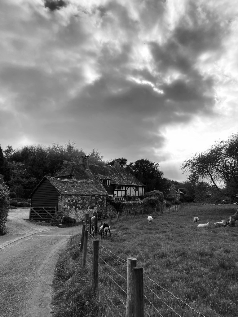
Clearing the bridge and leaving the industrial sprawl we are soon treated to some lovely autumnal colours which will be present throughout the hike.
We follow some very pleasant footpaths through fields and woodlands at a pretty competitive pace until we stop at 4 miles and shed a few layers, it’s warmer than we were expecting.
“Beer, John?” Mati offers, opening his supplies.
“It’s 9:30 in the morning!” John replies.
Mati looks at him, confused, wondering what the two things have to have in common.
Those who feel inclined imbibe and even for those of us who don’t, the next hour is a peaceful meander through woodlands, one of the nicest parts of the day.
Soon after that we leave our route temporarily to head downhill into a valley which hosts the Moot Brewery.

The Moot Brewery is everything a trendy microbrewery should be, but even for us, probably not the place to be at 10:30 in the morning. I would definitely return at a more appropriate hour though. Some of the crew pick up supplies to take with them and I nearly pinch a coaster and then we head off, rejoining our path.

Soon after that the hike gods punish us for deviating from our route so early and we’re treated to the first of several significant hills that get everyone’s heart rates good and racing.
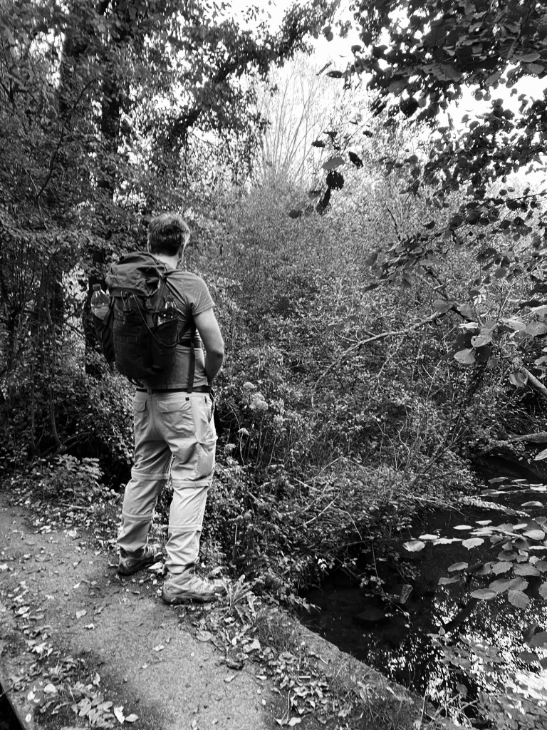
Several more miles of woods follow, as well as a fair bit of both ascent and descent. All good stuff but not worth dwelling on in terms of hike details. The miles add up.

At the base of one of the hills there’s a pretty grotty bunker looking thing, which ticks the Walking Idiots hikely requirement of a nice bit of urban decay.

After a while we reach the top of Holly Hill, where a handy plaque tells us that in the distance the Shard and Canary Wharf are visible. On a past hike we’d seen this from another angle, near Bagshot, so it was weird to see this from the other side.

It’s not long after that we find another sign that announces we are on the Pilgrims Way. Returning readers may remember it was our initial plan to walk the entire Pilgrim’s Way, but we’ve now amended it to be a long-term ambition to do the North Downs Way – very similar, but the former has large stretches with are road and can’t be walked. Looking at the map and reflecting on what sections we’ve already covered, we realise we have maybe only 3 or 4 hikes left to do before the North Downs Way is completed.

Speaking of exciting, it’s not long until we then stumble upon – or should I say past, we have to go back – the ancient and excellently preserved Coldrum Barrow. We spend a good few minutes examining the stone structure on the mound and reflecting on how much history this thing has seen.

From one man-made spectacle to another of a completely different nature, it’s not long after this that we encounter an enormous quarry, complete with signs that say not to play on it. We don’t, but it’s close.

Shortly after this as we close in on the halfway mark of our journey we reach our first pub stop of the day, The Angel at West Malling.

First impressions of the Angel are positive although the lady behind the bar looks at our unannounced arrival with an expression of dread and waxes long and lyrical about lack of space, seating, and what is no longer on the menu. It takes a longer time than expected to explain that we would just a few beers, please, (no food) and once that sinks in we accommodate even further by sitting in the lovely and inexplicably empty beer garden and even provide our requests in writing. Our drinks are gradually delivered by a series of smirking/despairing barmaids. Highlights of our stay here included Alex’s Heineken which tasted almost exactly like Thatchers cider (because it was) and everyone taking a moment to appreciate that Richard had brought his contingency crowbar, which made Max look practically unprepared in comparison.

With our glasses drained we set off in a pretty excellent mood. Soon we cross the A20 and spend the next several miles encountering plenty of charming houses and villages. We go through the village of Basted, which everyone has a delightful time saying.
It’s not long after this that approaching the 17 mile mark we reach pub no. 2, The Plough. We arrive in two batches, with the second contingent arriving all carrying improvised walking sticks to deal with the hills that were determined to slow us down.

The Plough was fine. No complaints. Rather local but not so-local-the-piano-player-stops-when-you-walk-in-local. I’ve probably used this term before but I’m sure you’ll forgive me. Some of the crew are experiencing stiffness and we administer a few stretches and some painkillers before we head off for the final leg, ignoring the fact that they’ve been drinking for most of the afternoon. Johnny also takes about four electrolyte tabs which I’m assuming has the same texture and consistency as Calpol.

Our departure from the Plough’s progress is short lived when we see a very charming little brook which we cross, and investigating it further, we find…

Our pace slows to a halt as a good few of us (yours truly included) give it a go. I’m relieved no one came by to witness it, we are FAR too old to pull it off really.
Soon after resuming we cross a few orchards, which is a bit of a novelty for these hikes, at least at this time of year. We enjoy a rather muted golden hour and plenty of woodlands and as the sun starts to set, we reach Ightam Mote.

Ightam Mote is one of two National Trust properties that we will pass on this hike, both of which have public footpaths which let us go through them. While we stop to admire it, Evan deliberates over when to leave us, and when we agree on a place where he can be collected, we enter what we hope will be the last of the elevation of this hike.
Oh boy is there elevation here, and as expected, it nails our pace. We should be okay as long as we keep moving, and 7 of 9 of us reach the top of the final hill with the last of the twilight.

We wait a few minutes for [REDACTED] and [REDACTED]. Then a bit longer. After ten minutes we call, but the signal in the woodlands is appalling. We have our ears peeled, and when we try getting them to shout, we realise we can hear voices… but not coming from the direction we came from.
After half an hour of waiting, Richard unleashes his emergency secret weapon. No, not the crowbar, but a rather nice bottle of Tallisker which gets passed around those of us waiting. Finally our missing brethren show us, quite a bit worse for wear but determined to keep on going. Evan sees us off, deciding to get picked up. He obviously knew something we didn’t.
Now the twilight has properly gone we are utterly in the dark. Head torches are donned and we set off.
Our visibility is of course completely lost and we are relying on our navigators and the route uploaded to my trusty garmin, whose battery is slowly draining away. One of our navigators, [REDACTED], has fallen victim to the meds/tequila combo which negate his ability to contribute to steering us. Worse, my watch tells me we are veering further and further off the plotted route on the map. Signal is non-existant and Google maps is no help.
Finally, after a quick pause and discussion, we agree on a route which at least seems to run vaguely parallel to the route, so we head in that direction. According to my trusty garmin, once we rejoin the route, there’ll only be a mile to go.
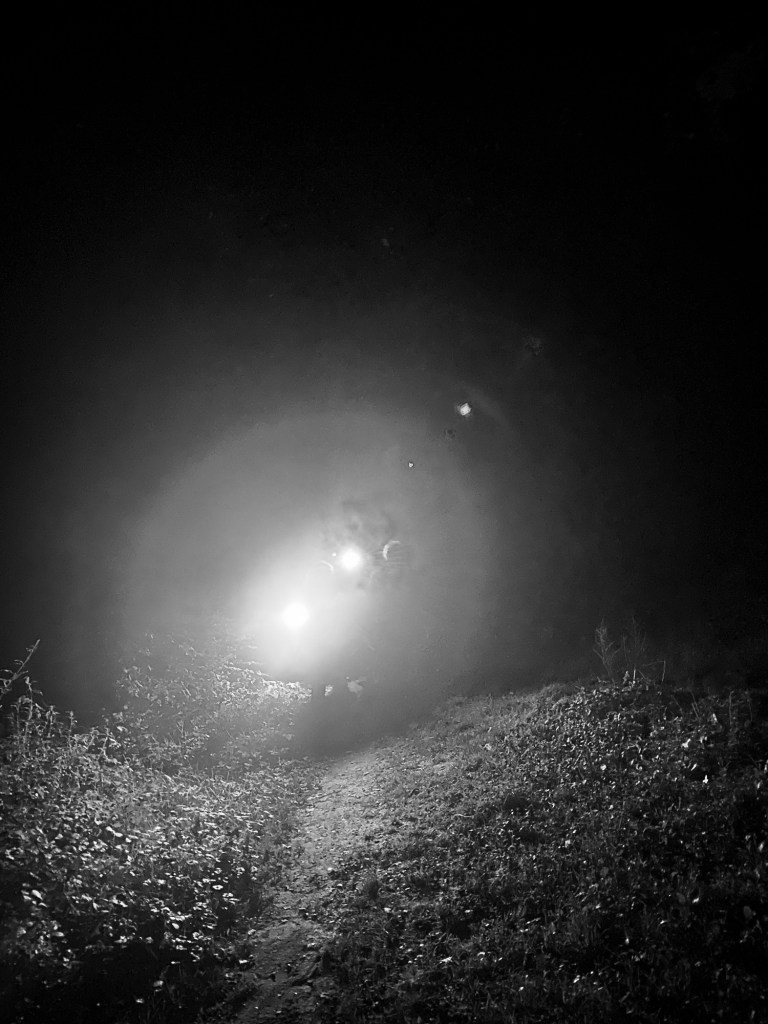
We have a target in the darkness: the gates of Knole Park, and it’s with huge relief that we find them and (briefly) rejoin the plotted route with apparently only a mile remaining. Unfortunately in the darkness it is almost entirely impossible to find the path through the parkland, and we quickly fall off route. The whole thing is looking increasingly Blair Witch Project. Through sheer force of will we head in the approximate direction we’re meant to go, but are made to pause when we realise we’ve somehow reached a golf course. Is this… right? We’ve no way of knowing. We have at least a vague indication of where to go, so we should probably keep moving.
Then we hear the growling.
I’m pretty sure I’ve heard deer growl before, but this is either extra close or extra loud, and it sounds like lions growling in movies. They sound thoroughly unimpressed, and their eyes reflect the light of our head torches to impressive effect. Best we crack on, we don’t want any trouble.

We stumble on through the darkness, serenaded by angry deers. The group fractures a couple of times, as some of the more, um, afflicted, have fallen behind. Andrew runs behind to encourage them, and I might have to admit I was getting a bit fed up by this point.
Oh well, only one mile to go, the group remind John and I with only a mild hint of irritation.
Finally, after what feels like ages, we realign with the route, as my garmin gives a little bleep of satisfaction. And it tells us we only have… a third of a mile to go!
After what feels like a lifetime, we finally emerge from Knole Park. We would never have seen it in the light even if we haven’t fallen behind, but the Beatles fan in me would’ve liked it (Strawberry Fields Forever and Penny Lane had their music videos shot there).
Despite my watch assuring me that the elevation on the route was done, we’re treated to one final short, sharp hill, and then all of a sudden we’re out in the open in Sevenoaks. What relief.
Our pub is just around the corner, so we take advantage of some strangers kindness to get a victory photo of us. The relief on our faces shows here.

We head towards our final pub, The Restoration, finally one with an original name.
And it is, of course, shut. Honestly. Private function. Flipping great. Some of our crew seek alternative shelter at the Anchor, while the rest of us look after [REDACTED], who probably wouldn’t be warmly received in a public house. Instead we enjoy a can of beer while we wait for the taxi, but actually after what turns out to be 26 miles (not 24) we’re pretty much happy to call it a day.
Still, end of hike hijinx aside, this was one of our better walks. Good route, some autumn colour, a bit of history, a healthy amount of silliness and a nice crew. Can’t fault that.


Very enjoyable read Nick.
LikeLike