In which the Idiots tackle the Surrey Hills (kind of), struggle to retain group cohesion (for a little bit) and make a wise decision (for us).
After a brief flirtation with ultra marathons we were back to BAU on the Pilgrims Way, by which of course we mostly mean the North Downs Way. Did you know most of the Pilgrims’ Way between Farnham and Canterbury is now road? I’d always been a bit confused by why we weren’t doing it until I read up on it. That’s progress for you. Still, at least we have the North Downs Way (NDW from now on) to use instead.
Alternating our hikes between stretches east and west, it was time to resume in the west having previously done a stretch in Kent, and we picked it up from Guildford, having memorably reached it in Hike XV (aka the one where we bought a box of 20 pints of beer from Denby’s brewery and strapped it to Max’s back and everything went off the rails).
The route at first glance didn’t look massively inspiring until I realised Jen and I drive through a fair part of it when we head down to see my parents, and once you get past Guildford there’s some really nice sights. That route (mostly the A283) runs through some stunning parts of the South Downs (think Chiddingfold, Petworth, Bury Hill and Arundel) and when we’re done with this NDW shenanigans I’m going to lobby the group to explore some of that. Or just do the Lake District, because I’m a little fixated with that at the moment.
A spot of planning followed courtesy of Angus (first seen on Hike XVIII,) who kindly helped us optimise the route mapping, having grown up in the area. This definitely came in handy from the off and continued to prove invaluable as the day unfolded.
As the hike approached we realised with a degree of mounting dread that although Guildford isn’t too awful to get to, for most of us, getting back from Alton was going to be a chore. Creative solutions were employed with the most attendees choosing to drive for the first time.
(I say Guildford isn’t awful to get to but for my part I had a cancelled train at Reading and anxious staff fretting that the next train might not come either, which wasn’t easy on the nerves. I consoled myself by getting a McDonald’s breakfast in Reading town centre and foolishly giving my spare hash brown to a homeless guy who was actually pretty grateful.)
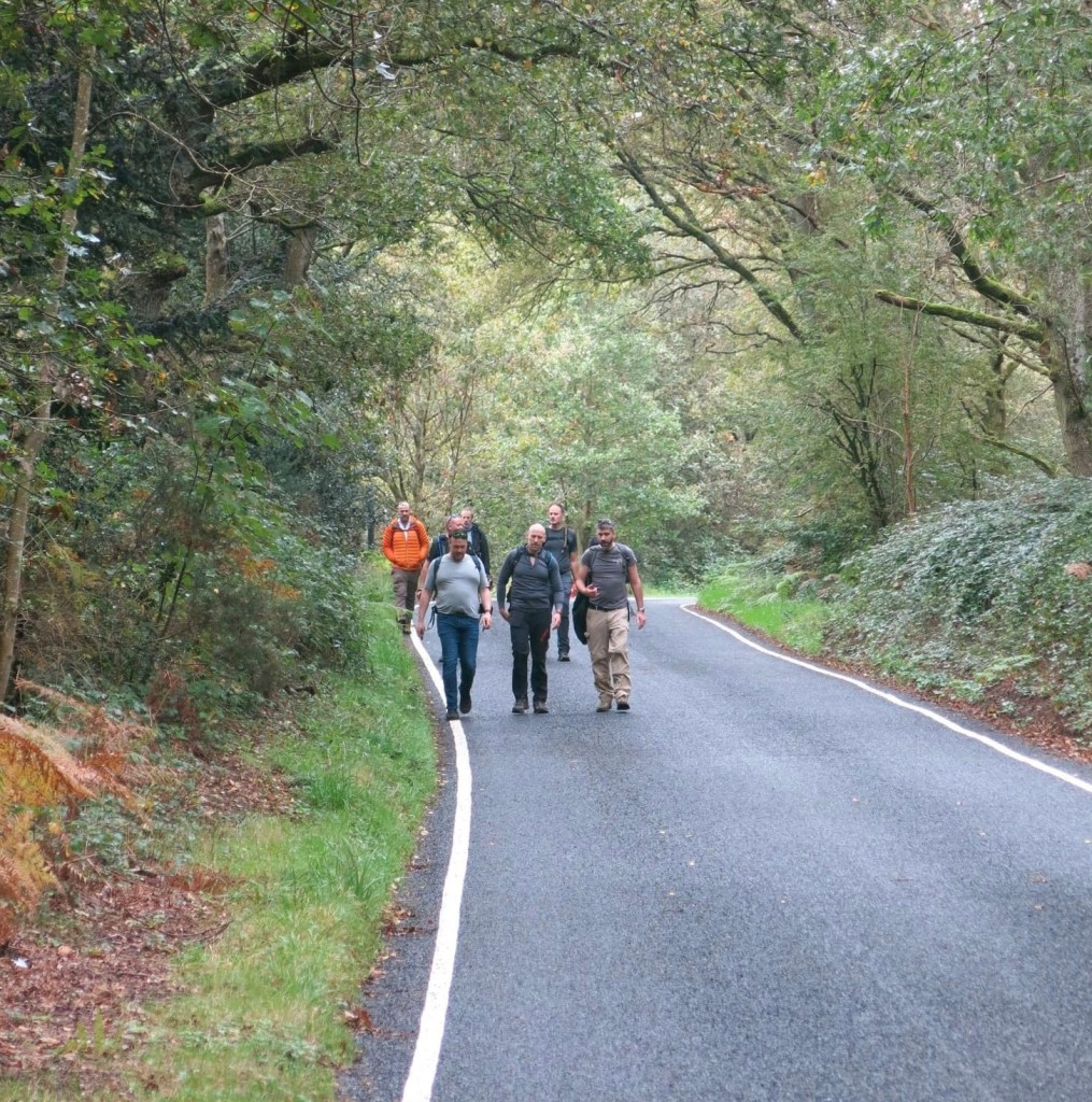
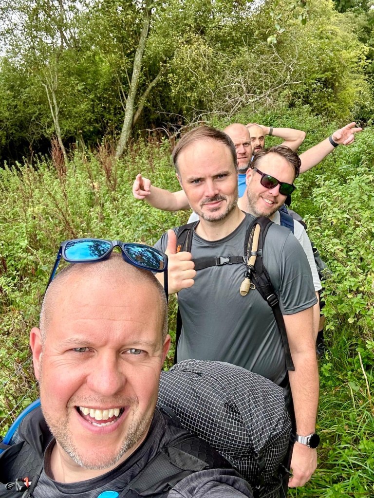
Anyway, we convene at Wetherspoons as is tradition and after some prep we head off, taking our obligatory start pic:

Well, I say we head off. What actually happens is John declares he hasn’t got lunch, so he nips off to get that from Tescos, but that’s less cinematic isn’t it.

And then, with sandwiches purchased and the sun rising blearily behind the clouds, creating a silvery autumnal pallor, we start our hike.
For once (and again thanks to Angus) we have the option of uploading our routes to our watches, which I am definitely doing from now on as it just made life immensely easier. Until we go off trail, at least, but we’ll get to that later. I’m not saying we’ve been doing these for a long time but when we started it was all print offs of Google maps.
Our route out of Guildford unfortunately doesn’t follow the river (it would’ve added too many miles too early) but at least took us past several of those rather posh Surrey houses I know I’ll never be able to afford but always like to look at.

Heading south of the Farnham Road and past the Watts Gallery, we cover a stretch that runs between holes at Puttenham golf club before we emerge at the base of the Hog’s Back, where we follow signs into Puttenham.
It takes us past another collection of charming Surrey cottages briefly and then on, along a long smooth road that we follow for miles.
I always think of roads like these as country death roads (which wouldn’t be a bad name for a song) just because there’s no footpath and cars can rocket down them at incredible speeds, but honestly the risk was mitigated by how quiet the road was and how straight it is, giving us full visibility. It also gave us a remarkable view of the countryside on both sides, but without having to worry about wetness underfoot, which was likely given all the recent rain. The only drawback was all the cyclists – the natural enemy of hikers – who often passed us by with a grimace as they had to move slightly into the centre of the road. Or because their Lycra was too tight, they didn’t stop to tell us which one it was.
Any doubts about following the road are quickly dismissed as we do our first bit of trail walking by the river, quickly having to tip toe over and around bog and puddles and scoring a few of us our first wet feet of the day.
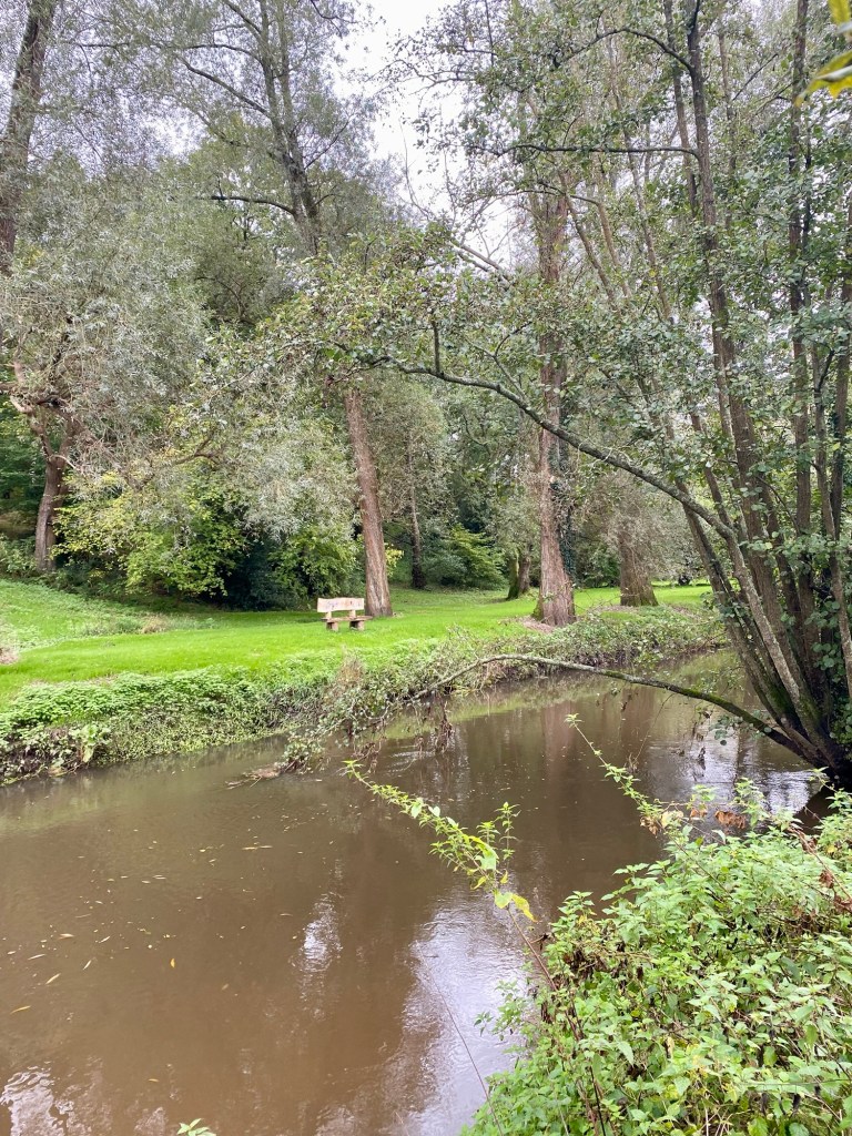
Somehow nine miles have flown by and it’s not long before we make it to our first rest stop, The Mill at Elstead.
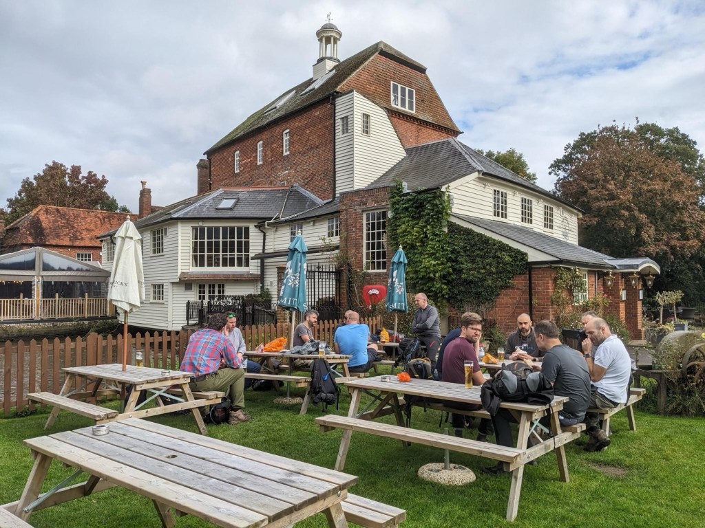
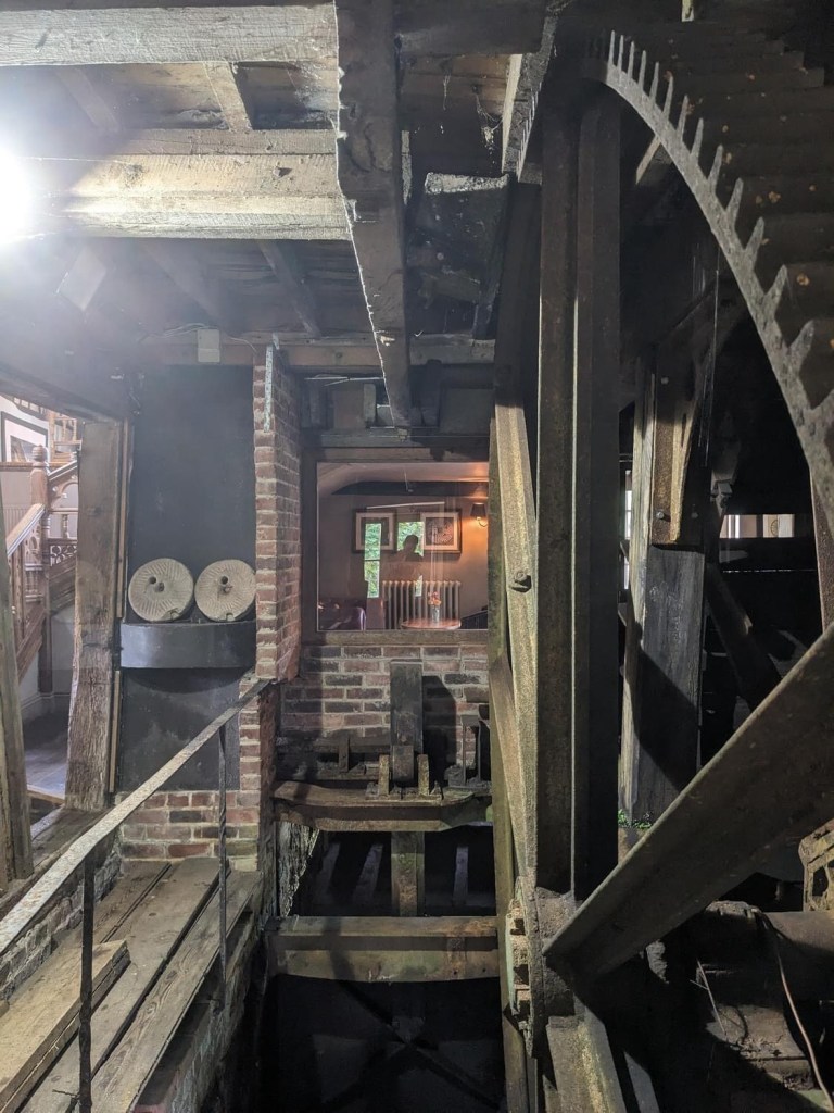
The Mill is quite beautiful. Beautiful enough to also be a wedding venue, and there’s a moment where we wonder if we’ll be allowed in or even shooed away. The original mill burned down in 1647, the same year it was occupied by Cromwell’s Roundheads (coincidence?) with a new one built the following year. It also served as a hospital in the Second World War, although presumably it wasn’t a pub then.
The original wheel is still preserved in the pub behind a large glass screen, and a few of us spend our recovery pint time admiring it before we move on.
Deciding to get on before any of us get roped into ushering at the wedding we get back on to the NDW and heading properly off road. The landscape takes quite an interesting turn as we climb, with a noticeable drop below us as we look down on the River Wey (pronounced “Waaaaaayyyyy” when we did GCSE Geography).
Throughout the afternoon the rain continually starts and stops, with one particularly vicious shower forcing everyone to hastily put on their waterproofs, including Alan’s epic whaling coat, which could comfortably host a family of four. Here it is in action on my favourite accessibility-challenged walkway to date:
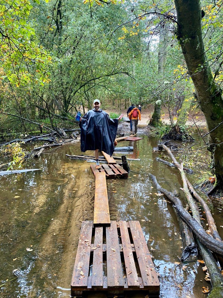
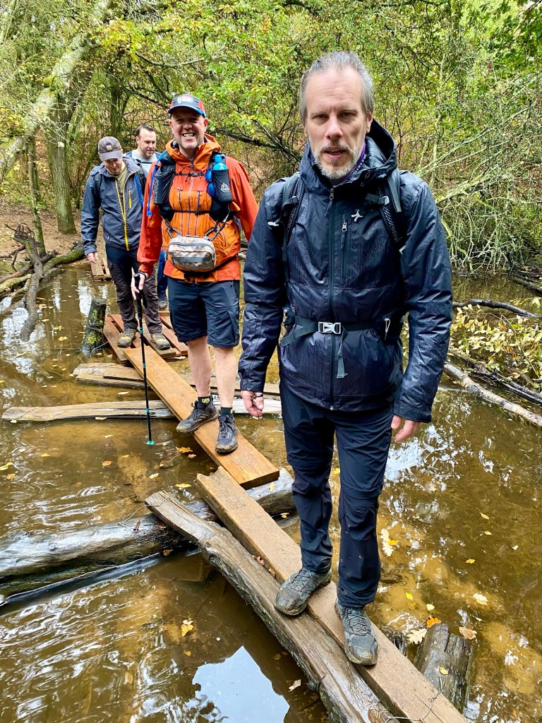
I loved this health and safety nightmare so much (the walkway, although I of course love Alan too) that I had to make the boys stop for more pictures of it:
Soon after we realise we’ve lost Mike and wait as he catches up – despite the path being relatively straight he went off trail and confused us with a bunch of golfers. After playing a few holes he rejoins us.
From here we begin to approach Frensham Common and its lovely ponds (which are more like lakes). The common is National Trust owned and the ponds (Little and Great, respectively) were originally created in the 13th century to provide Farnham Castle with fish.

We go off trail for the first time here as a particularly steep hill holds appeal for those of us in the lead, (it’s a barrow, what can you do) but as we come down the other side, we realise we’re missing almost half of our members. Bugger.

John, Angus and Henry decide to head on to the next stop, the Frensham Hotel, only a mile or so away, while the rest of us wait around for our missing crew. After ten or fifteen minutes and a few calls and messages to them we realise they aren’t coming the way we did, instruct them to meet us at the hotel, and we head off.
Our enjoyment of Frensham Ponds is a little marred by the fracture in the group and the realisation we’ve got ten miles to cover in three hours, but it’s not long before we rejoin the route and pass over various hills of heathland. Sailboats can be seen on the glittering ponds in the distance, and the sky finally clears up as we reach our second stop, the Frensham Ponds Hotel.
Much to our amusement/frustration (delete as appropriate) our missing five members have somehow overtaken us and made it to the hotel already, and everyone is sat in the lobby with a pint. John tells me if I’m getting a drink to make it snappy as the hotel’s vibe isn’t what we’re looking for, and the Bluebell pub (approximately a mile away) is far more appropriate. I mishear pretty much all of this and just register the point that if I’m to get a drink I have to rush it, and give what I refer to as The Stare (like what Paddington Bear gives), or as Rob describes it, I break character. Fortunately the situation is clarified and I’m mollified once a beer is in my hand. Alan is similarly fuming until he realises us lot who have just arrived were just behind, and hadn’t decided to march on to the end without stopping.

The issue of daylight and distance persists, however, and we discuss alternatives. Alluded to in the opening of this post, for the first time we make a smart decision and decide to shorten the distance, ending in Bentley rather than Alton, reducing the remaining distance from ten miles to a far more manageable six.
Inheriting the mantle of fury from Alan and I, it’s now Alex’s turn to be livid as he has counted on finishing in Alton and has planned around it. Unfortunately for him he doesn’t (yet) have a seat on the committee and his protests are ignored, or more accurately, we laugh at them.
The decision made to now head to Bentley we leave with renewed vigour (or bile in Alex’s case), although misfortune strikes once again as we pass the Bluebell, and John, Alan and Henry decide to stick to John’s initial plan to get their “proper” drink there. I leave them to inform the others who have gone on ahead, except the group consensus now is that we’re not stopping, having done so only a short while earlier. We split once again.
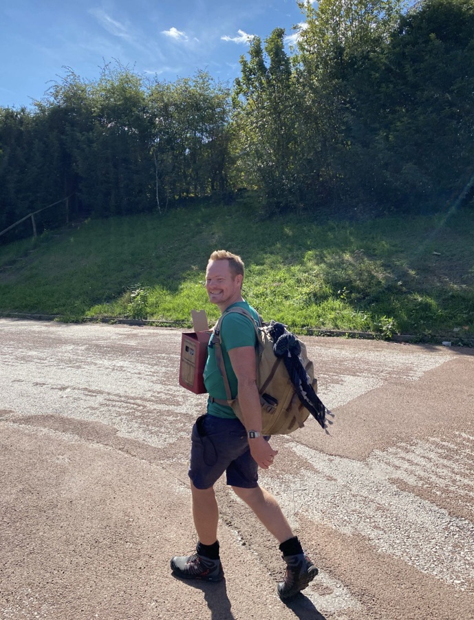
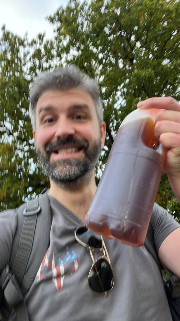
To say that mine, Rob and Mat’s anxiety levels spiked here is putting it mildly, and we catastrophise a rift in the group and the threat of fury from those we’ve left behind. Not having the amended route to Bentley (the original one on my watch now out of date) I stick with the main group and try calling and messaging John to let him know what’s going on enough times that I’m pretty sure it legally counted as stalking. To everyone’s great relief I receive a message that just says “yes” when I ask if he’s got the map, as well as this picture:
Not to mention a there’s a much more welcomed follow up message that says they’re just behind us. Everyone’s buttocks unclench and the sun comes out again.
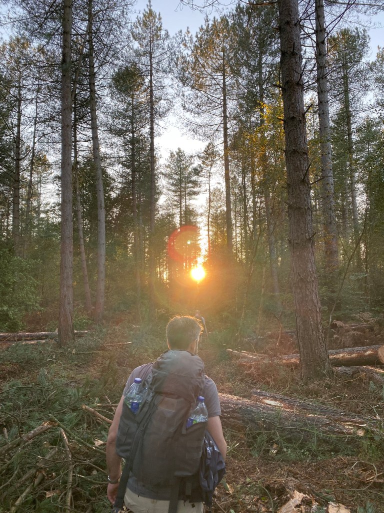
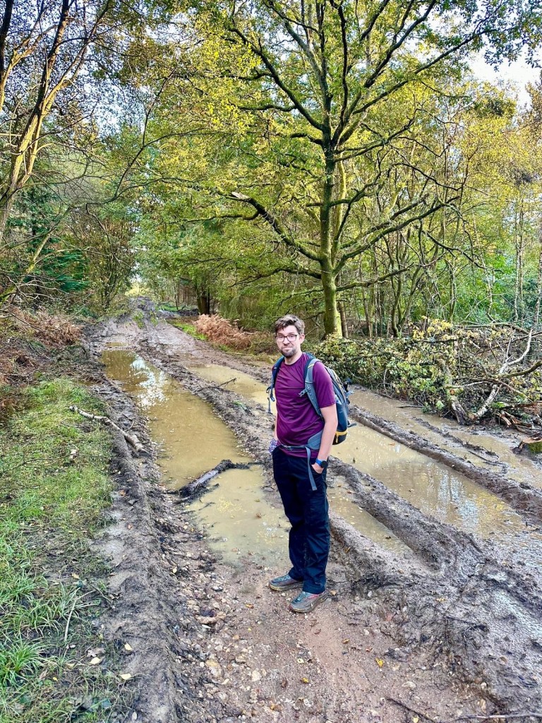
However, any further thoughts about our missing brethren are quickly set aside as we head deeper into the Blacknest Woods. Significant logging and felling has taken place, and the vehicles going over the main track combined with all the rain have managed to turn the pathway into one long stretch of bog.
Our pace slows down astonishingly as we pick our way through. I place a foot on what I assume to be a solid mound and am taken aback when I realise it has the consistency of stacked liquid (Arran and I both made reference to the soup tower joke from Black Books, if anyone remembers that). This misery continues for some time but we make our way through for the most part unscathed.
Better than unscathed actually, because miraculously as we regroup at the next corner, we find our missing crew, the gang reunited once more. Just as importantly, we learn what was in John’s bottle. It was, of course, a beer to go. Naturally.
In some ways what follows was almost as hard as navigating the mud, as our path is covered by loads of discarded branches of various sizes.

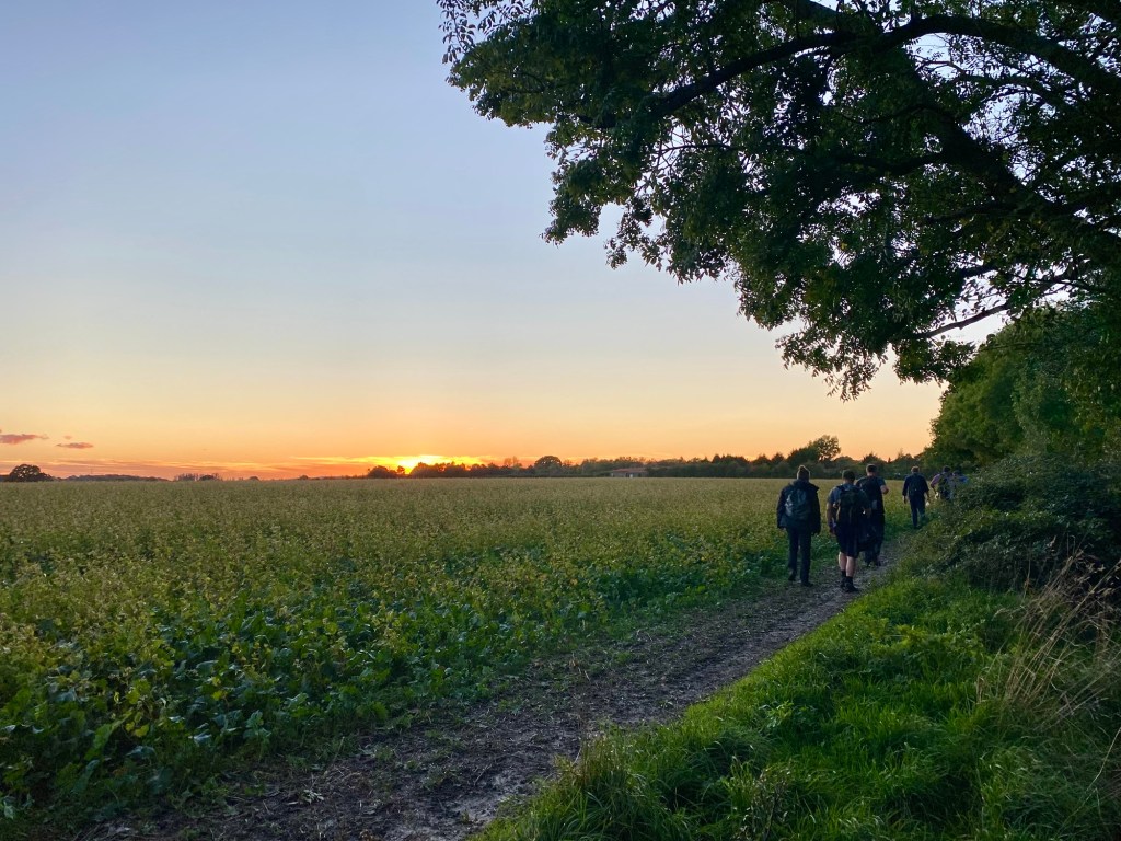
The ground becomes incredibly treacherous as we have no idea what the branches conceal (I’m picturing a pit with spikes for some reason) but miraculously we make it through and see out the rest of the woods enjoying the golden hour as the sun begins to set, always my favourite part of a hike.
From there it’s all very relaxed as we watch the sun set while walking through fields and pathways, until after the last of the twilight has faded we arrive at The Star Inn in Bentley.
We stop to get our obligatory in front of the pub finishing selfie, which unfortunately could be misconstrued as Mike taking a picture of the girls in the house over the road, but the police never come so we assume they understood.

We see the evening out in the Star, a lovely local pub with a pretty good menu and a range of beers. Mostly importantly the staff were welcoming and there was even an enormous table in a nook which could accommodate our raucous bunch with little disruption to the locals. John even got a round in for everyone, which was a lovely gesture.
As the evening wound on the ever-looming decision to head home came upon us, and a small fleet of ubers were called to get those of us not going from Bentley train station to wherever they needed to go. All we needed to do now was get home, sort our feet out, rest up, and wait for John’s wife’s inevitable sarcastic comment when Rob posts hike photos on Facebook.
So I guess the big question now is… is our next hike, the prestigiously titled Hike XX, going to be all four miles of Bentley to Alton?

Thank you for you latest epistle with the trials and tribulations of walking the countryside attacked by foresters, pathways close to rivers and the adage, the larger the group the greater the chance of dissent and group division.
However there are also the joys of the moment, the scene, which only occurs if you are there to appreciate it.
Jim Golding
LikeLiked by 1 person